Earthquakes on May 29, 2024
241
EARTHQUAKES on May 29, 2024
24-hour UTC period · USGS data
LARGEST: M5.5 — 210 km SE of Kushimoto, Japan
393 km deep · 4 people felt it
Normal activitycompared to daily average (~250/day)
Magnitude Breakdown
M5.0+
3
M4.0–4.9
32
M3.0–3.9
9
M2.0–2.9
46
M1.0–1.9
151
Activity Summary
241
Total earthquakes
~250
Daily average
Normal
Activity level
3
M5.0+ events
Geographic Breakdown
By US State
Top Countries (International)
Significant Earthquakes (M4.5+)
5.5
210 km SE of Kushimoto, Japan
17:14 UTC · 392.7 km deep
Felt by 4
5.4
29 km ESE of Mawlaik, Myanmar
13:13 UTC · 97.6 km deep
Felt by 24
5.0
120 km WNW of Sola, Vanuatu
23:40 UTC · 35.0 km deep
4.9
166 km SSW of Colonia, Micronesia
17:37 UTC · 10.0 km deep
4.7
Kepulauan Babar, Indonesia
01:04 UTC · 124.4 km deep
4.6
19 km E of Hualien City, Taiwan
23:54 UTC · 26.4 km deep
4.6
127 km E of Aras-asan, Philippines
23:46 UTC · 10.0 km deep
4.6
Mid-Indian Ridge
22:13 UTC · 10.0 km deep
Earthquake Map — May 29, 2024
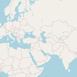
All Earthquakes — May 29, 2024
Showing 30 of 90 (filtered from 241)
(Filtered to M2.0+. Change the magnitude filter to see smaller events.)
| Time ↓ | Mag ↕ | Location ↕ | Depth ↕ | Felt ↕ | MMI | Alert | Status | Details |
|---|---|---|---|---|---|---|---|---|
2024-05-29 2024-05-29 23:54:44 UTC | 4.6mwr | 19 km E of Hualien City, Taiwan 23.945°, 121.797° | 26.4 km | - | - | - | ✓ Reviewed | USGS → |
The USGS recorded this magnitude 4.6 earthquake 19 km E of Hualien City, Taiwan at 23:54 UTC on May 29, 2024. The event was offshore. See the M4.6 event page for the full report, ShakeMap, and citizen-reported intensity data. | ||||||||
2024-05-29 2024-05-29 23:46:41 UTC | 4.6mb | 127 km E of Aras-asan, Philippines 8.782°, 127.463° | 10.0 km | - | - | - | ✓ Reviewed | USGS → |
This magnitude 4.6 event was detected 127 km E of Aras-asan, Philippines on May 29, 2024, with origin time 23:46 UTC. The event was offshore. See the M4.6 event page for the full report, ShakeMap, and citizen-reported intensity data. | ||||||||
2024-05-29 2024-05-29 23:40:04 UTC | 5.0mb | 120 km WNW of Sola, Vanuatu -13.565°, 166.484° | 35.0 km | - | - | - | ✓ Reviewed | USGS → |
Seismographs logged a magnitude 5.0 earthquake 120 km WNW of Sola, Vanuatu with origin time 23:40 UTC on May 29, 2024. See the M5.0 event page for the full report, ShakeMap, and citizen-reported intensity data. | ||||||||
2024-05-29 2024-05-29 23:35:51 UTC | 2.1ml | 64 km SSW of Whites City, New Mexico 31.610°, -104.527° | 8.3 km | - | - | - | ✓ Reviewed | USGS → |
On May 29, 2024, worldwide seismic activity registered a magnitude 2.1 earthquake 64 km SSW of Whites City, New Mexico at 23:35 UTC. This event falls inside the aftershock decay of a nearby magnitude 2.5 earthquake that occurred about 1 hours earlier. See the M2.1 event page for the full report, ShakeMap, and citizen-reported intensity data. | ||||||||
2024-05-29 2024-05-29 23:15:26 UTC | 2.1md | 1 km S of Yauco, Puerto Rico 18.023°, -66.848° | 12.7 km | - | - | - | ✓ Reviewed | USGS → |
Seismographs logged a magnitude 2.1 earthquake 1 km S of Yauco, Puerto Rico with origin time 23:15 UTC on May 29, 2024. It arrived roughly 3 hours after a larger magnitude 2.3 mainshock in the same 20 km area, placing it within the typical aftershock window. The event was offshore. See the M2.1 event page for the full report, ShakeMap, and citizen-reported intensity data. | ||||||||
2024-05-29 2024-05-29 23:01:17 UTC | 2.3md | 10 km SW of Willits, CA 39.335°, -123.415° | 7.1 km | 4 | - | - | ✓ Reviewed | USGS → |
Seismographs logged a magnitude 2.3 earthquake 10 km SW of Willits, CA with origin time 23:01 UTC on May 29, 2024. The event was offshore. See the M2.3 event page for the full report, ShakeMap, and citizen-reported intensity data. | ||||||||
2024-05-29 2024-05-29 22:36:34 UTC | 2.5ml | 64 km SSW of Whites City, New Mexico 31.611°, -104.527° | 8.1 km | - | - | - | ✓ Reviewed | USGS → |
The USGS recorded this magnitude 2.5 earthquake 64 km SSW of Whites City, New Mexico at 22:36 UTC on May 29, 2024. See the M2.5 event page for the full report, ShakeMap, and citizen-reported intensity data. | ||||||||
2024-05-29 2024-05-29 22:22:19 UTC | 3.6mb | 86 km SW of Atka, Alaska 51.623°, -175.041° | 32.7 km | - | - | - | ✓ Reviewed | USGS → |
A magnitude 3.6 seismic event took place 86 km SW of Atka, Alaska on May 29, 2024 at 22:22 UTC. The event was offshore. See the M3.6 event page for the full report, ShakeMap, and citizen-reported intensity data. | ||||||||
2024-05-29 2024-05-29 22:13:26 UTC | 4.6mb | Mid-Indian Ridge -22.905°, 69.537° | 10.0 km | - | - | - | ✓ Reviewed | USGS → |
Reports of a magnitude 4.6 earthquake near Mid-Indian Ridge came in on May 29, 2024 at 22:13 UTC. See the M4.6 event page for the full report, ShakeMap, and citizen-reported intensity data. | ||||||||
2024-05-29 2024-05-29 21:58:37 UTC | 4.3mb | 210 km N of Palu, Indonesia 0.999°, 119.808° | 29.7 km | - | - | - | ✓ Reviewed | USGS → |
A magnitude 4.3 seismic event took place 210 km N of Palu, Indonesia on May 29, 2024 at 21:58 UTC. The event was offshore. See the M4.3 event page for the full report, ShakeMap, and citizen-reported intensity data. | ||||||||
2024-05-29 2024-05-29 21:57:34 UTC | 4.2mb | Fiji region -20.311°, -178.313° | 585.4 km | - | - | - | ✓ Reviewed | USGS → |
On May 29, 2024, worldwide seismic activity registered a magnitude 4.2 earthquake in the Fiji region at 21:57 UTC. This is the deepest earthquake in the current dataset — a deep-focus event. See the M4.2 event page for the full report, ShakeMap, and citizen-reported intensity data. | ||||||||
2024-05-29 2024-05-29 21:26:26 UTC | 4.3mb | Revilla Gigedo Islands region 19.199°, -108.879° | 10.0 km | - | - | - | ✓ Reviewed | USGS → |
May 29, 2024 brought a magnitude 4.3 earthquake in the Revilla Gigedo Islands region, logged at 21:26 UTC. See the M4.3 event page for the full report, ShakeMap, and citizen-reported intensity data. | ||||||||
2024-05-29 2024-05-29 20:40:40 UTC | 2.3md | 6 km ENE of La Parguera, Puerto Rico 17.993°, -66.990° | 15.2 km | - | - | - | ✓ Reviewed | USGS → |
Reports of a magnitude 2.3 earthquake 6 km ENE of La Parguera, Puerto Rico came in on May 29, 2024 at 20:40 UTC. See the M2.3 event page for the full report, ShakeMap, and citizen-reported intensity data. | ||||||||
2024-05-29 2024-05-29 20:08:48 UTC | 2.5ml | 67 km SSE of Akutan, Alaska 53.617°, -165.240° | 35.0 km | - | - | - | ✓ Reviewed | USGS → |
This magnitude 2.5 event was detected 67 km SSE of Akutan, Alaska on May 29, 2024, with origin time 20:08 UTC. See the M2.5 event page for the full report, ShakeMap, and citizen-reported intensity data. | ||||||||
2024-05-29 2024-05-29 19:55:40 UTC | 2.8ml | 267 km WSW of Adak, Alaska 51.194°, 179.666° | 51.5 km | - | - | - | ✓ Reviewed | USGS → |
Reports of a magnitude 2.8 earthquake 267 km WSW of Adak, Alaska came in on May 29, 2024 at 19:55 UTC. See the M2.8 event page for the full report, ShakeMap, and citizen-reported intensity data. | ||||||||
2024-05-29 2024-05-29 19:44:57 UTC | 2.7ml | 112 km ESE of Akutan, Alaska 53.760°, -164.189° | 35.0 km | - | - | - | ✓ Reviewed | USGS → |
May 29, 2024 brought a magnitude 2.7 earthquake 112 km ESE of Akutan, Alaska, logged at 19:44 UTC. This event falls inside the aftershock decay of a nearby magnitude 2.9 earthquake that occurred about 13 hours earlier. See the M2.7 event page for the full report, ShakeMap, and citizen-reported intensity data. | ||||||||
2024-05-29 2024-05-29 19:41:04 UTC | 2.3ml | 105 km SSW of Nikolski, Alaska 52.033°, -169.345° | 25.6 km | - | - | - | ✓ Reviewed | USGS → |
On May 29, 2024, worldwide seismic activity registered a magnitude 2.3 earthquake 105 km SSW of Nikolski, Alaska at 19:41 UTC. See the M2.3 event page for the full report, ShakeMap, and citizen-reported intensity data. | ||||||||
2024-05-29 2024-05-29 19:34:45 UTC | 4.3mb | 79 km S of Pacocha, Peru -18.362°, -71.321° | 31.9 km | - | - | - | ✓ Reviewed | USGS → |
On May 29, 2024 at 19:34 UTC, a magnitude 4.3 earthquake struck 79 km S of Pacocha, Peru. The event was offshore. See the M4.3 event page for the full report, ShakeMap, and citizen-reported intensity data. | ||||||||
2024-05-29 2024-05-29 18:54:54 UTC | 3.4md | 74 km ESE of Cruz Bay, U.S. Virgin Islands 18.125°, -64.121° | 21.6 km | - | - | - | ✓ Reviewed | USGS → |
On May 29, 2024 at 18:54 UTC, a magnitude 3.4 earthquake struck 74 km ESE of Cruz Bay, U.S. Virgin Islands. See the M3.4 event page for the full report, ShakeMap, and citizen-reported intensity data. | ||||||||
2024-05-29 2024-05-29 18:43:05 UTC | 2.3ml | 8 km ENE of Stanley, Idaho 44.259°, -114.851° | 5.5 km | - | - | - | ✓ Reviewed | USGS → |
At 18:43 UTC on May 29, 2024, a magnitude 2.3 tremor occurred 8 km ENE of Stanley, Idaho. See the M2.3 event page for the full report, ShakeMap, and citizen-reported intensity data. | ||||||||
2024-05-29 2024-05-29 18:19:16 UTC | 2.0ml | 54 km S of Whites City, New Mexico 31.689°, -104.406° | 5.7 km | - | - | - | ✓ Reviewed | USGS → |
A magnitude 2.0 earthquake was recorded 54 km S of Whites City, New Mexico on May 29, 2024 at 18:19 UTC. It arrived roughly 3 hours after a larger magnitude 2.5 mainshock in the same 20 km area, placing it within the typical aftershock window. The event was offshore. See the M2.0 event page for the full report, ShakeMap, and citizen-reported intensity data. | ||||||||
2024-05-29 2024-05-29 18:18:58 UTC | 2.8ml | 201 km SE of Akutan, Alaska 52.638°, -164.058° | 10.0 km | - | - | - | ✓ Reviewed | USGS → |
A magnitude 2.8 seismic event took place 201 km SE of Akutan, Alaska on May 29, 2024 at 18:18 UTC. The event was offshore. See the M2.8 event page for the full report, ShakeMap, and citizen-reported intensity data. | ||||||||
2024-05-29 2024-05-29 17:37:25 UTC | 4.9mb | 166 km SSW of Colonia, Micronesia 8.154°, 137.476° | 10.0 km | - | - | - | ✓ Reviewed | USGS → |
On May 29, 2024, worldwide seismic activity registered a magnitude 4.9 earthquake 166 km SSW of Colonia, Micronesia at 17:37 UTC. See the M4.9 event page for the full report, ShakeMap, and citizen-reported intensity data. | ||||||||
2024-05-29 2024-05-29 17:32:43 UTC | 4.5mb | 269 km SSE of Katsuura, Japan 33.108°, 141.901° | 18.6 km | - | - | - | ✓ Reviewed | USGS → |
On May 29, 2024 at 17:32 UTC, a magnitude 4.5 earthquake struck 269 km SSE of Katsuura, Japan. See the M4.5 event page for the full report, ShakeMap, and citizen-reported intensity data. | ||||||||
2024-05-29 2024-05-29 17:14:58 UTC | 5.5mww | 210 km SE of Kushimoto, Japan 32.313°, 137.564° | 392.7 km | 4 | II | green | ✓ Reviewed | USGS → |
On May 29, 2024 at 17:14 UTC, a magnitude 5.5 earthquake struck 210 km SE of Kushimoto, Japan. The USGS PAGER system assigned a green alert level for this event, signalling no significant casualties or damage expected. It is the largest earthquake currently listed for worldwide seismic activity on May 29, 2024. See the M5.5 event page for the full report, ShakeMap, and citizen-reported intensity data. | ||||||||
2024-05-29 2024-05-29 16:54:01 UTC | 4.6mb | 88 km WNW of Sinabang, Indonesia 2.723°, 95.619° | 10.0 km | - | - | - | ✓ Reviewed | USGS → |
A magnitude 4.6 seismic event took place 88 km WNW of Sinabang, Indonesia on May 29, 2024 at 16:54 UTC. See the M4.6 event page for the full report, ShakeMap, and citizen-reported intensity data. | ||||||||
2024-05-29 2024-05-29 16:04:05 UTC | 4.1mb | 20 km E of Ambunti, Papua New Guinea -4.211°, 143.004° | 86.1 km | - | - | - | ✓ Reviewed | USGS → |
May 29, 2024 brought a magnitude 4.1 earthquake 20 km E of Ambunti, Papua New Guinea, logged at 16:04 UTC. The event was offshore. See the M4.1 event page for the full report, ShakeMap, and citizen-reported intensity data. | ||||||||
2024-05-29 2024-05-29 15:59:12 UTC | 2.1md | 16 km SSE of Fern Forest, Hawaii 19.337°, -155.066° | -0.5 km | - | - | - | Auto | USGS → |
A magnitude 2.1 seismic event took place 16 km SSE of Fern Forest, Hawaii on May 29, 2024 at 15:59 UTC. This very shallow event was close enough to the surface that even modest magnitudes can produce significant local shaking. See the M2.1 event page for the full report, ShakeMap, and citizen-reported intensity data. | ||||||||
2024-05-29 2024-05-29 15:58:41 UTC | 4.2mb | 265 km SSE of Katsuura, Japan 33.140°, 141.879° | 10.0 km | - | - | - | ✓ Reviewed | USGS → |
At 15:58 UTC on May 29, 2024, a magnitude 4.2 tremor occurred 265 km SSE of Katsuura, Japan. See the M4.2 event page for the full report, ShakeMap, and citizen-reported intensity data. | ||||||||
2024-05-29 2024-05-29 15:51:26 UTC | 4.2mb | 41 km ESE of Farkhār, Afghanistan 36.495°, 70.313° | 204.6 km | - | - | - | ✓ Reviewed | USGS → |
The USGS recorded this magnitude 4.2 earthquake 41 km ESE of Farkhār, Afghanistan at 15:51 UTC on May 29, 2024. See the M4.2 event page for the full report, ShakeMap, and citizen-reported intensity data. | ||||||||
Legend:
Mag: Magnitude (magType = ml, mb, mw, etc.)
Felt: Number of DYFI felt reports
MMI: Modified Mercalli Intensity (I-X+)
Alert: PAGER alert level
Depth: Shallow (<70km), Intermediate, Deep (>300km)
Status: Auto = preliminary, Reviewed = verified by seismologist
Click any row to see additional technical details.
About This Page
This page shows all earthquakes recorded by the USGS Earthquake Hazards Program during the 24-hour UTC period on May 29, 2024. Data includes all events of magnitude 1.0 or greater. Past earthquake data is considered final after review by USGS seismologists.