Seismic Activity in Dominican Republic
Over the past 30 days, there have been 33 recorded earthquakes in this region. The largest recent earthquake was a magnitude 5.0 event near 51 km S of Boca de Yuma, Dominican Republic.
Over the past 30 days, Dominican Republic has recorded 33 earthquakes of magnitude 2.5 or greater in our tracker. 1 reached magnitude 5.0 or higher. 1 landed between M4.0 and M4.9. The remaining 31 fell in the M2.5–M3.9 band. By depth: 24 shallow (<70 km), 9 intermediate (70–300 km). 19 of the epicenters were offshore. 3 events produced at least one felt report, totalling 130 citizen submissions to the USGS Did You Feel It? system. Focal depths ranged from 5.8 km to 158.0 km. All 33 solutions have been reviewed by a USGS seismologist.
Leading the list is a magnitude 5.0 event near 51 km S of Boca de Yuma, Dominican Republic at 82.0 km depth, which drew 125 felt reports from the public. The second-ranked event, at magnitude 4.1 near 34 km E of Miches, Dominican Republic, trails by 0.9 magnitude units — a meaningful gap that makes the leader clearly dominant in energy release. Rounding out the top three is a magnitude 3.9 earthquake near 13 km SE of La Romana, Dominican Republic.
Each row in the table below includes a narrative summary of the event, ordered by time. Use the column headers to sort or filter by magnitude.
| Time ↓ | Mag ↕ | Location ↕ | Depth ↕ | Felt ↕ | MMI | Alert | Status | Details |
|---|---|---|---|---|---|---|---|---|
8 hours ago 2026-07-04 18:06:07 UTC | 3.3md | 89 km N of Punta Cana, Dominican Republic 19.384°, -68.293° | 37.1 km | - | - | - | ✓ Reviewed | USGS → |
On July 4, 2026, Dominican Republic registered a magnitude 3.3 earthquake 89 km N of Punta Cana, Dominican Republic at 18:06 UTC. This was a shallow crustal earthquake, focused at 37.1 km depth. The event was offshore — common for earthquakes along subduction zones and transform plate boundaries. Coordinates: 19.384°, -68.293°. The solution has been reviewed by a USGS seismologist and is considered finalized. See the M3.3 event page for the full report, ShakeMap, and citizen-reported intensity data. | ||||||||
13 hours ago 2026-07-04 13:55:04 UTC | 3.9md | 87 km NNE of Punta Cana, Dominican Republic 19.306°, -68.080° | 62.0 km | 1 | - | - | ✓ Reviewed | USGS → |
At 13:55 UTC on July 4, 2026, a magnitude 3.9 tremor occurred 87 km NNE of Punta Cana, Dominican Republic. It ranks as the fifth largest event in the current dataset. A small number of nearby observers (1) submitted felt reports to the USGS. The hypocenter lay at 62.0 km, placing this in the shallow crustal category. Geolocation places the event at 19.306°N, -68.080°E. The solution has been reviewed by a USGS seismologist and is considered finalized. See the M3.9 event page for the full report, ShakeMap, and citizen-reported intensity data. | ||||||||
1 day ago 2026-07-04 02:21:39 UTC | 3.8md | 92 km NW of San Antonio, Puerto Rico 19.151°, -67.639° | 67.0 km | - | - | - | ✓ Reviewed | USGS → |
This magnitude 3.8 event was detected 92 km NW of San Antonio, Puerto Rico on July 4, 2026, with origin time 02:21 UTC. The event originated approximately 67.0 km below the surface, classifying it as shallow crustal. The event was offshore — common for earthquakes along subduction zones and transform plate boundaries. The epicenter is at 19.151°, -67.639°. The solution has been reviewed by a USGS seismologist and is considered finalized. See the M3.8 event page for the full report, ShakeMap, and citizen-reported intensity data. | ||||||||
1 day ago 2026-07-03 14:57:35 UTC | 3.9md | 13 km SE of La Romana, Dominican Republic 18.328°, -68.891° | 148.0 km | - | - | - | ✓ Reviewed | USGS → |
Seismographs logged a magnitude 3.9 earthquake 13 km SE of La Romana, Dominican Republic with origin time 14:57 UTC on July 3, 2026. It ranks as the third largest event in the current dataset. The event originated approximately 148.0 km below the surface, classifying it as intermediate depth. The offshore location combined with this depth is characteristic of seismicity along descending slabs. Coordinates: 18.328°, -68.891°. The solution has been reviewed by a USGS seismologist and is considered finalized. See the M3.9 event page for the full report, ShakeMap, and citizen-reported intensity data. | ||||||||
2 days ago 2026-07-02 20:31:54 UTC | 3.1md | 37 km NW of San Antonio, Puerto Rico 18.712°, -67.373° | 5.8 km | - | - | - | ✓ Reviewed | USGS → |
A magnitude 3.1 seismic event took place 37 km NW of San Antonio, Puerto Rico on July 2, 2026 at 20:31 UTC. At just 5.8 km, it was the shallowest earthquake in the current dataset — a shallow crustal event. The event was offshore — common for earthquakes along subduction zones and transform plate boundaries. Geolocation places the event at 18.712°N, -67.373°E. The solution has been reviewed by a USGS seismologist and is considered finalized. See the M3.1 event page for the full report, ShakeMap, and citizen-reported intensity data. | ||||||||
3 days ago 2026-07-01 16:04:19 UTC | 3.8md | 59 km S of Boca de Yuma, Dominican Republic 17.848°, -68.539° | 48.0 km | - | - | - | ✓ Reviewed | USGS → |
A magnitude 3.8 seismic event took place 59 km S of Boca de Yuma, Dominican Republic on July 1, 2026 at 16:04 UTC. The hypocenter lay at 48.0 km, placing this in the shallow crustal category. The event was offshore — common for earthquakes along subduction zones and transform plate boundaries. Coordinates: 17.848°, -68.539°. The solution has been reviewed by a USGS seismologist and is considered finalized. See the M3.8 event page for the full report, ShakeMap, and citizen-reported intensity data. | ||||||||
3 days ago 2026-07-01 15:57:37 UTC | 3.4md | 3 km N of Otra Banda, Dominican Republic 18.681°, -68.657° | 85.3 km | - | - | - | ✓ Reviewed | USGS → |
Reports of a magnitude 3.4 earthquake 3 km N of Otra Banda, Dominican Republic came in on July 1, 2026 at 15:57 UTC. At a depth of 85.3 km, the event was intermediate depth. The offshore location combined with this depth is characteristic of seismicity along descending slabs. Coordinates: 18.681°, -68.657°. The solution has been reviewed by a USGS seismologist and is considered finalized. See the M3.4 event page for the full report, ShakeMap, and citizen-reported intensity data. | ||||||||
3 days ago 2026-07-01 09:23:22 UTC | 3.7md | 65 km NNE of Punta Cana, Dominican Republic 19.123°, -68.151° | 55.0 km | - | - | - | ✓ Reviewed | USGS → |
Seismographs logged a magnitude 3.7 earthquake 65 km NNE of Punta Cana, Dominican Republic with origin time 09:23 UTC on July 1, 2026. The hypocenter lay at 55.0 km, placing this in the shallow crustal category. The epicenter is at 19.123°, -68.151°. The solution has been reviewed by a USGS seismologist and is considered finalized. See the M3.7 event page for the full report, ShakeMap, and citizen-reported intensity data. | ||||||||
4 days ago 2026-06-30 21:27:11 UTC | 3.4md | 53 km S of Boca de Yuma, Dominican Republic 17.900°, -68.547° | 58.8 km | - | - | - | ✓ Reviewed | USGS → |
June 30, 2026 brought a magnitude 3.4 earthquake 53 km S of Boca de Yuma, Dominican Republic, logged at 21:27 UTC. This was a shallow crustal earthquake, focused at 58.8 km depth. The event was offshore — common for earthquakes along subduction zones and transform plate boundaries. Geolocation places the event at 17.900°N, -68.547°E. The solution has been reviewed by a USGS seismologist and is considered finalized. See the M3.4 event page for the full report, ShakeMap, and citizen-reported intensity data. | ||||||||
6 days ago 2026-06-28 09:45:32 UTC | 3.8md | 20 km SSE of Punta Cana, Dominican Republic 18.406°, -68.352° | 158.0 km | - | - | - | ✓ Reviewed | USGS → |
Reports of a magnitude 3.8 earthquake 20 km SSE of Punta Cana, Dominican Republic came in on June 28, 2026 at 09:45 UTC. At 158.0 km, this is the deepest earthquake in the current dataset — firmly in the intermediate depth category. Geolocation places the event at 18.406°N, -68.352°E. The solution has been reviewed by a USGS seismologist and is considered finalized. See the M3.8 event page for the full report, ShakeMap, and citizen-reported intensity data. | ||||||||
2026-06-26 2026-06-26 16:06:49 UTC | 5.0ml | 51 km S of Boca de Yuma, Dominican Republic 17.918°, -68.522° | 82.0 km | 125 | - | - | ✓ Reviewed | USGS → |
On June 26, 2026 at 16:06 UTC, a magnitude 5.0 earthquake struck 51 km S of Boca de Yuma, Dominican Republic. Of every earthquake currently listed for Dominican Republic, this one generated the most felt reports from the public. The USGS received 125 felt reports from nearby residents — a notable response for an event of this magnitude. It is the largest earthquake currently listed for Dominican Republic over the past 30 days. The hypocenter lay at 82.0 km, placing this in the intermediate depth category. The offshore location combined with this depth is characteristic of seismicity along descending slabs. The epicenter is at 17.918°, -68.522°. The solution has been reviewed by a USGS seismologist and is considered finalized. See the M5.0 event page for the full report, ShakeMap, and citizen-reported intensity data. | ||||||||
2026-06-23 2026-06-23 16:59:39 UTC | 3.3md | 90 km NW of San Antonio, Puerto Rico 19.118°, -67.657° | 30.3 km | - | - | - | ✓ Reviewed | USGS → |
On June 23, 2026 at 16:59 UTC, a magnitude 3.3 earthquake struck 90 km NW of San Antonio, Puerto Rico. The hypocenter lay at 30.3 km, placing this in the shallow crustal category. The event was offshore — common for earthquakes along subduction zones and transform plate boundaries. Coordinates: 19.118°, -67.657°. The solution has been reviewed by a USGS seismologist and is considered finalized. See the M3.3 event page for the full report, ShakeMap, and citizen-reported intensity data. | ||||||||
2026-06-23 2026-06-23 13:52:32 UTC | 3.4md | 46 km NNW of San Antonio, Puerto Rico 18.847°, -67.334° | 20.7 km | - | - | - | ✓ Reviewed | USGS → |
On June 23, 2026, Dominican Republic registered a magnitude 3.4 earthquake 46 km NNW of San Antonio, Puerto Rico at 13:52 UTC. At a depth of 20.7 km, the event was shallow crustal. Geolocation places the event at 18.847°N, -67.334°E. The solution has been reviewed by a USGS seismologist and is considered finalized. See the M3.4 event page for the full report, ShakeMap, and citizen-reported intensity data. | ||||||||
2026-06-23 2026-06-23 13:04:15 UTC | 3.1md | 84 km ENE of Punta Cana, Dominican Republic 18.986°, -67.725° | 8.4 km | - | - | - | ✓ Reviewed | USGS → |
June 23, 2026 brought a magnitude 3.1 earthquake 84 km ENE of Punta Cana, Dominican Republic, logged at 13:04 UTC. At a depth of 8.4 km, the event was shallow crustal. Coordinates: 18.986°, -67.725°. The solution has been reviewed by a USGS seismologist and is considered finalized. See the M3.1 event page for the full report, ShakeMap, and citizen-reported intensity data. | ||||||||
2026-06-22 2026-06-22 09:58:59 UTC | 2.9ml | 36 km NE of Samaná, Dominican Republic 19.410°, -69.067° | 35.0 km | - | - | - | ✓ Reviewed | USGS → |
A magnitude 2.9 earthquake was recorded 36 km NE of Samaná, Dominican Republic on June 22, 2026 at 09:58 UTC. This was a shallow crustal earthquake, focused at 35.0 km depth. The event was offshore — common for earthquakes along subduction zones and transform plate boundaries. Geolocation places the event at 19.410°N, -69.067°E. The solution has been reviewed by a USGS seismologist and is considered finalized. See the M2.9 event page for the full report, ShakeMap, and citizen-reported intensity data. | ||||||||
2026-06-20 2026-06-20 22:30:00 UTC | 3.2md | 66 km NW of Rincón, Puerto Rico 18.794°, -67.659° | 17.5 km | - | - | - | ✓ Reviewed | USGS → |
At 22:30 UTC on June 20, 2026, a magnitude 3.2 tremor occurred 66 km NW of Rincón, Puerto Rico. The hypocenter lay at 17.5 km, placing this in the shallow crustal category. The event was offshore — common for earthquakes along subduction zones and transform plate boundaries. The epicenter is at 18.794°, -67.659°. The solution has been reviewed by a USGS seismologist and is considered finalized. See the M3.2 event page for the full report, ShakeMap, and citizen-reported intensity data. | ||||||||
2026-06-20 2026-06-20 04:27:02 UTC | 3.4md | 30 km S of Boca de Yuma, Dominican Republic 18.109°, -68.561° | 70.3 km | - | - | - | ✓ Reviewed | USGS → |
At 04:27 UTC on June 20, 2026, a magnitude 3.4 tremor occurred 30 km S of Boca de Yuma, Dominican Republic. The event originated approximately 70.3 km below the surface, classifying it as intermediate depth. The offshore location combined with this depth is characteristic of seismicity along descending slabs. Coordinates: 18.109°, -68.561°. The solution has been reviewed by a USGS seismologist and is considered finalized. See the M3.4 event page for the full report, ShakeMap, and citizen-reported intensity data. | ||||||||
2026-06-19 2026-06-19 15:27:20 UTC | 3.4md | 58 km SSE of Boca de Yuma, Dominican Republic 17.886°, -68.414° | 62.6 km | - | - | - | ✓ Reviewed | USGS → |
The USGS recorded this magnitude 3.4 earthquake 58 km SSE of Boca de Yuma, Dominican Republic at 15:27 UTC on June 19, 2026. This was a shallow crustal earthquake, focused at 62.6 km depth. The epicenter is at 17.886°, -68.414°. The solution has been reviewed by a USGS seismologist and is considered finalized. See the M3.4 event page for the full report, ShakeMap, and citizen-reported intensity data. | ||||||||
2026-06-19 2026-06-19 09:24:24 UTC | 3.0md | 69 km NW of San Antonio, Puerto Rico 18.954°, -67.543° | 10.2 km | - | - | - | ✓ Reviewed | USGS → |
On June 19, 2026 at 09:24 UTC, a magnitude 3.0 earthquake struck 69 km NW of San Antonio, Puerto Rico. The event originated approximately 10.2 km below the surface, classifying it as shallow crustal. The event was offshore — common for earthquakes along subduction zones and transform plate boundaries. The epicenter is at 18.954°, -67.543°. The solution has been reviewed by a USGS seismologist and is considered finalized. See the M3.0 event page for the full report, ShakeMap, and citizen-reported intensity data. | ||||||||
2026-06-19 2026-06-19 07:55:52 UTC | 4.1md | 34 km E of Miches, Dominican Republic 18.965°, -68.720° | 138.0 km | - | - | - | ✓ Reviewed | USGS → |
A magnitude 4.1 earthquake was recorded 34 km E of Miches, Dominican Republic on June 19, 2026 at 07:55 UTC. It ranks as the second largest event in the current dataset. At a depth of 138.0 km, the event was intermediate depth. The offshore location combined with this depth is characteristic of seismicity along descending slabs. Geolocation places the event at 18.965°N, -68.720°E. The solution has been reviewed by a USGS seismologist and is considered finalized. See the M4.1 event page for the full report, ShakeMap, and citizen-reported intensity data. | ||||||||
2026-06-18 2026-06-18 00:17:34 UTC | 3.4md | 67 km SE of Punta Cana, Dominican Republic 18.099°, -68.022° | 75.7 km | - | - | - | ✓ Reviewed | USGS → |
This magnitude 3.4 event was detected 67 km SE of Punta Cana, Dominican Republic on June 18, 2026, with origin time 00:17 UTC. The hypocenter lay at 75.7 km, placing this in the intermediate depth category. The offshore location combined with this depth is characteristic of seismicity along descending slabs. Geolocation places the event at 18.099°N, -68.022°E. The solution has been reviewed by a USGS seismologist and is considered finalized. See the M3.4 event page for the full report, ShakeMap, and citizen-reported intensity data. | ||||||||
2026-06-17 2026-06-17 23:06:23 UTC | 3.8md | 3 km N of Guaymate, Dominican Republic 18.623°, -68.976° | 61.0 km | - | - | - | ✓ Reviewed | USGS → |
June 17, 2026 brought a magnitude 3.8 earthquake 3 km N of Guaymate, Dominican Republic, logged at 23:06 UTC. At a depth of 61.0 km, the event was shallow crustal. The event was offshore — common for earthquakes along subduction zones and transform plate boundaries. The epicenter is at 18.623°, -68.976°. The solution has been reviewed by a USGS seismologist and is considered finalized. See the M3.8 event page for the full report, ShakeMap, and citizen-reported intensity data. | ||||||||
2026-06-15 2026-06-15 12:36:10 UTC | 3.4md | 55 km NNE of Punta Cana, Dominican Republic 19.000°, -68.119° | 6.2 km | - | - | - | ✓ Reviewed | USGS → |
A magnitude 3.4 seismic event took place 55 km NNE of Punta Cana, Dominican Republic on June 15, 2026 at 12:36 UTC. The event originated approximately 6.2 km below the surface, classifying it as shallow crustal. The epicenter is at 19.000°, -68.119°. The solution has been reviewed by a USGS seismologist and is considered finalized. See the M3.4 event page for the full report, ShakeMap, and citizen-reported intensity data. | ||||||||
2026-06-15 2026-06-15 08:40:40 UTC | 3.7md | 19 km ENE of Punta Cana, Dominican Republic 18.630°, -68.229° | 61.0 km | - | - | - | ✓ Reviewed | USGS → |
On June 15, 2026 at 08:40 UTC, a magnitude 3.7 earthquake struck 19 km ENE of Punta Cana, Dominican Republic. The event originated approximately 61.0 km below the surface, classifying it as shallow crustal. Geolocation places the event at 18.630°N, -68.229°E. The solution has been reviewed by a USGS seismologist and is considered finalized. See the M3.7 event page for the full report, ShakeMap, and citizen-reported intensity data. | ||||||||
2026-06-14 2026-06-14 10:10:47 UTC | 3.2md | 23 km WSW of Stella, Puerto Rico 18.275°, -67.464° | 108.6 km | - | - | - | ✓ Reviewed | USGS → |
The USGS recorded this magnitude 3.2 earthquake 23 km WSW of Stella, Puerto Rico at 10:10 UTC on June 14, 2026. At a depth of 108.6 km, the event was intermediate depth. Geolocation places the event at 18.275°N, -67.464°E. The solution has been reviewed by a USGS seismologist and is considered finalized. See the M3.2 event page for the full report, ShakeMap, and citizen-reported intensity data. | ||||||||
2026-06-14 2026-06-14 00:14:24 UTC | 3.1md | 46 km NE of Punta Cana, Dominican Republic 18.897°, -68.118° | 8.5 km | - | - | - | ✓ Reviewed | USGS → |
Reports of a magnitude 3.1 earthquake 46 km NE of Punta Cana, Dominican Republic came in on June 14, 2026 at 00:14 UTC. This was a shallow crustal earthquake, focused at 8.5 km depth. The event was offshore — common for earthquakes along subduction zones and transform plate boundaries. The epicenter is at 18.897°, -68.118°. The solution has been reviewed by a USGS seismologist and is considered finalized. See the M3.1 event page for the full report, ShakeMap, and citizen-reported intensity data. | ||||||||
2026-06-12 2026-06-12 00:48:30 UTC | 3.3md | 68 km NNE of Punta Cana, Dominican Republic 19.181°, -68.257° | 25.9 km | - | - | - | ✓ Reviewed | USGS → |
A magnitude 3.3 earthquake was recorded 68 km NNE of Punta Cana, Dominican Republic on June 12, 2026 at 00:48 UTC. At a depth of 25.9 km, the event was shallow crustal. The epicenter is at 19.181°, -68.257°. The solution has been reviewed by a USGS seismologist and is considered finalized. See the M3.3 event page for the full report, ShakeMap, and citizen-reported intensity data. | ||||||||
2026-06-10 2026-06-10 16:20:40 UTC | 2.8md | 19 km WNW of Rincón, Puerto Rico 18.408°, -67.417° | 12.0 km | - | - | - | ✓ Reviewed | USGS → |
Seismographs logged a magnitude 2.8 earthquake 19 km WNW of Rincón, Puerto Rico with origin time 16:20 UTC on June 10, 2026. The hypocenter lay at 12.0 km, placing this in the shallow crustal category. Coordinates: 18.408°, -67.417°. The solution has been reviewed by a USGS seismologist and is considered finalized. See the M2.8 event page for the full report, ShakeMap, and citizen-reported intensity data. | ||||||||
2026-06-10 2026-06-10 11:44:11 UTC | 3.9ml | 33 km N of Las Terrenas, Dominican Republic 19.607°, -69.501° | 10.0 km | 4 | - | - | ✓ Reviewed | USGS → |
On June 10, 2026, Dominican Republic registered a magnitude 3.9 earthquake 33 km N of Las Terrenas, Dominican Republic at 11:44 UTC. It ranks as the fourth largest event in the current dataset. A small number of nearby observers (4) submitted felt reports to the USGS. This was a shallow crustal earthquake, focused at 10.0 km depth. The event was offshore — common for earthquakes along subduction zones and transform plate boundaries. The epicenter is at 19.607°, -69.501°. See the M3.9 event page for the full report, ShakeMap, and citizen-reported intensity data. | ||||||||
2026-06-09 2026-06-09 23:27:18 UTC | 3.3md | 53 km SE of Boca de Yuma, Dominican Republic 18.033°, -68.253° | 5.9 km | - | - | - | ✓ Reviewed | USGS → |
Seismographs logged a magnitude 3.3 earthquake 53 km SE of Boca de Yuma, Dominican Republic with origin time 23:27 UTC on June 9, 2026. The event originated approximately 5.9 km below the surface, classifying it as shallow crustal. The event was offshore — common for earthquakes along subduction zones and transform plate boundaries. Geolocation places the event at 18.033°N, -68.253°E. The solution has been reviewed by a USGS seismologist and is considered finalized. See the M3.3 event page for the full report, ShakeMap, and citizen-reported intensity data. | ||||||||
51 km S of Boca de Yuma, Dominican Republic
2026-06-26
51 km S of Boca de Yuma, Dominican Republic
2026-06-26
Data from USGS Earthquake Hazards Program. Updated every 5 minutes.
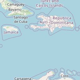
The Dominican Republic shares the island of Hispaniola with Haiti on an active plate boundary. Several fault systems pose significant seismic hazard.
In 2026, Dominican Republic has recorded 164 earthquakes of magnitude 2.5 or greater so far. The largest earthquake in Dominican Republic in 2026 was a magnitude 5.0 event near Boca de Yuma, Dominican Republic.
Over the past 30 days, there have been 33 recorded earthquakes in this region. The largest recent earthquake was a magnitude 5.0 event near 51 km S of Boca de Yuma, Dominican Republic.
In the past 30 days, 33 earthquakes have been recorded in the Dominican Republic region.
The largest recent earthquake in the Dominican Republic area was a magnitude 5.0 event that occurred 51 km S of Boca de Yuma, Dominican Republic.
Residents should secure heavy furniture, create an emergency kit with supplies for 72 hours, develop a family communication plan, and practice "Drop, Cover, and Hold On" during earthquake drills. Visit our preparedness section for detailed guides.
Haiti sits on the boundary between the Caribbean and North American plates. The ...
Puerto Rico sits between the Caribbean and North American plates with the Puerto...
Jamaica lies on the plate boundary between the Caribbean and Gonâve microplates....
Cuba experiences earthquakes primarily in its eastern regions near the plate bou...