Earthquakes in Jamaica

0 earthquakes in the last 24 hours• Latest significant: M4.3

Earthquake Map

Map showing earthquake epicenter at 18.11°, -77.30°

Recent Earthquakes (Last 30 Days)

Dataset at a glance — Jamaica

Over the past 30 days, Jamaica has recorded 1 earthquake of magnitude 2.5 or greater in our tracker. 1 landed between M4.0 and M4.9. By depth: 1 shallow (<70 km). 1 of the epicenters were offshore. 1 event produced at least one felt report, totalling 8 citizen submissions to the USGS Did You Feel It? system. All 1 solutions have been reviewed by a USGS seismologist.

Leading the list is a magnitude 4.3 event near 5 km SW of Easington, Jamaica at 10.0 km depth, which drew 8 felt reports from the public.

Each row in the table below includes a narrative summary of the event, ordered by time. Use the column headers to sort or filter by magnitude.

Showing 1 of 1
Time Mag Location Depth Felt MMIAlertStatusDetails
2026-05-13
2026-05-13 08:20:12 UTC
4.3mb
5 km SW of Easington, Jamaica
17.890°, -76.624°
10.0 km8--✓ ReviewedUSGS →
On May 13, 2026 at 08:20 UTC, a magnitude 4.3 earthquake struck 5 km SW of Easington, Jamaica. A small number of nearby observers (8) submitted felt reports to the USGS. The hypocenter lay at 10.0 km, placing this in the shallow crustal category. The event was offshore — common for earthquakes along subduction zones and transform plate boundaries. The epicenter is at 17.890°, -76.624°. The solution has been reviewed by a USGS seismologist and is considered finalized. See the M4.3 event page for the full report, ShakeMap, and citizen-reported intensity data.
Legend:
Mag: Magnitude ({magType} = ml, mb, mw, etc.)
Felt: Number of DYFI felt reports
MMI: Modified Mercalli Intensity (I-X+)
Alert: PAGER alert level
Depth: Shallow (<70km), Intermediate, Deep (>300km)
Status: Auto = preliminary, Reviewed = verified by seismologist
Click any row to see additional technical details.

Earthquake Statistics

Last 24 Hours0
Last 30 Days1
2026 (M2.5+)5

Largest (30 Days)
M4.3

5 km SW of Easington, Jamaica

2026-05-13

Largest in 2026
M5.0

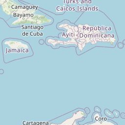
78 km ENE of Manchioneal, Jamaica

2026-02-10

Data from USGS Earthquake Hazards Program. Updated every 5 minutes.

About Jamaica

Jamaica lies on the plate boundary between the Caribbean and Gonâve microplates. The 1692 Port Royal earthquake caused massive destruction.

Jamaica Earthquakes 2026

In 2026, Jamaica has recorded 5 earthquakes of magnitude 2.5 or greater so far. The largest earthquake in Jamaica in 2026 was a magnitude 5.0 event near Manchioneal, Jamaica. As of today, seismic monitoring continues with 0 earthquakes detected in the past 24 hours and 1 in the last 30 days.

Seismic Activity in Jamaica

Jamaica lies on the plate boundary between the Caribbean and Gonâve microplates. The 1692 Port Royal earthquake caused massive destruction.

Over the past 30 days, there have been 1 recorded earthquakes in this region. The largest recent earthquake was a magnitude 4.3 event near 5 km SW of Easington, Jamaica.

Frequently Asked Questions

How many earthquakes occur in Jamaica?

In the past 30 days, 1 earthquakes have been recorded in the Jamaica region. The number varies based on seismic activity in the area.

What was the biggest recent earthquake in Jamaica?

The largest recent earthquake in the Jamaica area was a magnitude 4.3 event that occurred 5 km SW of Easington, Jamaica.

How can I prepare for earthquakes in Jamaica?

Residents should secure heavy furniture, create an emergency kit with supplies for 72 hours, develop a family communication plan, and practice "Drop, Cover, and Hold On" during earthquake drills. Visit our preparedness section for detailed guides.