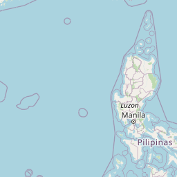
Seismic Activity in Philippines
Over the past 30 days, there have been 29 recorded earthquakes in this region. The largest recent earthquake was a magnitude 5.2 event near 1 km SE of San Roque, Philippines.
Over the past 30 days, Philippines has recorded 29 earthquakes of magnitude 2.5 or greater in our tracker. 6 reached magnitude 5.0 or higher. 23 landed between M4.0 and M4.9. By depth: 26 shallow (<70 km), 3 intermediate (70–300 km). 10 of the epicenters were offshore. 5 events produced at least one felt report, totalling 33 citizen submissions to the USGS Did You Feel It? system. Cluster detection flagged 1 aftershock sequence; the largest contained 3 smaller events within 20 km and 72 hours of its mainshock. Focal depths ranged from 8.7 km to 202.1 km. All 29 solutions have been reviewed by a USGS seismologist.
Leading the list is a magnitude 5.2 event near 1 km SE of San Roque, Philippines at 10.0 km depth, which drew 27 felt reports from the public. The second-ranked event, at magnitude 5.1 near 30 km SE of Magdalena, Philippines, trails by 0.1 magnitude units — a narrow gap, indicating two comparably energetic events in the current window. Rounding out the top three is a magnitude 5.1 earthquake near 2 km NE of Maygatasan, Philippines.
Each row in the table below includes a narrative summary of the event, ordered by time. Use the column headers to sort or filter by magnitude.
| Time ↓ | Mag ↕ | Location ↕ | Depth ↕ | Felt ↕ | MMI | Alert | Status | Details |
|---|---|---|---|---|---|---|---|---|
2 days ago 2026-07-02 11:24:38 UTC | 4.7mb | 60 km WNW of Catuday, Philippines 16.419°, 119.255° | 22.0 km | - | - | - | ✓ Reviewed | USGS → |
A magnitude 4.7 earthquake was recorded 60 km WNW of Catuday, Philippines on July 2, 2026 at 11:24 UTC. Coming 2 hours after a magnitude 4.8 earthquake in the immediate vicinity, it is most likely an aftershock of that larger rupture. This was a shallow crustal earthquake, focused at 22.0 km depth. Coordinates: 16.419°, 119.255°. The solution has been reviewed by a USGS seismologist and is considered finalized. See the M4.7 event page for the full report, ShakeMap, and citizen-reported intensity data. | ||||||||
2 days ago 2026-07-02 09:59:26 UTC | 4.7mb | 64 km WNW of Catuday, Philippines 16.437°, 119.221° | 22.1 km | - | - | - | ✓ Reviewed | USGS → |
Seismographs logged a magnitude 4.7 earthquake 64 km WNW of Catuday, Philippines with origin time 09:59 UTC on July 2, 2026. It arrived roughly 1 hours after a larger magnitude 4.8 mainshock in the same 20 km area, placing it within the typical aftershock window. The hypocenter lay at 22.1 km, placing this in the shallow crustal category. The epicenter is at 16.437°, 119.221°. The solution has been reviewed by a USGS seismologist and is considered finalized. See the M4.7 event page for the full report, ShakeMap, and citizen-reported intensity data. | ||||||||
2 days ago 2026-07-02 09:30:13 UTC | 4.6mb | 56 km WNW of Catuday, Philippines 16.418°, 119.293° | 22.6 km | - | - | - | ✓ Reviewed | USGS → |
At 09:30 UTC on July 2, 2026, a magnitude 4.6 tremor occurred 56 km WNW of Catuday, Philippines. Coming 1 hours after a magnitude 4.8 earthquake in the immediate vicinity, it is most likely an aftershock of that larger rupture. The event originated approximately 22.6 km below the surface, classifying it as shallow crustal. Coordinates: 16.418°, 119.293°. The solution has been reviewed by a USGS seismologist and is considered finalized. See the M4.6 event page for the full report, ShakeMap, and citizen-reported intensity data. | ||||||||
2 days ago 2026-07-02 09:11:23 UTC | 4.8mb | 65 km WNW of Catuday, Philippines 16.538°, 119.249° | 12.5 km | - | - | - | ✓ Reviewed | USGS → |
A magnitude 4.8 seismic event took place 65 km WNW of Catuday, Philippines on July 2, 2026 at 09:11 UTC. In the 72 hours after this event, the USGS recorded 3 smaller earthquakes within 20 km, consistent with an ongoing aftershock sequence rooted here. The hypocenter lay at 12.5 km, placing this in the shallow crustal category. Coordinates: 16.538°, 119.249°. The solution has been reviewed by a USGS seismologist and is considered finalized. See the M4.8 event page for the full report, ShakeMap, and citizen-reported intensity data. | ||||||||
6 days ago 2026-06-28 20:01:33 UTC | 4.7mb | 65 km WNW of Catuday, Philippines 16.444°, 119.216° | 10.0 km | - | - | - | ✓ Reviewed | USGS → |
On June 28, 2026, Philippines registered a magnitude 4.7 earthquake 65 km WNW of Catuday, Philippines at 20:01 UTC. This event falls inside the aftershock decay of a nearby magnitude 5.0 earthquake that occurred about 1 hours earlier. At a depth of 10.0 km, the event was shallow crustal. Geolocation places the event at 16.444°N, 119.216°E. The solution has been reviewed by a USGS seismologist and is considered finalized. See the M4.7 event page for the full report, ShakeMap, and citizen-reported intensity data. | ||||||||
6 days ago 2026-06-28 19:25:57 UTC | 4.6mb | 63 km WNW of Catuday, Philippines 16.488°, 119.243° | 10.0 km | - | - | - | ✓ Reviewed | USGS → |
The USGS recorded this magnitude 4.6 earthquake 63 km WNW of Catuday, Philippines at 19:25 UTC on June 28, 2026. It arrived roughly 1 hours after a larger magnitude 5.0 mainshock in the same 20 km area, placing it within the typical aftershock window. This was a shallow crustal earthquake, focused at 10.0 km depth. The epicenter is at 16.488°, 119.243°. The solution has been reviewed by a USGS seismologist and is considered finalized. See the M4.6 event page for the full report, ShakeMap, and citizen-reported intensity data. | ||||||||
6 days ago 2026-06-28 19:09:03 UTC | 5.0mww | 68 km WNW of Catuday, Philippines 16.515°, 119.209° | 10.0 km | - | - | - | ✓ Reviewed | USGS → |
On June 28, 2026, Philippines registered a magnitude 5.0 earthquake 68 km WNW of Catuday, Philippines at 19:09 UTC. It ranks as the fourth largest event in the current dataset. This was a shallow crustal earthquake, focused at 10.0 km depth. The epicenter is at 16.515°, 119.209°. The solution has been reviewed by a USGS seismologist and is considered finalized. See the M5.0 event page for the full report, ShakeMap, and citizen-reported intensity data. | ||||||||
2026-06-25 2026-06-25 21:17:49 UTC | 5.0mww | 93 km E of Union, Philippines 9.892°, 126.952° | 10.0 km | 2 | - | - | ✓ Reviewed | USGS → |
At 21:17 UTC on June 25, 2026, a magnitude 5.0 tremor occurred 93 km E of Union, Philippines. It ranks as the fifth largest event in the current dataset. A small number of nearby observers (2) submitted felt reports to the USGS. The hypocenter lay at 10.0 km, placing this in the shallow crustal category. The event was offshore — common for earthquakes along subduction zones and transform plate boundaries. Geolocation places the event at 9.892°N, 126.952°E. See the M5.0 event page for the full report, ShakeMap, and citizen-reported intensity data. | ||||||||
2026-06-24 2026-06-24 10:51:28 UTC | 4.5mb | 64 km WNW of Catuday, Philippines 16.574°, 119.278° | 10.0 km | - | - | - | ✓ Reviewed | USGS → |
Reports of a magnitude 4.5 earthquake 64 km WNW of Catuday, Philippines came in on June 24, 2026 at 10:51 UTC. Coming 9 hours after a magnitude 5.0 earthquake in the immediate vicinity, it is most likely an aftershock of that larger rupture. At a depth of 10.0 km, the event was shallow crustal. Coordinates: 16.574°, 119.278°. The solution has been reviewed by a USGS seismologist and is considered finalized. See the M4.5 event page for the full report, ShakeMap, and citizen-reported intensity data. | ||||||||
2026-06-24 2026-06-24 02:04:49 UTC | 5.0mww | 71 km WNW of Catuday, Philippines 16.512°, 119.173° | 10.0 km | - | - | - | ✓ Reviewed | USGS → |
The USGS recorded this magnitude 5.0 earthquake 71 km WNW of Catuday, Philippines at 02:04 UTC on June 24, 2026. At a depth of 10.0 km, the event was shallow crustal. Coordinates: 16.512°, 119.173°. The solution has been reviewed by a USGS seismologist and is considered finalized. See the M5.0 event page for the full report, ShakeMap, and citizen-reported intensity data. | ||||||||
2026-06-24 2026-06-24 01:48:29 UTC | 4.4mb | 49 km WNW of Macabuboni, Philippines 16.326°, 119.334° | 10.0 km | - | - | - | ✓ Reviewed | USGS → |
At 01:48 UTC on June 24, 2026, a magnitude 4.4 tremor occurred 49 km WNW of Macabuboni, Philippines. It arrived roughly 1 hours after a larger magnitude 4.8 mainshock in the same 20 km area, placing it within the typical aftershock window. The hypocenter lay at 10.0 km, placing this in the shallow crustal category. The epicenter is at 16.326°, 119.334°. The solution has been reviewed by a USGS seismologist and is considered finalized. See the M4.4 event page for the full report, ShakeMap, and citizen-reported intensity data. | ||||||||
2026-06-24 2026-06-24 01:37:28 UTC | 4.8mb | 61 km WNW of Catuday, Philippines 16.457°, 119.260° | 10.0 km | - | - | - | ✓ Reviewed | USGS → |
June 24, 2026 brought a magnitude 4.8 earthquake 61 km WNW of Catuday, Philippines, logged at 01:37 UTC. It arrived roughly 1 hours after a larger magnitude 4.9 mainshock in the same 20 km area, placing it within the typical aftershock window. At a depth of 10.0 km, the event was shallow crustal. The epicenter is at 16.457°, 119.260°. The solution has been reviewed by a USGS seismologist and is considered finalized. See the M4.8 event page for the full report, ShakeMap, and citizen-reported intensity data. | ||||||||
2026-06-24 2026-06-24 01:34:19 UTC | 4.9mb | 64 km WNW of Catuday, Philippines 16.502°, 119.244° | 10.0 km | - | - | - | ✓ Reviewed | USGS → |
This magnitude 4.9 event was detected 64 km WNW of Catuday, Philippines on June 24, 2026, with origin time 01:34 UTC. The event originated approximately 10.0 km below the surface, classifying it as shallow crustal. The epicenter is at 16.502°, 119.244°. The solution has been reviewed by a USGS seismologist and is considered finalized. See the M4.9 event page for the full report, ShakeMap, and citizen-reported intensity data. | ||||||||
2026-06-24 2026-06-24 00:20:14 UTC | 4.5mb | 68 km W of Macabuboni, Philippines 16.224°, 119.138° | 77.0 km | - | - | - | ✓ Reviewed | USGS → |
A magnitude 4.5 seismic event took place 68 km W of Macabuboni, Philippines on June 24, 2026 at 00:20 UTC. It arrived roughly 1 hours after a larger magnitude 4.8 mainshock in the same 20 km area, placing it within the typical aftershock window. The event originated approximately 77.0 km below the surface, classifying it as intermediate depth. The offshore location combined with this depth is characteristic of seismicity along descending slabs. The epicenter is at 16.224°, 119.138°. The solution has been reviewed by a USGS seismologist and is considered finalized. See the M4.5 event page for the full report, ShakeMap, and citizen-reported intensity data. | ||||||||
2026-06-23 2026-06-23 23:55:17 UTC | 4.8mb | 64 km WNW of Macabuboni, Philippines 16.358°, 119.205° | 10.0 km | - | - | - | ✓ Reviewed | USGS → |
On June 23, 2026 at 23:55 UTC, a magnitude 4.8 earthquake struck 64 km WNW of Macabuboni, Philippines. The event originated approximately 10.0 km below the surface, classifying it as shallow crustal. Geolocation places the event at 16.358°N, 119.205°E. The solution has been reviewed by a USGS seismologist and is considered finalized. See the M4.8 event page for the full report, ShakeMap, and citizen-reported intensity data. | ||||||||
2026-06-23 2026-06-23 23:52:59 UTC | 4.2mb | 68 km W of Macabuboni, Philippines 16.239°, 119.140° | 10.0 km | - | - | - | ✓ Reviewed | USGS → |
This magnitude 4.2 event was detected 68 km W of Macabuboni, Philippines on June 23, 2026, with origin time 23:52 UTC. The event originated approximately 10.0 km below the surface, classifying it as shallow crustal. The event was offshore — common for earthquakes along subduction zones and transform plate boundaries. Coordinates: 16.239°, 119.140°. The solution has been reviewed by a USGS seismologist and is considered finalized. See the M4.2 event page for the full report, ShakeMap, and citizen-reported intensity data. | ||||||||
2026-06-21 2026-06-21 23:03:14 UTC | 4.0mb | 11 km WNW of Rimus, Philippines 16.910°, 120.293° | 55.1 km | - | - | - | ✓ Reviewed | USGS → |
A magnitude 4.0 seismic event took place 11 km WNW of Rimus, Philippines on June 21, 2026 at 23:03 UTC. The hypocenter lay at 55.1 km, placing this in the shallow crustal category. Geolocation places the event at 16.910°N, 120.293°E. The solution has been reviewed by a USGS seismologist and is considered finalized. See the M4.0 event page for the full report, ShakeMap, and citizen-reported intensity data. | ||||||||
2026-06-19 2026-06-19 18:18:19 UTC | 4.5mb | 17 km S of Calatagan, Philippines 13.678°, 120.601° | 80.4 km | - | - | - | ✓ Reviewed | USGS → |
June 19, 2026 brought a magnitude 4.5 earthquake 17 km S of Calatagan, Philippines, logged at 18:18 UTC. This was a intermediate depth earthquake, focused at 80.4 km depth. The offshore location combined with this depth is characteristic of seismicity along descending slabs. Geolocation places the event at 13.678°N, 120.601°E. The solution has been reviewed by a USGS seismologist and is considered finalized. See the M4.5 event page for the full report, ShakeMap, and citizen-reported intensity data. | ||||||||
2026-06-17 2026-06-17 10:31:54 UTC | 4.5mb | 10 km NNE of Luklukan, Philippines 14.404°, 122.763° | 61.7 km | - | - | - | ✓ Reviewed | USGS → |
On June 17, 2026 at 10:31 UTC, a magnitude 4.5 earthquake struck 10 km NNE of Luklukan, Philippines. The hypocenter lay at 61.7 km, placing this in the shallow crustal category. Coordinates: 14.404°, 122.763°. The solution has been reviewed by a USGS seismologist and is considered finalized. See the M4.5 event page for the full report, ShakeMap, and citizen-reported intensity data. | ||||||||
2026-06-14 2026-06-14 16:01:24 UTC | 4.6mb | 30 km WNW of Linaon, Philippines 10.094°, 122.206° | 10.0 km | - | - | - | ✓ Reviewed | USGS → |
This magnitude 4.6 event was detected 30 km WNW of Linaon, Philippines on June 14, 2026, with origin time 16:01 UTC. This event falls inside the aftershock decay of a nearby magnitude 5.1 earthquake that occurred about 1 hours earlier. The hypocenter lay at 10.0 km, placing this in the shallow crustal category. Geolocation places the event at 10.094°N, 122.206°E. The solution has been reviewed by a USGS seismologist and is considered finalized. See the M4.6 event page for the full report, ShakeMap, and citizen-reported intensity data. | ||||||||
2026-06-14 2026-06-14 15:34:42 UTC | 5.1mb | 30 km SE of Magdalena, Philippines 10.209°, 122.148° | 10.0 km | 2 | - | - | ✓ Reviewed | USGS → |
A magnitude 5.1 earthquake was recorded 30 km SE of Magdalena, Philippines on June 14, 2026 at 15:34 UTC. It ranks as the second largest event in the current dataset. A small number of nearby observers (2) submitted felt reports to the USGS. At a depth of 10.0 km, the event was shallow crustal. The event was offshore — common for earthquakes along subduction zones and transform plate boundaries. Geolocation places the event at 10.209°N, 122.148°E. See the M5.1 event page for the full report, ShakeMap, and citizen-reported intensity data. | ||||||||
2026-06-14 2026-06-14 15:22:53 UTC | 4.5mb | 20 km SSW of La Paz, Philippines 10.257°, 122.411° | 10.0 km | - | - | - | ✓ Reviewed | USGS → |
A magnitude 4.5 earthquake was recorded 20 km SSW of La Paz, Philippines on June 14, 2026 at 15:22 UTC. At a depth of 10.0 km, the event was shallow crustal. The epicenter is at 10.257°, 122.411°. The solution has been reviewed by a USGS seismologist and is considered finalized. See the M4.5 event page for the full report, ShakeMap, and citizen-reported intensity data. | ||||||||
2026-06-14 2026-06-14 13:06:47 UTC | 4.5mb | 21 km N of Kaliling, Philippines 10.175°, 122.485° | 10.0 km | - | - | - | ✓ Reviewed | USGS → |
Seismographs logged a magnitude 4.5 earthquake 21 km N of Kaliling, Philippines with origin time 13:06 UTC on June 14, 2026. The event originated approximately 10.0 km below the surface, classifying it as shallow crustal. The event was offshore — common for earthquakes along subduction zones and transform plate boundaries. Geolocation places the event at 10.175°N, 122.485°E. The solution has been reviewed by a USGS seismologist and is considered finalized. See the M4.5 event page for the full report, ShakeMap, and citizen-reported intensity data. | ||||||||
2026-06-12 2026-06-12 20:21:57 UTC | 4.2mb | 7 km S of Hukay, Philippines 13.780°, 120.699° | 202.1 km | 1 | - | - | ✓ Reviewed | USGS → |
Reports of a magnitude 4.2 earthquake 7 km S of Hukay, Philippines came in on June 12, 2026 at 20:21 UTC. At 202.1 km, this is the deepest earthquake in the current dataset — firmly in the intermediate depth category. A small number of nearby observers (1) submitted felt reports to the USGS. The offshore location combined with this depth is characteristic of seismicity along descending slabs. The epicenter is at 13.780°, 120.699°. The solution has been reviewed by a USGS seismologist and is considered finalized. See the M4.2 event page for the full report, ShakeMap, and citizen-reported intensity data. | ||||||||
2026-06-11 2026-06-11 23:18:30 UTC | 4.3mb | 5 km NNE of Santa Monica, Philippines 10.066°, 126.049° | 8.7 km | - | - | - | ✓ Reviewed | USGS → |
The USGS recorded this magnitude 4.3 earthquake 5 km NNE of Santa Monica, Philippines at 23:18 UTC on June 11, 2026. At just 8.7 km, it was the shallowest earthquake in the current dataset — a shallow crustal event. Geolocation places the event at 10.066°N, 126.049°E. The solution has been reviewed by a USGS seismologist and is considered finalized. See the M4.3 event page for the full report, ShakeMap, and citizen-reported intensity data. | ||||||||
2026-06-09 2026-06-09 09:25:03 UTC | 5.1mb | 2 km NE of Maygatasan, Philippines 8.725°, 125.738° | 41.0 km | 1 | - | - | ✓ Reviewed | USGS → |
Seismographs logged a magnitude 5.1 earthquake 2 km NE of Maygatasan, Philippines with origin time 09:25 UTC on June 9, 2026. It ranks as the third largest event in the current dataset. A small number of nearby observers (1) submitted felt reports to the USGS. The event originated approximately 41.0 km below the surface, classifying it as shallow crustal. The event was offshore — common for earthquakes along subduction zones and transform plate boundaries. Coordinates: 8.725°, 125.738°. See the M5.1 event page for the full report, ShakeMap, and citizen-reported intensity data. | ||||||||
2026-06-06 2026-06-06 09:07:22 UTC | 4.9mb | 56 km WSW of Magdalena, Philippines 10.277°, 121.479° | 10.0 km | - | - | - | ✓ Reviewed | USGS → |
Reports of a magnitude 4.9 earthquake 56 km WSW of Magdalena, Philippines came in on June 6, 2026 at 09:07 UTC. This was a shallow crustal earthquake, focused at 10.0 km depth. Geolocation places the event at 10.277°N, 121.479°E. The solution has been reviewed by a USGS seismologist and is considered finalized. See the M4.9 event page for the full report, ShakeMap, and citizen-reported intensity data. | ||||||||
2026-06-05 2026-06-05 21:03:48 UTC | 4.5mb | 56 km W of Catuday, Philippines 16.376°, 119.289° | 10.0 km | - | - | - | ✓ Reviewed | USGS → |
On June 5, 2026, Philippines registered a magnitude 4.5 earthquake 56 km W of Catuday, Philippines at 21:03 UTC. This was a shallow crustal earthquake, focused at 10.0 km depth. The event was offshore — common for earthquakes along subduction zones and transform plate boundaries. Coordinates: 16.376°, 119.289°. The solution has been reviewed by a USGS seismologist and is considered finalized. See the M4.5 event page for the full report, ShakeMap, and citizen-reported intensity data. | ||||||||
2026-06-05 2026-06-05 13:57:59 UTC | 5.2mww | 1 km SE of San Roque, Philippines 13.146°, 123.765° | 10.0 km | 27 | - | - | ✓ Reviewed | USGS → |
On June 5, 2026 at 13:57 UTC, a magnitude 5.2 earthquake struck 1 km SE of San Roque, Philippines. Of every earthquake currently listed for Philippines, this one generated the most felt reports from the public. It is the largest earthquake currently listed for Philippines over the past 30 days. 27 people reported feeling the earthquake via the USGS Did You Feel It? system. The hypocenter lay at 10.0 km, placing this in the shallow crustal category. The event was offshore — common for earthquakes along subduction zones and transform plate boundaries. The epicenter is at 13.146°, 123.765°. The solution has been reviewed by a USGS seismologist and is considered finalized. See the M5.2 event page for the full report, ShakeMap, and citizen-reported intensity data. | ||||||||
1 km SE of San Roque, Philippines
2026-06-05
10 km WSW of Nena, Philippines
2026-05-04
Data from USGS Earthquake Hazards Program. Updated every 5 minutes.
The Philippines sits on the Pacific Ring of Fire and experiences regular earthquakes from multiple fault systems throughout the archipelago.
In 2026, Philippines has recorded 141 earthquakes of magnitude 2.5 or greater so far. The largest earthquake in Philippines in 2026 was a magnitude 6.0 event near Nena, Philippines.
Over the past 30 days, there have been 29 recorded earthquakes in this region. The largest recent earthquake was a magnitude 5.2 event near 1 km SE of San Roque, Philippines.
In the past 30 days, 29 earthquakes have been recorded in the Philippines region.
The largest recent earthquake in the Philippines area was a magnitude 5.2 event that occurred 1 km SE of San Roque, Philippines.
Residents should secure heavy furniture, create an emergency kit with supplies for 72 hours, develop a family communication plan, and practice "Drop, Cover, and Hold On" during earthquake drills. Visit our preparedness section for detailed guides.
Taiwan sits at the collision zone between the Philippine Sea Plate and the Euras...
Vietnam experiences moderate seismic activity, particularly in its northwestern ...
Indonesia's location along major subduction zones makes it one of the most earth...
Thailand experiences earthquakes primarily in its northern regions near the Saga...