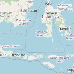
Seismic Activity in Indonesia
Over the past 30 days, there have been 326 recorded earthquakes in this region. The largest recent earthquake was a magnitude 7.8 event near 25 km SW of Kablalan, Philippines.
Over the past 30 days, Indonesia has recorded 200 earthquakes of magnitude 2.5 or greater in our tracker. 33 reached magnitude 5.0 or higher. 167 landed between M4.0 and M4.9. By depth: 144 shallow (<70 km), 53 intermediate (70–300 km), 3 deep-focus (>300 km). 106 of the epicenters were offshore. 27 events produced at least one felt report, totalling 107 citizen submissions to the USGS Did You Feel It? system. Cluster detection flagged 43 aftershock sequences; the largest contained 18 smaller events within 20 km and 72 hours of its mainshock. Focal depths ranged from 7.6 km to 536.4 km. All 200 solutions have been reviewed by a USGS seismologist.
Leading the list is a magnitude 6.7 event near 43 km ESE of Palu, Indonesia at 10.0 km depth, which drew 9 felt reports from the public and triggered a yellow PAGER alert. The second-ranked event, at magnitude 6.5 near 34 km WSW of Sarangani, Philippines, trails by 0.2 magnitude units — a narrow gap, indicating two comparably energetic events in the current window. Rounding out the top three is a magnitude 5.9 earthquake near 192 km N of Metinaro, Timor Leste.
Each row in the table below includes a narrative summary of the event, ordered by time. Use the column headers to sort or filter by magnitude.
| Time ↓ | Mag ↕ | Location ↕ | Depth ↕ | Felt ↕ | MMI | Alert | Status | Details |
|---|---|---|---|---|---|---|---|---|
18 hours ago 2026-07-04 08:53:23 UTC | 4.9mb | 51 km SW of Sarangani, Philippines 5.099°, 125.116° | 35.0 km | 2 | - | - | ✓ Reviewed | USGS → |
On July 4, 2026, Indonesia registered a magnitude 4.9 earthquake 51 km SW of Sarangani, Philippines at 08:53 UTC. A small number of nearby observers (2) submitted felt reports to the USGS. At a depth of 35.0 km, the event was shallow crustal. The event was offshore — common for earthquakes along subduction zones and transform plate boundaries. The epicenter is at 5.099°, 125.116°. The solution has been reviewed by a USGS seismologist and is considered finalized. See the M4.9 event page for the full report, ShakeMap, and citizen-reported intensity data. | ||||||||
23 hours ago 2026-07-04 04:26:27 UTC | 4.8mb | 26 km SW of Balangonan, Philippines 5.424°, 125.170° | 10.1 km | - | - | - | ✓ Reviewed | USGS → |
Reports of a magnitude 4.8 earthquake 26 km SW of Balangonan, Philippines came in on July 4, 2026 at 04:26 UTC. Coming 2 hours after a magnitude 5.2 earthquake in the immediate vicinity, it is most likely an aftershock of that larger rupture. This was a shallow crustal earthquake, focused at 10.1 km depth. The event was offshore — common for earthquakes along subduction zones and transform plate boundaries. Coordinates: 5.424°, 125.170°. The solution has been reviewed by a USGS seismologist and is considered finalized. See the M4.8 event page for the full report, ShakeMap, and citizen-reported intensity data. | ||||||||
1 day ago 2026-07-04 02:21:23 UTC | 5.2mb | 24 km SW of Balangonan, Philippines 5.429°, 125.181° | 10.0 km | 3 | - | - | ✓ Reviewed | USGS → |
Reports of a magnitude 5.2 earthquake 24 km SW of Balangonan, Philippines came in on July 4, 2026 at 02:21 UTC. A small number of nearby observers (3) submitted felt reports to the USGS. This was a shallow crustal earthquake, focused at 10.0 km depth. The event was offshore — common for earthquakes along subduction zones and transform plate boundaries. Geolocation places the event at 5.429°N, 125.181°E. The solution has been reviewed by a USGS seismologist and is considered finalized. See the M5.2 event page for the full report, ShakeMap, and citizen-reported intensity data. | ||||||||
1 day ago 2026-07-03 19:09:17 UTC | 4.8mb | 42 km SW of Balangonan, Philippines 5.337°, 125.049° | 59.8 km | - | - | - | ✓ Reviewed | USGS → |
A magnitude 4.8 seismic event took place 42 km SW of Balangonan, Philippines on July 3, 2026 at 19:09 UTC. It arrived roughly 9 hours after a larger magnitude 4.9 mainshock in the same 20 km area, placing it within the typical aftershock window. The hypocenter lay at 59.8 km, placing this in the shallow crustal category. The event was offshore — common for earthquakes along subduction zones and transform plate boundaries. The epicenter is at 5.337°, 125.049°. The solution has been reviewed by a USGS seismologist and is considered finalized. See the M4.8 event page for the full report, ShakeMap, and citizen-reported intensity data. | ||||||||
1 day ago 2026-07-03 17:14:52 UTC | 4.8mb | 24 km SE of Tambolaka, Indonesia -9.555°, 119.422° | 41.7 km | 1 | - | - | ✓ Reviewed | USGS → |
July 3, 2026 brought a magnitude 4.8 earthquake 24 km SE of Tambolaka, Indonesia, logged at 17:14 UTC. A small number of nearby observers (1) submitted felt reports to the USGS. At a depth of 41.7 km, the event was shallow crustal. The event was offshore — common for earthquakes along subduction zones and transform plate boundaries. Geolocation places the event at -9.555°N, 119.422°E. The solution has been reviewed by a USGS seismologist and is considered finalized. See the M4.8 event page for the full report, ShakeMap, and citizen-reported intensity data. | ||||||||
1 day ago 2026-07-03 10:10:39 UTC | 4.9mb | 18 km SW of Sarangani, Philippines 5.276°, 125.358° | 67.6 km | 1 | - | - | ✓ Reviewed | USGS → |
At 10:10 UTC on July 3, 2026, a magnitude 4.9 tremor occurred 18 km SW of Sarangani, Philippines. A small number of nearby observers (1) submitted felt reports to the USGS. The event originated approximately 67.6 km below the surface, classifying it as shallow crustal. The event was offshore — common for earthquakes along subduction zones and transform plate boundaries. Geolocation places the event at 5.276°N, 125.358°E. The solution has been reviewed by a USGS seismologist and is considered finalized. See the M4.9 event page for the full report, ShakeMap, and citizen-reported intensity data. | ||||||||
1 day ago 2026-07-03 10:08:41 UTC | 4.9mb | 36 km WSW of Sarangani, Philippines 5.242°, 125.173° | 61.5 km | - | - | - | ✓ Reviewed | USGS → |
The USGS recorded this magnitude 4.9 earthquake 36 km WSW of Sarangani, Philippines at 10:08 UTC on July 3, 2026. This was a shallow crustal earthquake, focused at 61.5 km depth. Coordinates: 5.242°, 125.173°. The solution has been reviewed by a USGS seismologist and is considered finalized. See the M4.9 event page for the full report, ShakeMap, and citizen-reported intensity data. | ||||||||
2 days ago 2026-07-02 18:13:24 UTC | 4.3mb | 26 km S of Maasim, Philippines 5.622°, 124.971° | 59.3 km | 2 | - | - | ✓ Reviewed | USGS → |
A magnitude 4.3 seismic event took place 26 km S of Maasim, Philippines on July 2, 2026 at 18:13 UTC. A small number of nearby observers (2) submitted felt reports to the USGS. The hypocenter lay at 59.3 km, placing this in the shallow crustal category. The event was offshore — common for earthquakes along subduction zones and transform plate boundaries. Geolocation places the event at 5.622°N, 124.971°E. The solution has been reviewed by a USGS seismologist and is considered finalized. See the M4.3 event page for the full report, ShakeMap, and citizen-reported intensity data. | ||||||||
2 days ago 2026-07-02 05:50:15 UTC | 4.5mb | 88 km WSW of Gorontalo, Indonesia 0.243°, 122.319° | 144.3 km | - | - | - | ✓ Reviewed | USGS → |
A magnitude 4.5 earthquake was recorded 88 km WSW of Gorontalo, Indonesia on July 2, 2026 at 05:50 UTC. This was a intermediate depth earthquake, focused at 144.3 km depth. Geolocation places the event at 0.243°N, 122.319°E. The solution has been reviewed by a USGS seismologist and is considered finalized. See the M4.5 event page for the full report, ShakeMap, and citizen-reported intensity data. | ||||||||
4 days ago 2026-06-30 21:34:53 UTC | 4.9mb | 8 km SE of Pangyan, Philippines 5.653°, 125.337° | 76.1 km | 2 | - | - | ✓ Reviewed | USGS → |
This magnitude 4.9 event was detected 8 km SE of Pangyan, Philippines on June 30, 2026, with origin time 21:34 UTC. A small number of nearby observers (2) submitted felt reports to the USGS. The hypocenter lay at 76.1 km, placing this in the intermediate depth category. The offshore location combined with this depth is characteristic of seismicity along descending slabs. The epicenter is at 5.653°, 125.337°. The solution has been reviewed by a USGS seismologist and is considered finalized. See the M4.9 event page for the full report, ShakeMap, and citizen-reported intensity data. | ||||||||
4 days ago 2026-06-30 14:26:47 UTC | 4.6mb | 221 km NNE of Bitung, Indonesia 3.267°, 125.946° | 56.2 km | - | - | - | ✓ Reviewed | USGS → |
This magnitude 4.6 event was detected 221 km NNE of Bitung, Indonesia on June 30, 2026, with origin time 14:26 UTC. The hypocenter lay at 56.2 km, placing this in the shallow crustal category. Geolocation places the event at 3.267°N, 125.946°E. The solution has been reviewed by a USGS seismologist and is considered finalized. See the M4.6 event page for the full report, ShakeMap, and citizen-reported intensity data. | ||||||||
5 days ago 2026-06-29 07:19:50 UTC | 4.6mb | 131 km E of Bitung, Indonesia 1.285°, 126.295° | 35.0 km | - | - | - | ✓ Reviewed | USGS → |
Reports of a magnitude 4.6 earthquake 131 km E of Bitung, Indonesia came in on June 29, 2026 at 07:19 UTC. At a depth of 35.0 km, the event was shallow crustal. The event was offshore — common for earthquakes along subduction zones and transform plate boundaries. Coordinates: 1.285°, 126.295°. The solution has been reviewed by a USGS seismologist and is considered finalized. See the M4.6 event page for the full report, ShakeMap, and citizen-reported intensity data. | ||||||||
5 days ago 2026-06-29 04:23:05 UTC | 5.2mb | 107 km SSW of Sarangani, Philippines 4.472°, 125.189° | 9.9 km | 2 | - | - | ✓ Reviewed | USGS → |
A magnitude 5.2 seismic event took place 107 km SSW of Sarangani, Philippines on June 29, 2026 at 04:23 UTC. A small number of nearby observers (2) submitted felt reports to the USGS. The hypocenter lay at 9.9 km, placing this in the shallow crustal category. Coordinates: 4.472°, 125.189°. The solution has been reviewed by a USGS seismologist and is considered finalized. See the M5.2 event page for the full report, ShakeMap, and citizen-reported intensity data. | ||||||||
5 days ago 2026-06-29 04:14:33 UTC | 4.9mb | 90 km S of Sarangani, Philippines 4.591°, 125.404° | 45.1 km | - | - | - | ✓ Reviewed | USGS → |
Reports of a magnitude 4.9 earthquake 90 km S of Sarangani, Philippines came in on June 29, 2026 at 04:14 UTC. At a depth of 45.1 km, the event was shallow crustal. The event was offshore — common for earthquakes along subduction zones and transform plate boundaries. Geolocation places the event at 4.591°N, 125.404°E. The solution has been reviewed by a USGS seismologist and is considered finalized. See the M4.9 event page for the full report, ShakeMap, and citizen-reported intensity data. | ||||||||
6 days ago 2026-06-28 21:43:51 UTC | 4.9mb | 173 km S of Lembar, Indonesia -10.297°, 116.143° | 10.0 km | - | - | - | ✓ Reviewed | USGS → |
A magnitude 4.9 seismic event took place 173 km S of Lembar, Indonesia on June 28, 2026 at 21:43 UTC. The event originated approximately 10.0 km below the surface, classifying it as shallow crustal. The event was offshore — common for earthquakes along subduction zones and transform plate boundaries. Coordinates: -10.297°, 116.143°. The solution has been reviewed by a USGS seismologist and is considered finalized. See the M4.9 event page for the full report, ShakeMap, and citizen-reported intensity data. | ||||||||
6 days ago 2026-06-28 17:57:17 UTC | 4.5mb | 10 km SSE of Kiupo, Philippines 5.756°, 125.360° | 60.2 km | - | - | - | ✓ Reviewed | USGS → |
Seismographs logged a magnitude 4.5 earthquake 10 km SSE of Kiupo, Philippines with origin time 17:57 UTC on June 28, 2026. Coming 46 hours after a magnitude 4.6 earthquake in the immediate vicinity, it is most likely an aftershock of that larger rupture. The hypocenter lay at 60.2 km, placing this in the shallow crustal category. Coordinates: 5.756°, 125.360°. The solution has been reviewed by a USGS seismologist and is considered finalized. See the M4.5 event page for the full report, ShakeMap, and citizen-reported intensity data. | ||||||||
2026-06-27 2026-06-27 21:10:26 UTC | 5.1mb | 112 km SW of Bandar Lampung, Indonesia -6.210°, 104.608° | 10.0 km | 1 | - | - | ✓ Reviewed | USGS → |
The USGS recorded this magnitude 5.1 earthquake 112 km SW of Bandar Lampung, Indonesia at 21:10 UTC on June 27, 2026. A small number of nearby observers (1) submitted felt reports to the USGS. This was a shallow crustal earthquake, focused at 10.0 km depth. The event was offshore — common for earthquakes along subduction zones and transform plate boundaries. The epicenter is at -6.210°, 104.608°. The solution has been reviewed by a USGS seismologist and is considered finalized. See the M5.1 event page for the full report, ShakeMap, and citizen-reported intensity data. | ||||||||
2026-06-27 2026-06-27 10:37:02 UTC | 5.9mww | 192 km N of Metinaro, Timor Leste -6.790°, 125.612° | 525.5 km | - | II | green | ✓ Reviewed | USGS → |
Seismographs logged a magnitude 5.9 earthquake 192 km N of Metinaro, Timor Leste with origin time 10:37 UTC on June 27, 2026. The USGS PAGER system assigned a green alert level for this event, signalling no significant casualties or damage expected. At 525.5 km, this deep-focus earthquake originated far below the brittle crust, deep inside the mantle. Peak ground motion corresponded to MMI 2.1, classified as weak shaking. It ranks as the third largest event in the current dataset. The offshore location combined with this depth is characteristic of seismicity along descending slabs. Coordinates: -6.790°, 125.612°. The solution has been reviewed by a USGS seismologist and is considered finalized. See the M5.9 event page for the full report, ShakeMap, and citizen-reported intensity data. | ||||||||
2026-06-27 2026-06-27 07:47:23 UTC | 5.2mww | 114 km SSW of Trenggalek, Indonesia -8.956°, 111.150° | 65.6 km | 11 | - | - | ✓ Reviewed | USGS → |
June 27, 2026 brought a magnitude 5.2 earthquake 114 km SSW of Trenggalek, Indonesia, logged at 07:47 UTC. 11 people reported feeling the earthquake via the USGS Did You Feel It? system. At a depth of 65.6 km, the event was shallow crustal. The epicenter is at -8.956°, 111.150°. The solution has been reviewed by a USGS seismologist and is considered finalized. See the M5.2 event page for the full report, ShakeMap, and citizen-reported intensity data. | ||||||||
2026-06-26 2026-06-26 20:08:03 UTC | 4.6mb | 3 km WNW of Nuing, Philippines 5.646°, 125.410° | 55.4 km | 1 | - | - | ✓ Reviewed | USGS → |
A magnitude 4.6 seismic event took place 3 km WNW of Nuing, Philippines on June 26, 2026 at 20:08 UTC. A small number of nearby observers (1) submitted felt reports to the USGS. The event originated approximately 55.4 km below the surface, classifying it as shallow crustal. The epicenter is at 5.646°, 125.410°. The solution has been reviewed by a USGS seismologist and is considered finalized. See the M4.6 event page for the full report, ShakeMap, and citizen-reported intensity data. | ||||||||
2026-06-26 2026-06-26 16:40:58 UTC | 4.7mb | 119 km ESE of Bitung, Indonesia 1.052°, 126.127° | 21.6 km | - | - | - | ✓ Reviewed | USGS → |
June 26, 2026 brought a magnitude 4.7 earthquake 119 km ESE of Bitung, Indonesia, logged at 16:40 UTC. At a depth of 21.6 km, the event was shallow crustal. The epicenter is at 1.052°, 126.127°. The solution has been reviewed by a USGS seismologist and is considered finalized. See the M4.7 event page for the full report, ShakeMap, and citizen-reported intensity data. | ||||||||
2026-06-26 2026-06-26 11:34:41 UTC | 6.5mww | 34 km WSW of Sarangani, Philippines 5.239°, 125.197° | 42.0 km | 49 | VII | green | ✓ Reviewed | USGS → |
A magnitude 6.5 earthquake was recorded 34 km WSW of Sarangani, Philippines on June 26, 2026 at 11:34 UTC. On the Modified Mercalli scale, shaking reached 7.0 — considered severe. Of every earthquake currently listed for Indonesia, this one generated the most felt reports from the public. The USGS PAGER system assigned a green alert level for this event, signalling no significant casualties or damage expected. Nearby residents submitted 49 felt reports to the USGS DYFI platform. It ranks as the second largest event in the current dataset. At a depth of 42.0 km, the event was shallow crustal. Geolocation places the event at 5.239°N, 125.197°E. The solution has been reviewed by a USGS seismologist and is considered finalized. See the M6.5 event page for the full report, ShakeMap, and citizen-reported intensity data. | ||||||||
2026-06-25 2026-06-25 04:03:41 UTC | 4.9mb | 24 km WSW of Sarangani, Philippines 5.288°, 125.274° | 75.1 km | - | - | - | ✓ Reviewed | USGS → |
June 25, 2026 brought a magnitude 4.9 earthquake 24 km WSW of Sarangani, Philippines, logged at 04:03 UTC. This was a intermediate depth earthquake, focused at 75.1 km depth. The epicenter is at 5.288°, 125.274°. The solution has been reviewed by a USGS seismologist and is considered finalized. See the M4.9 event page for the full report, ShakeMap, and citizen-reported intensity data. | ||||||||
2026-06-24 2026-06-24 03:32:06 UTC | 4.8mb | 78 km SSW of Lumatil, Philippines 5.194°, 124.696° | 35.0 km | - | - | - | ✓ Reviewed | USGS → |
On June 24, 2026 at 03:32 UTC, a magnitude 4.8 earthquake struck 78 km SSW of Lumatil, Philippines. The event originated approximately 35.0 km below the surface, classifying it as shallow crustal. Coordinates: 5.194°, 124.696°. The solution has been reviewed by a USGS seismologist and is considered finalized. See the M4.8 event page for the full report, ShakeMap, and citizen-reported intensity data. | ||||||||
2026-06-23 2026-06-23 04:53:36 UTC | 4.9mb | 171 km WNW of Tobelo, Indonesia 2.482°, 126.665° | 35.0 km | - | - | - | ✓ Reviewed | USGS → |
On June 23, 2026 at 04:53 UTC, a magnitude 4.9 earthquake struck 171 km WNW of Tobelo, Indonesia. The hypocenter lay at 35.0 km, placing this in the shallow crustal category. Geolocation places the event at 2.482°N, 126.665°E. The solution has been reviewed by a USGS seismologist and is considered finalized. See the M4.9 event page for the full report, ShakeMap, and citizen-reported intensity data. | ||||||||
2026-06-23 2026-06-23 00:24:10 UTC | 4.5mb | 2 km SW of Balangonan, Philippines 5.555°, 125.335° | 74.3 km | - | - | - | ✓ Reviewed | USGS → |
On June 23, 2026, Indonesia registered a magnitude 4.5 earthquake 2 km SW of Balangonan, Philippines at 00:24 UTC. At a depth of 74.3 km, the event was intermediate depth. The offshore location combined with this depth is characteristic of seismicity along descending slabs. The epicenter is at 5.555°, 125.335°. The solution has been reviewed by a USGS seismologist and is considered finalized. See the M4.5 event page for the full report, ShakeMap, and citizen-reported intensity data. | ||||||||
2026-06-22 2026-06-22 18:03:47 UTC | 4.8mb | 90 km SW of Pagar Alam, Indonesia -4.627°, 102.695° | 65.6 km | - | - | - | ✓ Reviewed | USGS → |
A magnitude 4.8 earthquake was recorded 90 km SW of Pagar Alam, Indonesia on June 22, 2026 at 18:03 UTC. This was a shallow crustal earthquake, focused at 65.6 km depth. The event was offshore — common for earthquakes along subduction zones and transform plate boundaries. The epicenter is at -4.627°, 102.695°. The solution has been reviewed by a USGS seismologist and is considered finalized. See the M4.8 event page for the full report, ShakeMap, and citizen-reported intensity data. | ||||||||
2026-06-22 2026-06-22 02:17:47 UTC | 4.8mb | 17 km WSW of Burias, Philippines 5.632°, 125.123° | 10.0 km | - | - | - | ✓ Reviewed | USGS → |
Seismographs logged a magnitude 4.8 earthquake 17 km WSW of Burias, Philippines with origin time 02:17 UTC on June 22, 2026. The hypocenter lay at 10.0 km, placing this in the shallow crustal category. Geolocation places the event at 5.632°N, 125.123°E. The solution has been reviewed by a USGS seismologist and is considered finalized. See the M4.8 event page for the full report, ShakeMap, and citizen-reported intensity data. | ||||||||
2026-06-21 2026-06-21 07:41:00 UTC | 4.2mb | 55 km E of Palu, Indonesia -0.883°, 120.373° | 10.0 km | - | - | - | ✓ Reviewed | USGS → |
At 07:41 UTC on June 21, 2026, a magnitude 4.2 tremor occurred 55 km E of Palu, Indonesia. It arrived roughly 59 hours after a larger magnitude 4.4 mainshock in the same 20 km area, placing it within the typical aftershock window. The event originated approximately 10.0 km below the surface, classifying it as shallow crustal. The event was offshore — common for earthquakes along subduction zones and transform plate boundaries. The epicenter is at -0.883°, 120.373°. The solution has been reviewed by a USGS seismologist and is considered finalized. See the M4.2 event page for the full report, ShakeMap, and citizen-reported intensity data. | ||||||||
2026-06-21 2026-06-21 06:18:21 UTC | 4.4mb | 106 km NNE of Bitung, Indonesia 2.259°, 125.630° | 132.7 km | 2 | - | - | ✓ Reviewed | USGS → |
A magnitude 4.4 seismic event took place 106 km NNE of Bitung, Indonesia on June 21, 2026 at 06:18 UTC. A small number of nearby observers (2) submitted felt reports to the USGS. The event originated approximately 132.7 km below the surface, classifying it as intermediate depth. Geolocation places the event at 2.259°N, 125.630°E. The solution has been reviewed by a USGS seismologist and is considered finalized. See the M4.4 event page for the full report, ShakeMap, and citizen-reported intensity data. | ||||||||
25 km SW of Kablalan, Philippines
2026-06-07
25 km SW of Kablalan, Philippines
2026-06-07
Data from USGS Earthquake Hazards Program. Updated every 5 minutes.
Indonesia's location along major subduction zones makes it one of the most earthquake-prone nations on Earth. The 2004 Sumatra earthquake triggered a devastating tsunami.
In 2026, Indonesia has recorded 500 earthquakes of magnitude 2.5 or greater so far. The largest earthquake in Indonesia in 2026 was a magnitude 7.8 event near Kablalan, Philippines.
Over the past 30 days, there have been 326 recorded earthquakes in this region. The largest recent earthquake was a magnitude 7.8 event near 25 km SW of Kablalan, Philippines.
In the past 30 days, 326 earthquakes have been recorded in the Indonesia region.
The largest recent earthquake in the Indonesia area was a magnitude 7.8 event that occurred 25 km SW of Kablalan, Philippines.
Residents should secure heavy furniture, create an emergency kit with supplies for 72 hours, develop a family communication plan, and practice "Drop, Cover, and Hold On" during earthquake drills. Visit our preparedness section for detailed guides.
Malaysia experiences occasional earthquakes, particularly in Sabah on Borneo. Th...
Vietnam experiences moderate seismic activity, particularly in its northwestern ...
The Philippines sits on the Pacific Ring of Fire and experiences regular earthqu...
Thailand experiences earthquakes primarily in its northern regions near the Saga...