Seismic Activity in Malaysia
Over the past 30 days, there have been 3 recorded earthquakes in this region. The largest recent earthquake was a magnitude 5.0 event near 55 km WSW of Langsa, Indonesia.
Over the past 30 days, Malaysia has recorded 3 earthquakes of magnitude 2.5 or greater in our tracker. 1 reached magnitude 5.0 or higher. 2 landed between M4.0 and M4.9. By depth: 1 shallow (<70 km), 2 intermediate (70–300 km). 2 events produced at least one felt report, totalling 5 citizen submissions to the USGS Did You Feel It? system. Focal depths ranged from 10.0 km to 85.7 km. All 3 solutions have been reviewed by a USGS seismologist.
Each row in the table below includes a narrative summary of the event, ordered by time. Use the column headers to sort or filter by magnitude.
| Time ↓ | Mag ↕ | Location ↕ | Depth ↕ | Felt ↕ | MMI | Alert | Status | Details |
|---|---|---|---|---|---|---|---|---|
4 days ago 2026-07-22 04:18:22 UTC | 5.0mww | 55 km WSW of Langsa, Indonesia 4.244°, 97.524° | 10.0 km | 4 | - | - | ✓ Reviewed | USGS → |
On July 22, 2026 at 04:18 UTC, a magnitude 5.0 earthquake struck 55 km WSW of Langsa, Indonesia. It is the largest earthquake currently listed for Malaysia over the past 30 days. See the M5.0 event page for the full report, ShakeMap, and citizen-reported intensity data. | ||||||||
2026-07-07 2026-07-07 15:36:07 UTC | 4.2mb | 76 km NNW of Singkil, Indonesia 2.949°, 97.580° | 76.9 km | 1 | - | - | ✓ Reviewed | USGS → |
Seismographs logged a magnitude 4.2 earthquake 76 km NNW of Singkil, Indonesia with origin time 15:36 UTC on July 7, 2026. See the M4.2 event page for the full report, ShakeMap, and citizen-reported intensity data. | ||||||||
2026-06-27 2026-06-27 04:01:50 UTC | 4.3mb | 74 km SSE of Blangpidie, Indonesia 3.135°, 97.127° | 85.7 km | - | - | - | ✓ Reviewed | USGS → |
A magnitude 4.3 earthquake was recorded 74 km SSE of Blangpidie, Indonesia on June 27, 2026 at 04:01 UTC. See the M4.3 event page for the full report, ShakeMap, and citizen-reported intensity data. | ||||||||
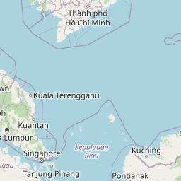
55 km WSW of Langsa, Indonesia
4 days ago
55 km WSW of Langsa, Indonesia
4 days ago
Data from USGS Earthquake Hazards Program. Updated every 5 minutes.
Malaysia experiences occasional earthquakes, particularly in Sabah on Borneo. The country also feels effects from Indonesian subduction zone events.
In 2026, Malaysia has recorded 20 earthquakes of magnitude 2.5 or greater so far. The largest earthquake in Malaysia in 2026 was a magnitude 5.0 event near Langsa, Indonesia.
Over the past 30 days, there have been 3 recorded earthquakes in this region. The largest recent earthquake was a magnitude 5.0 event near 55 km WSW of Langsa, Indonesia.
In the past 30 days, 3 earthquakes have been recorded in the Malaysia region.
The largest recent earthquake in the Malaysia area was a magnitude 5.0 event that occurred 55 km WSW of Langsa, Indonesia.
Thailand experiences earthquakes primarily in its northern regions near the Saga...
Vietnam experiences moderate seismic activity, particularly in its northwestern ...
Indonesia's location along major subduction zones makes it one of the most earth...
Myanmar lies along the Burma Plate boundary with multiple active fault systems i...