11 earthquakes in the last 24 hours• Latest significant: M4.7
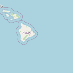
Earthquake Map
Recent Earthquakes (Last 30 Days)
Dataset at a glance — Hawaii
Over the past 30 days, Hawaii has recorded 38 earthquakes of magnitude 2.5 or greater in our tracker. 3 landed between M4.0 and M4.9. The remaining 35 fell in the M2.5–M3.9 band. By depth: 37 shallow (<70 km), 1 intermediate (70–300 km). 25 of the epicenters were offshore. 22 events produced at least one felt report, totalling 1,754 citizen submissions to the USGS Did You Feel It? system. Focal depths ranged from 0.3 km to 122.3 km. 36 of the 38 solutions have been reviewed by a USGS seismologist; the remaining 2 are automatic and may be refined.
Leading the list is a magnitude 4.7 event near 23 km E of Pāpa‘ikou, Hawaii at 39.2 km depth, which drew 912 felt reports from the public and triggered a green PAGER alert. The second-ranked event, at magnitude 4.5 near 17 km SE of Pāhala, Hawaii, trails by 0.2 magnitude units — a narrow gap, indicating two comparably energetic events in the current window. Rounding out the top three is a magnitude 4.1 earthquake near 18 km SE of Pāhala, Hawaii.
Each row in the table below includes a narrative summary of the event, ordered by time. Use the column headers to sort or filter by magnitude.
Reports of a magnitude 3.2 earthquake 13 km N of Wai‘ōhinu, Hawaii came in on July 4, 2026 at 10:26 UTC. A small number of nearby observers (6) submitted felt reports to the USGS. This was a shallow crustal earthquake, focused at 7.2 km depth. The event was offshore — common for earthquakes along subduction zones and transform plate boundaries. Geolocation places the event at 19.194°N, -155.609°E. The solution has been reviewed by a USGS seismologist and is considered finalized. See the M3.2 event page for the full report, ShakeMap, and citizen-reported intensity data.
This magnitude 3.3 event was detected 15 km WSW of Captain Cook, Hawaii on July 3, 2026, with origin time 02:42 UTC. At 122.3 km, this is the deepest earthquake in the current dataset — firmly in the intermediate depth category. The epicenter is at 19.456°, -156.066°. The automatic solution is preliminary and may be refined as additional station data arrives. See the M3.3 event page for the full report, ShakeMap, and citizen-reported intensity data.
Reports of a magnitude 2.7 earthquake 2 km SW of Pāhala, Hawaii came in on July 1, 2026 at 17:13 UTC. It arrived roughly 12 hours after a larger magnitude 3.4 mainshock in the same 20 km area, placing it within the typical aftershock window. This was a shallow crustal earthquake, focused at 32.0 km depth. The event was offshore — common for earthquakes along subduction zones and transform plate boundaries. The epicenter is at 19.181°, -155.494°. The solution has been reviewed by a USGS seismologist and is considered finalized. See the M2.7 event page for the full report, ShakeMap, and citizen-reported intensity data.
The USGS recorded this magnitude 3.4 earthquake 1 km W of Pāhala, Hawaii at 05:06 UTC on July 1, 2026. The event generated 26 citizen felt reports to the USGS. Peak ground motion corresponded to MMI 3.5, classified as light shaking. At a depth of 31.7 km, the event was shallow crustal. The event was offshore — common for earthquakes along subduction zones and transform plate boundaries. Coordinates: 19.200°, -155.494°. The solution has been reviewed by a USGS seismologist and is considered finalized. See the M3.4 event page for the full report, ShakeMap, and citizen-reported intensity data.
At 01:01 UTC on July 1, 2026, a magnitude 2.6 tremor occurred 11 km ESE of Waimea, Hawaii. The event originated approximately 7.3 km below the surface, classifying it as shallow crustal. Geolocation places the event at 19.994°N, -155.566°E. The solution has been reviewed by a USGS seismologist and is considered finalized. See the M2.6 event page for the full report, ShakeMap, and citizen-reported intensity data.
The USGS recorded this magnitude 2.7 earthquake 2 km SE of Naalehu, Hawaii at 16:26 UTC on June 30, 2026. At a depth of 49.7 km, the event was shallow crustal. The event was offshore — common for earthquakes along subduction zones and transform plate boundaries. Geolocation places the event at 19.050°N, -155.559°E. The solution has been reviewed by a USGS seismologist and is considered finalized. See the M2.7 event page for the full report, ShakeMap, and citizen-reported intensity data.
Seismographs logged a magnitude 3.1 earthquake 21 km SE of Pāhala, Hawaii with origin time 15:04 UTC on June 30, 2026. The hypocenter lay at 33.3 km, placing this in the shallow crustal category. The event was offshore — common for earthquakes along subduction zones and transform plate boundaries. The epicenter is at 19.044°, -155.367°. The solution has been reviewed by a USGS seismologist and is considered finalized. See the M3.1 event page for the full report, ShakeMap, and citizen-reported intensity data.
June 30, 2026 brought a magnitude 2.6 earthquake 19 km SE of Pāhala, Hawaii, logged at 11:14 UTC. A small number of nearby observers (1) submitted felt reports to the USGS. At a depth of 32.5 km, the event was shallow crustal. The event was offshore — common for earthquakes along subduction zones and transform plate boundaries. Coordinates: 19.053°, -155.373°. The solution has been reviewed by a USGS seismologist and is considered finalized. See the M2.6 event page for the full report, ShakeMap, and citizen-reported intensity data.
At 01:25 UTC on June 28, 2026, a magnitude 2.9 tremor occurred 45 km W of Kailua-Kona, Hawaii. At a depth of just 0.5 km, this was a very shallow event, close enough to the surface that modest magnitudes can produce significant local shaking. The event was offshore — common for earthquakes along subduction zones and transform plate boundaries. Coordinates: 19.684°, -156.435°. The solution has been reviewed by a USGS seismologist and is considered finalized. See the M2.9 event page for the full report, ShakeMap, and citizen-reported intensity data.
June 27, 2026 brought a magnitude 2.8 earthquake 44 km ESE of Naalehu, Hawaii, logged at 10:55 UTC. This was a shallow crustal earthquake, focused at 8.1 km depth. Geolocation places the event at 18.853°N, -155.226°E. The solution has been reviewed by a USGS seismologist and is considered finalized. See the M2.8 event page for the full report, ShakeMap, and citizen-reported intensity data.
A magnitude 2.6 earthquake was recorded 13 km S of Volcano, Hawaii on June 27, 2026 at 01:10 UTC. This event falls inside the aftershock decay of a nearby magnitude 3.6 earthquake that occurred about 55 hours earlier. This was a shallow crustal earthquake, focused at 6.9 km depth. The event was offshore — common for earthquakes along subduction zones and transform plate boundaries. Geolocation places the event at 19.319°N, -155.223°E. The solution has been reviewed by a USGS seismologist and is considered finalized. See the M2.6 event page for the full report, ShakeMap, and citizen-reported intensity data.
A magnitude 2.7 seismic event took place 19 km ESE of Honaunau-Napoopoo, Hawaii on June 25, 2026 at 18:34 UTC. The hypocenter lay at 9.6 km, placing this in the shallow crustal category. Geolocation places the event at 19.414°N, -155.680°E. The solution has been reviewed by a USGS seismologist and is considered finalized. See the M2.7 event page for the full report, ShakeMap, and citizen-reported intensity data.
June 25, 2026 brought a magnitude 3.1 earthquake 12 km S of Honaunau-Napoopoo, Hawaii, logged at 18:34 UTC. 91 people reported feeling the earthquake via the USGS Did You Feel It? system. At a depth of 21.3 km, the event was shallow crustal. The event was offshore — common for earthquakes along subduction zones and transform plate boundaries. The epicenter is at 19.340°, -155.857°. The solution has been reviewed by a USGS seismologist and is considered finalized. See the M3.1 event page for the full report, ShakeMap, and citizen-reported intensity data.
At 18:29 UTC on June 24, 2026, a magnitude 3.6 tremor occurred 14 km S of Volcano, Hawaii. The USGS received 107 felt reports from nearby residents — a notable response for an event of this magnitude. On the Modified Mercalli scale, shaking reached 4.1 — considered moderate. It ranks as the fifth largest event in the current dataset. The hypocenter lay at 7.4 km, placing this in the shallow crustal category. The event was offshore — common for earthquakes along subduction zones and transform plate boundaries. Geolocation places the event at 19.309°N, -155.216°E. The solution has been reviewed by a USGS seismologist and is considered finalized. See the M3.6 event page for the full report, ShakeMap, and citizen-reported intensity data.
A magnitude 3.2 seismic event took place 13 km SSE of Fern Forest, Hawaii on June 23, 2026 at 19:00 UTC. The event generated 31 citizen felt reports to the USGS. Peak ground motion corresponded to MMI 3.9, classified as light shaking. The hypocenter lay at 6.4 km, placing this in the shallow crustal category. Coordinates: 19.354°, -155.079°. The solution has been reviewed by a USGS seismologist and is considered finalized. See the M3.2 event page for the full report, ShakeMap, and citizen-reported intensity data.
On June 23, 2026 at 05:10 UTC, a magnitude 2.8 earthquake struck 3 km SSW of Pāhala, Hawaii. Coming 26 hours after a magnitude 2.9 earthquake in the immediate vicinity, it is most likely an aftershock of that larger rupture. A small number of nearby observers (3) submitted felt reports to the USGS. The hypocenter lay at 33.5 km, placing this in the shallow crustal category. Coordinates: 19.178°, -155.496°. The solution has been reviewed by a USGS seismologist and is considered finalized. See the M2.8 event page for the full report, ShakeMap, and citizen-reported intensity data.
On June 23, 2026 at 00:11 UTC, a magnitude 2.6 earthquake struck 3 km SSW of Pāhala, Hawaii. It arrived roughly 21 hours after a larger magnitude 2.9 mainshock in the same 20 km area, placing it within the typical aftershock window. A small number of nearby observers (1) submitted felt reports to the USGS. The event originated approximately 33.0 km below the surface, classifying it as shallow crustal. The epicenter is at 19.173°, -155.488°. The solution has been reviewed by a USGS seismologist and is considered finalized. See the M2.6 event page for the full report, ShakeMap, and citizen-reported intensity data.
A magnitude 2.8 earthquake was recorded 5 km NW of Kea‘au, Hawaii on June 22, 2026 at 16:58 UTC. A small number of nearby observers (6) submitted felt reports to the USGS. At a depth of 12.7 km, the event was shallow crustal. The event was offshore — common for earthquakes along subduction zones and transform plate boundaries. The epicenter is at 19.651°, -155.077°. The solution has been reviewed by a USGS seismologist and is considered finalized. See the M2.8 event page for the full report, ShakeMap, and citizen-reported intensity data.
On June 22, 2026, Hawaii registered a magnitude 3.8 earthquake 21 km S of Honaunau-Napoopoo, Hawaii at 16:20 UTC. 50 people reported feeling the earthquake via the USGS Did You Feel It? system. Maximum shaking intensity peaked at MMI 3.5 (light). It ranks as the fourth largest event in the current dataset. This was a shallow crustal earthquake, focused at 5.8 km depth. The event was offshore — common for earthquakes along subduction zones and transform plate boundaries. The epicenter is at 19.263°, -155.837°. The solution has been reviewed by a USGS seismologist and is considered finalized. See the M3.8 event page for the full report, ShakeMap, and citizen-reported intensity data.
On June 22, 2026, Hawaii registered a magnitude 2.8 earthquake 5 km S of Honoka‘a, Hawaii at 05:11 UTC. The event generated 22 citizen felt reports to the USGS. This was a shallow crustal earthquake, focused at 13.6 km depth. The event was offshore — common for earthquakes along subduction zones and transform plate boundaries. Coordinates: 20.028°, -155.465°. The solution has been reviewed by a USGS seismologist and is considered finalized. See the M2.8 event page for the full report, ShakeMap, and citizen-reported intensity data.
The USGS recorded this magnitude 2.9 earthquake 1 km NW of Pāhala, Hawaii at 02:43 UTC on June 22, 2026. A small number of nearby observers (4) submitted felt reports to the USGS. This was a shallow crustal earthquake, focused at 30.7 km depth. The event was offshore — common for earthquakes along subduction zones and transform plate boundaries. The epicenter is at 19.212°, -155.489°. The solution has been reviewed by a USGS seismologist and is considered finalized. See the M2.9 event page for the full report, ShakeMap, and citizen-reported intensity data.
On June 21, 2026, Hawaii registered a magnitude 3.1 earthquake 12 km SSE of Volcano, Hawaii at 05:55 UTC. Nearby residents submitted 11 felt reports to the USGS DYFI platform. At a depth of 6.1 km, the event was shallow crustal. Geolocation places the event at 19.334°N, -155.207°E. The solution has been reviewed by a USGS seismologist and is considered finalized. See the M3.1 event page for the full report, ShakeMap, and citizen-reported intensity data.
At 12:11 UTC on June 18, 2026, a magnitude 2.8 tremor occurred 13 km SSW of Honoka‘a, Hawaii. A small number of nearby observers (8) submitted felt reports to the USGS. The hypocenter lay at 27.3 km, placing this in the shallow crustal category. The epicenter is at 19.962°, -155.508°. The solution has been reviewed by a USGS seismologist and is considered finalized. See the M2.8 event page for the full report, ShakeMap, and citizen-reported intensity data.
A magnitude 4.5 earthquake was recorded 17 km SE of Pāhala, Hawaii on June 17, 2026 at 12:14 UTC. The USGS received 292 felt reports from nearby residents — a notable response for an event of this magnitude. The USGS PAGER system assigned a green alert level for this event, signalling no significant casualties or damage expected. On the Modified Mercalli scale, shaking reached 3.8 — considered light. It ranks as the second largest event in the current dataset. At a depth of 33.1 km, the event was shallow crustal. The event was offshore — common for earthquakes along subduction zones and transform plate boundaries. Geolocation places the event at 19.095°N, -155.362°E. The solution has been reviewed by a USGS seismologist and is considered finalized. See the M4.5 event page for the full report, ShakeMap, and citizen-reported intensity data.
Reports of a magnitude 2.5 earthquake 6 km ESE of Naalehu, Hawaii came in on June 17, 2026 at 06:53 UTC. At a depth of 45.4 km, the event was shallow crustal. Geolocation places the event at 19.040°N, -155.521°E. The solution has been reviewed by a USGS seismologist and is considered finalized. See the M2.5 event page for the full report, ShakeMap, and citizen-reported intensity data.
A magnitude 2.8 seismic event took place 7 km ENE of Pa‘auilo, Hawaii on June 16, 2026 at 14:54 UTC. The event originated approximately 8.9 km below the surface, classifying it as shallow crustal. The epicenter is at 20.055°, -155.303°. The solution has been reviewed by a USGS seismologist and is considered finalized. See the M2.8 event page for the full report, ShakeMap, and citizen-reported intensity data.
Seismographs logged a magnitude 2.8 earthquake 8 km S of Honaunau-Napoopoo, Hawaii with origin time 21:16 UTC on June 14, 2026. A small number of nearby observers (8) submitted felt reports to the USGS. The event originated approximately 22.2 km below the surface, classifying it as shallow crustal. The event was offshore — common for earthquakes along subduction zones and transform plate boundaries. Geolocation places the event at 19.377°N, -155.861°E. The solution has been reviewed by a USGS seismologist and is considered finalized. See the M2.8 event page for the full report, ShakeMap, and citizen-reported intensity data.
On June 13, 2026, Hawaii registered a magnitude 2.6 earthquake 4 km SW of Pāhala, Hawaii at 14:36 UTC. At a depth of 30.7 km, the event was shallow crustal. The event was offshore — common for earthquakes along subduction zones and transform plate boundaries. The epicenter is at 19.171°, -155.508°. The solution has been reviewed by a USGS seismologist and is considered finalized. See the M2.6 event page for the full report, ShakeMap, and citizen-reported intensity data.
On June 13, 2026 at 07:48 UTC, a magnitude 3.1 earthquake struck 6 km W of Kahaluu-Keauhou, Hawaii. Nearby residents submitted 86 felt reports to the USGS DYFI platform. The event originated approximately 5.1 km below the surface, classifying it as shallow crustal. The event was offshore — common for earthquakes along subduction zones and transform plate boundaries. Geolocation places the event at 19.573°N, -156.022°E. The solution has been reviewed by a USGS seismologist and is considered finalized. See the M3.1 event page for the full report, ShakeMap, and citizen-reported intensity data.
Seismographs logged a magnitude 2.6 earthquake 0 km W of Volcano, Hawaii with origin time 13:34 UTC on June 11, 2026. Coming 1 hours after a magnitude 2.7 earthquake in the immediate vicinity, it is most likely an aftershock of that larger rupture. At just 0.3 km, it was the shallowest earthquake in the current dataset — a shallow crustal event. The event was offshore — common for earthquakes along subduction zones and transform plate boundaries. Coordinates: 19.442°, -155.241°. The automatic solution is preliminary and may be refined as additional station data arrives. See the M2.6 event page for the full report, ShakeMap, and citizen-reported intensity data.
Legend:
Mag: Magnitude (magType = ml, mb, mw, etc.)
Felt: Number of DYFI felt reports
MMI: Modified Mercalli Intensity (I-X+)
Alert: PAGER alert level
Depth:Shallow (<70km), Intermediate, Deep (>300km)
Status: Auto = preliminary, Reviewed = verified by seismologist
Click any row to see additional technical details.
Earthquake Statistics
Last 24 Hours11
Last 30 Days38
2026 (M2.5+)147
Largest (30 Days)
M4.7
23 km E of Pāpa‘ikou, Hawaii
2026-06-10
Largest in 2026
M6.0
13 km S of Honaunau-Napoopoo, Hawaii
2026-05-23
Seismic Risk Level
High
Data from USGS Earthquake Hazards Program. Updated every 5 minutes.
About Hawaii
Hawaii's volcanic activity generates frequent earthquakes, particularly on the Big Island. Kilauea volcano's eruptions are often accompanied by significant seismic events.
Hawaii Earthquakes 2026
In 2026, Hawaii has recorded 147 earthquakes of magnitude 2.5 or greater so far. The largest earthquake in Hawaii in 2026 was a magnitude 6.0 event near Honaunau-Napoopoo, Hawaii.
Seismic Activity in Hawaii
Hawaii has a High seismic risk level based on historical earthquake data and proximity to active fault lines.
Over the past 30 days, there have been 38 recorded earthquakes in this region. The largest recent earthquake was a magnitude 4.7 event near 23 km E of Pāpa‘ikou, Hawaii.
Frequently Asked Questions
How many earthquakes occur in Hawaii?
In the past 30 days, 38 earthquakes have been recorded in the Hawaii region.
What was the biggest recent earthquake in Hawaii?
The largest recent earthquake in the Hawaii area was a magnitude 4.7 event that occurred 23 km E of Pāpa‘ikou, Hawaii.
Is Hawaii at risk for earthquakes?
Hawaii has a high seismic risk level. Hawaii's volcanic activity generates frequent earthquakes, particularly on the Big Island. Kilauea volcano's eruptions are often accompanied by significant seismic events.
How can I prepare for earthquakes in Hawaii?
Residents should secure heavy furniture, create an emergency kit with supplies for 72 hours, develop a family communication plan, and practice "Drop, Cover, and Hold On" during earthquake drills. Visit our preparedness section for detailed guides.