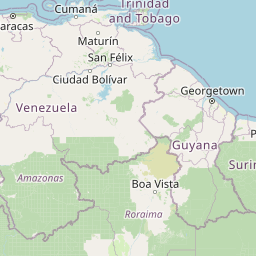
Seismic Activity in Venezuela
Over the past 30 days, there have been 14 recorded earthquakes in this region. The largest recent earthquake was a magnitude 7.5 event near 20 km ESE of Yumare, Venezuela.

Over the past 30 days, Venezuela has recorded 14 earthquakes of magnitude 2.5 or greater in our tracker. 3 reached magnitude 5.0 or higher. 11 landed between M4.0 and M4.9. By depth: 14 shallow (<70 km). 7 of the epicenters were offshore. 13 events produced at least one felt report, totalling 986 citizen submissions to the USGS Did You Feel It? system. Focal depths ranged from 10.0 km to 27.6 km. All 14 solutions have been reviewed by a USGS seismologist.
Each row in the table below includes a narrative summary of the event, ordered by time. Use the column headers to sort or filter by magnitude.
| Time ↓ | Mag ↕ | Location ↕ | Depth ↕ | Felt ↕ | MMI | Alert | Status | Details |
|---|---|---|---|---|---|---|---|---|
2026-06-29 2026-06-29 11:01:03 UTC | 4.6mb | 27 km N of Caraballeda, Venezuela 10.860°, -66.844° | 10.0 km | 87 | - | - | ✓ Reviewed | USGS → |
This magnitude 4.6 event was detected 27 km N of Caraballeda, Venezuela on June 29, 2026, with origin time 11:01 UTC. The event was offshore. See the M4.6 event page for the full report, ShakeMap, and citizen-reported intensity data. | ||||||||
2026-06-28 2026-06-28 09:33:58 UTC | 4.3mb | 19 km WSW of Morón, Venezuela 10.450°, -68.377° | 10.0 km | 8 | - | - | ✓ Reviewed | USGS → |
On June 28, 2026, Venezuela registered a magnitude 4.3 earthquake 19 km WSW of Morón, Venezuela at 09:33 UTC. This event falls inside the aftershock decay of a nearby magnitude 4.5 earthquake that occurred about 1 hours earlier. See the M4.3 event page for the full report, ShakeMap, and citizen-reported intensity data. | ||||||||
2026-06-28 2026-06-28 08:46:09 UTC | 4.5mb | 11 km SW of Boca de Aroa, Venezuela 10.609°, -68.370° | 10.0 km | 5 | - | - | ✓ Reviewed | USGS → |
Reports of a magnitude 4.5 earthquake 11 km SW of Boca de Aroa, Venezuela came in on June 28, 2026 at 08:46 UTC. The event was offshore. See the M4.5 event page for the full report, ShakeMap, and citizen-reported intensity data. | ||||||||
2026-06-27 2026-06-27 19:20:37 UTC | 4.8mww | 41 km N of El Limón, Venezuela 10.677°, -67.613° | 10.0 km | 49 | - | - | ✓ Reviewed | USGS → |
On June 27, 2026, Venezuela registered a magnitude 4.8 earthquake 41 km N of El Limón, Venezuela at 19:20 UTC. The event was offshore. See the M4.8 event page for the full report, ShakeMap, and citizen-reported intensity data. | ||||||||
2026-06-27 2026-06-27 14:23:39 UTC | 4.4mb | 12 km W of Catia La Mar, Venezuela 10.607°, -67.143° | 10.0 km | 2 | - | - | ✓ Reviewed | USGS → |
June 27, 2026 brought a magnitude 4.4 earthquake 12 km W of Catia La Mar, Venezuela, logged at 14:23 UTC. It arrived roughly 64 hours after a larger magnitude 4.5 mainshock in the same 20 km area, placing it within the typical aftershock window. The event was offshore. See the M4.4 event page for the full report, ShakeMap, and citizen-reported intensity data. | ||||||||
2026-06-26 2026-06-26 22:16:11 UTC | 4.7mww | 54 km N of El Limón, Venezuela 10.797°, -67.601° | 10.0 km | 43 | - | - | ✓ Reviewed | USGS → |
At 22:16 UTC on June 26, 2026, a magnitude 4.7 tremor occurred 54 km N of El Limón, Venezuela. The event was offshore. See the M4.7 event page for the full report, ShakeMap, and citizen-reported intensity data. | ||||||||
2026-06-26 2026-06-26 04:19:30 UTC | 4.4mb | 17 km WSW of Morón, Venezuela 10.454°, -68.361° | 10.0 km | 6 | - | - | ✓ Reviewed | USGS → |
On June 26, 2026 at 04:19 UTC, a magnitude 4.4 earthquake struck 17 km WSW of Morón, Venezuela. This event falls inside the aftershock decay of a nearby magnitude 7.5 earthquake that occurred about 30 hours earlier. See the M4.4 event page for the full report, ShakeMap, and citizen-reported intensity data. | ||||||||
2026-06-25 2026-06-25 07:48:51 UTC | 4.4mb | 38 km NNE of El Limón, Venezuela 10.601°, -67.451° | 10.0 km | 1 | - | - | ✓ Reviewed | USGS → |
A magnitude 4.4 earthquake was recorded 38 km NNE of El Limón, Venezuela on June 25, 2026 at 07:48 UTC. See the M4.4 event page for the full report, ShakeMap, and citizen-reported intensity data. | ||||||||
2026-06-25 2026-06-25 05:48:25 UTC | 4.4mb | 12 km NE of Caraballeda, Venezuela 10.706°, -66.783° | 10.0 km | 15 | - | - | ✓ Reviewed | USGS → |
Seismographs logged a magnitude 4.4 earthquake 12 km NE of Caraballeda, Venezuela with origin time 05:48 UTC on June 25, 2026. The event was offshore. See the M4.4 event page for the full report, ShakeMap, and citizen-reported intensity data. | ||||||||
2026-06-24 2026-06-24 22:54:00 UTC | 5.0mb | 31 km NNE of Catia La Mar, Venezuela 10.885°, -66.973° | 10.0 km | 1 | - | - | ✓ Reviewed | USGS → |
Seismographs logged a magnitude 5.0 earthquake 31 km NNE of Catia La Mar, Venezuela with origin time 22:54 UTC on June 24, 2026. See the M5.0 event page for the full report, ShakeMap, and citizen-reported intensity data. | ||||||||
2026-06-24 2026-06-24 22:23:55 UTC | 4.5mb | 20 km WSW of Catia La Mar, Venezuela 10.533°, -67.209° | 10.0 km | 9 | - | - | ✓ Reviewed | USGS → |
A magnitude 4.5 seismic event took place 20 km WSW of Catia La Mar, Venezuela on June 24, 2026 at 22:23 UTC. See the M4.5 event page for the full report, ShakeMap, and citizen-reported intensity data. | ||||||||
2026-06-24 2026-06-24 22:05:11 UTC | 7.5mww | 20 km ESE of Yumare, Venezuela 10.509°, -68.504° | 10.0 km | 753 | VIII | red | ✓ Reviewed | USGS → |
On June 24, 2026 at 22:05 UTC, a magnitude 7.5 earthquake struck 20 km ESE of Yumare, Venezuela. The USGS PAGER system assigned a red alert level for this event, signalling widespread severe impact likely. It is the largest earthquake currently listed for Venezuela over the past 30 days. See the M7.5 event page for the full report, ShakeMap, and citizen-reported intensity data. | ||||||||
2026-06-24 2026-06-24 22:04:34 UTC | 7.2mww | 21 km ENE of San Felipe, Venezuela 10.409°, -68.557° | 27.6 km | - | VIII | red | ✓ Reviewed | USGS → |
A magnitude 7.2 earthquake was recorded 21 km ENE of San Felipe, Venezuela on June 24, 2026 at 22:04 UTC. The USGS PAGER system assigned a red alert level for this event, signalling widespread severe impact likely. This is the deepest earthquake in the current dataset — a shallow crustal event. See the M7.2 event page for the full report, ShakeMap, and citizen-reported intensity data. | ||||||||
2026-06-18 2026-06-18 01:23:29 UTC | 4.7mb | 34 km NW of Guanare, Venezuela 9.293°, -69.930° | 10.0 km | 7 | - | - | ✓ Reviewed | USGS → |
The USGS recorded this magnitude 4.7 earthquake 34 km NW of Guanare, Venezuela at 01:23 UTC on June 18, 2026. The event was offshore. See the M4.7 event page for the full report, ShakeMap, and citizen-reported intensity data. | ||||||||
20 km ESE of Yumare, Venezuela
2026-06-24
20 km ESE of Yumare, Venezuela
2026-06-24
Data from USGS Earthquake Hazards Program. Updated every 5 minutes.
Venezuela lies along the boundary between the Caribbean and South American plates. The Boconó Fault system in the Andes produces regular earthquakes.
In 2026, Venezuela has recorded 19 earthquakes of magnitude 2.5 or greater so far. The largest earthquake in Venezuela in 2026 was a magnitude 7.5 event near Yumare, Venezuela.
Over the past 30 days, there have been 14 recorded earthquakes in this region. The largest recent earthquake was a magnitude 7.5 event near 20 km ESE of Yumare, Venezuela.
In the past 30 days, 14 earthquakes have been recorded in the Venezuela region.
The largest recent earthquake in the Venezuela area was a magnitude 7.5 event that occurred 20 km ESE of Yumare, Venezuela.
Colombia sits at the junction of the Nazca, Caribbean, and South American plates...
Puerto Rico sits between the Caribbean and North American plates with the Puerto...
The Dominican Republic shares the island of Hispaniola with Haiti on an active p...
Panama lies at the junction of the Cocos, Nazca, Caribbean, and South American p...