Seismic Activity in Colombia
Over the past 30 days, there have been 6 recorded earthquakes in this region. The largest recent earthquake was a magnitude 4.7 event near 18 km ESE of Monterrey, Colombia.
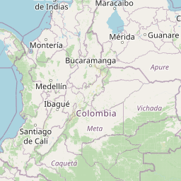
Over the past 30 days, Colombia has recorded 6 earthquakes of magnitude 2.5 or greater in our tracker. 6 landed between M4.0 and M4.9. By depth: 3 shallow (<70 km), 3 intermediate (70–300 km). 3 of the epicenters were offshore. 3 events produced at least one felt report, totalling 5 citizen submissions to the USGS Did You Feel It? system. Focal depths ranged from 10.0 km to 157.0 km. All 6 solutions have been reviewed by a USGS seismologist.
Each row in the table below includes a narrative summary of the event, ordered by time. Use the column headers to sort or filter by magnitude.
| Time ↓ | Mag ↕ | Location ↕ | Depth ↕ | Felt ↕ | MMI | Alert | Status | Details |
|---|---|---|---|---|---|---|---|---|
2 days ago 2026-07-26 02:13:46 UTC | 4.7mb | 18 km ESE of Monterrey, Colombia 4.791°, -72.755° | 12.4 km | - | - | - | ✓ Reviewed | USGS → |
On July 26, 2026 at 02:13 UTC, a magnitude 4.7 earthquake struck 18 km ESE of Monterrey, Colombia. It is the largest earthquake currently listed for Colombia over the past 30 days. See the M4.7 event page for the full report, ShakeMap, and citizen-reported intensity data. | ||||||||
3 days ago 2026-07-25 06:29:17 UTC | 4.4mb | 148 km WSW of Santa Genoveva de Docordó, Colombia 3.914°, -78.656° | 10.0 km | - | - | - | ✓ Reviewed | USGS → |
On July 25, 2026, Colombia registered a magnitude 4.4 earthquake 148 km WSW of Santa Genoveva de Docordó, Colombia at 06:29 UTC. See the M4.4 event page for the full report, ShakeMap, and citizen-reported intensity data. | ||||||||
5 days ago 2026-07-23 17:50:29 UTC | 4.6mb | 8 km NNW of Jordán, Colombia 6.804°, -73.126° | 147.5 km | 1 | - | - | ✓ Reviewed | USGS → |
A magnitude 4.6 earthquake was recorded 8 km NNW of Jordán, Colombia on July 23, 2026 at 17:50 UTC. See the M4.6 event page for the full report, ShakeMap, and citizen-reported intensity data. | ||||||||
2026-07-20 2026-07-20 01:44:14 UTC | 4.6mb | 3 km NE of Jordán, Colombia 6.758°, -73.072° | 152.0 km | 1 | - | - | ✓ Reviewed | USGS → |
Seismographs logged a magnitude 4.6 earthquake 3 km NE of Jordán, Colombia with origin time 01:44 UTC on July 20, 2026. The event was offshore. See the M4.6 event page for the full report, ShakeMap, and citizen-reported intensity data. | ||||||||
2026-07-18 2026-07-18 08:40:27 UTC | 4.4mb | 136 km NW of Mosquera, Colombia 3.327°, -79.372° | 10.0 km | - | - | - | ✓ Reviewed | USGS → |
At 08:40 UTC on July 18, 2026, a magnitude 4.4 tremor occurred 136 km NW of Mosquera, Colombia. The event was offshore. See the M4.4 event page for the full report, ShakeMap, and citizen-reported intensity data. | ||||||||
2026-07-15 2026-07-15 20:13:38 UTC | 4.3mb | 4 km N of Curití, Colombia 6.644°, -73.066° | 157.0 km | 3 | - | - | ✓ Reviewed | USGS → |
The USGS recorded this magnitude 4.3 earthquake 4 km N of Curití, Colombia at 20:13 UTC on July 15, 2026. This is the deepest earthquake in the current dataset — an intermediate depth event. See the M4.3 event page for the full report, ShakeMap, and citizen-reported intensity data. | ||||||||
18 km ESE of Monterrey, Colombia
2 days ago
30 km NW of Darien, Colombia
2026-05-14
Data from USGS Earthquake Hazards Program. Updated every 5 minutes.
Colombia sits at the junction of the Nazca, Caribbean, and South American plates, experiencing frequent earthquakes. The 1999 Armenia earthquake killed over 1,000 people.
In 2026, Colombia has recorded 37 earthquakes of magnitude 2.5 or greater so far. The largest earthquake in Colombia in 2026 was a magnitude 5.3 event near Darien, Colombia.
Over the past 30 days, there have been 6 recorded earthquakes in this region. The largest recent earthquake was a magnitude 4.7 event near 18 km ESE of Monterrey, Colombia.
In the past 30 days, 6 earthquakes have been recorded in the Colombia region.
The largest recent earthquake in the Colombia area was a magnitude 4.7 event that occurred 18 km ESE of Monterrey, Colombia.
Venezuela lies along the boundary between the Caribbean and South American plate...
Ecuador's location along the Nazca-South American plate boundary results in freq...
Panama lies at the junction of the Cocos, Nazca, Caribbean, and South American p...
Peru lies along the Pacific Ring of Fire where the Nazca Plate subducts beneath ...