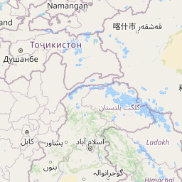
Seismic Activity in Tajikistan
Over the past 30 days, there have been 14 recorded earthquakes in this region. The largest recent earthquake was a magnitude 6.1 event near 43 km S of Jurm, Afghanistan.
Over the past 30 days, Tajikistan has recorded 14 earthquakes of magnitude 2.5 or greater in our tracker. 3 reached magnitude 5.0 or higher. 11 landed between M4.0 and M4.9. By depth: 4 shallow (<70 km), 10 intermediate (70–300 km). 10 of the epicenters were offshore. 5 events produced at least one felt report, totalling 36 citizen submissions to the USGS Did You Feel It? system. Focal depths ranged from 10.0 km to 222.1 km. All 14 solutions have been reviewed by a USGS seismologist.
Leading the list is a magnitude 6.1 event near 43 km S of Jurm, Afghanistan at 199.0 km depth, which drew 30 felt reports from the public and triggered a green PAGER alert. The second-ranked event, at magnitude 5.5 near 47 km SW of Jurm, Afghanistan, trails by 0.6 magnitude units — a meaningful gap that makes the leader clearly dominant in energy release. Rounding out the top three is a magnitude 5.2 earthquake near 42 km SSW of Jurm, Afghanistan.
Each row in the table below includes a narrative summary of the event, ordered by time. Use the column headers to sort or filter by magnitude.
| Time ↓ | Mag ↕ | Location ↕ | Depth ↕ | Felt ↕ | MMI | Alert | Status | Details |
|---|---|---|---|---|---|---|---|---|
1 day ago 2026-07-03 09:35:53 UTC | 4.4mb | 59 km ENE of Kyzyl-Eshme, Kyrgyzstan 39.751°, 72.921° | 10.0 km | - | - | - | ✓ Reviewed | USGS → |
The USGS recorded this magnitude 4.4 earthquake 59 km ENE of Kyzyl-Eshme, Kyrgyzstan at 09:35 UTC on July 3, 2026. At just 10.0 km, it was the shallowest earthquake in the current dataset — a shallow crustal event. Coordinates: 39.751°, 72.921°. The solution has been reviewed by a USGS seismologist and is considered finalized. See the M4.4 event page for the full report, ShakeMap, and citizen-reported intensity data. | ||||||||
3 days ago 2026-07-02 01:20:13 UTC | 4.2mb | 64 km NW of Murghob, Tajikistan 38.522°, 73.385° | 119.6 km | - | - | - | ✓ Reviewed | USGS → |
July 2, 2026 brought a magnitude 4.2 earthquake 64 km NW of Murghob, Tajikistan, logged at 01:20 UTC. At a depth of 119.6 km, the event was intermediate depth. The offshore location combined with this depth is characteristic of seismicity along descending slabs. The epicenter is at 38.522°, 73.385°. The solution has been reviewed by a USGS seismologist and is considered finalized. See the M4.2 event page for the full report, ShakeMap, and citizen-reported intensity data. | ||||||||
3 days ago 2026-07-01 17:57:02 UTC | 5.5mww | 47 km SW of Jurm, Afghanistan 36.567°, 70.449° | 212.9 km | 2 | III | green | ✓ Reviewed | USGS → |
A magnitude 5.5 earthquake was recorded 47 km SW of Jurm, Afghanistan on July 1, 2026 at 17:57 UTC. The USGS PAGER system assigned a green alert level for this event, signalling no significant casualties or damage expected. On the Modified Mercalli scale, shaking reached 3.3 — considered light. It ranks as the second largest event in the current dataset. A small number of nearby observers (2) submitted felt reports to the USGS. At a depth of 212.9 km, the event was intermediate depth. The offshore location combined with this depth is characteristic of seismicity along descending slabs. Geolocation places the event at 36.567°N, 70.449°E. The solution has been reviewed by a USGS seismologist and is considered finalized. See the M5.5 event page for the full report, ShakeMap, and citizen-reported intensity data. | ||||||||
4 days ago 2026-06-30 10:32:27 UTC | 4.0mwr | 121 km W of Kashgar, China 39.614°, 74.589° | 19.2 km | - | - | - | ✓ Reviewed | USGS → |
On June 30, 2026, Tajikistan registered a magnitude 4.0 earthquake 121 km W of Kashgar, China at 10:32 UTC. At a depth of 19.2 km, the event was shallow crustal. The event was offshore — common for earthquakes along subduction zones and transform plate boundaries. Geolocation places the event at 39.614°N, 74.589°E. The solution has been reviewed by a USGS seismologist and is considered finalized. See the M4.0 event page for the full report, ShakeMap, and citizen-reported intensity data. | ||||||||
5 days ago 2026-06-29 11:33:12 UTC | 4.5mb | 40 km SW of Jurm, Afghanistan 36.563°, 70.579° | 204.4 km | - | - | - | ✓ Reviewed | USGS → |
At 11:33 UTC on June 29, 2026, a magnitude 4.5 tremor occurred 40 km SW of Jurm, Afghanistan. This event falls inside the aftershock decay of a nearby magnitude 6.1 earthquake that occurred about 46 hours earlier. It ranks as the fifth largest event in the current dataset. The hypocenter lay at 204.4 km, placing this in the intermediate depth category. The offshore location combined with this depth is characteristic of seismicity along descending slabs. Geolocation places the event at 36.563°N, 70.579°E. The solution has been reviewed by a USGS seismologist and is considered finalized. See the M4.5 event page for the full report, ShakeMap, and citizen-reported intensity data. | ||||||||
6 days ago 2026-06-28 21:31:36 UTC | 4.1mb | 53 km S of Jurm, Afghanistan 36.384°, 70.849° | 146.9 km | - | - | - | ✓ Reviewed | USGS → |
A magnitude 4.1 earthquake was recorded 53 km S of Jurm, Afghanistan on June 28, 2026 at 21:31 UTC. Coming 32 hours after a magnitude 6.1 earthquake in the immediate vicinity, it is most likely an aftershock of that larger rupture. This was a intermediate depth earthquake, focused at 146.9 km depth. The offshore location combined with this depth is characteristic of seismicity along descending slabs. Coordinates: 36.384°, 70.849°. The solution has been reviewed by a USGS seismologist and is considered finalized. See the M4.1 event page for the full report, ShakeMap, and citizen-reported intensity data. | ||||||||
2026-06-27 2026-06-27 13:34:52 UTC | 6.1mww | 43 km S of Jurm, Afghanistan 36.473°, 70.764° | 199.0 km | 30 | III | green | ✓ Reviewed | USGS → |
On June 27, 2026 at 13:34 UTC, a magnitude 6.1 earthquake struck 43 km S of Jurm, Afghanistan. Of every earthquake currently listed for Tajikistan, this one generated the most felt reports from the public. The USGS PAGER system assigned a green alert level for this event, signalling no significant casualties or damage expected. It is the largest earthquake currently listed for Tajikistan over the past 30 days. 30 people reported feeling the earthquake via the USGS Did You Feel It? system. Maximum shaking intensity peaked at MMI 3.7 (light). The hypocenter lay at 199.0 km, placing this in the intermediate depth category. The offshore location combined with this depth is characteristic of seismicity along descending slabs. The epicenter is at 36.473°, 70.764°. See the M6.1 event page for the full report, ShakeMap, and citizen-reported intensity data. | ||||||||
2026-06-24 2026-06-24 16:07:02 UTC | 4.3mb | 10 km W of Quvasoy, Uzbekistan 40.310°, 71.864° | 19.0 km | 2 | - | - | ✓ Reviewed | USGS → |
A magnitude 4.3 seismic event took place 10 km W of Quvasoy, Uzbekistan on June 24, 2026 at 16:07 UTC. A small number of nearby observers (2) submitted felt reports to the USGS. The hypocenter lay at 19.0 km, placing this in the shallow crustal category. The event was offshore — common for earthquakes along subduction zones and transform plate boundaries. Coordinates: 40.310°, 71.864°. The solution has been reviewed by a USGS seismologist and is considered finalized. See the M4.3 event page for the full report, ShakeMap, and citizen-reported intensity data. | ||||||||
2026-06-22 2026-06-22 10:22:23 UTC | 5.2mww | 42 km SSW of Jurm, Afghanistan 36.490°, 70.733° | 207.0 km | 1 | - | - | ✓ Reviewed | USGS → |
Seismographs logged a magnitude 5.2 earthquake 42 km SSW of Jurm, Afghanistan with origin time 10:22 UTC on June 22, 2026. It ranks as the third largest event in the current dataset. A small number of nearby observers (1) submitted felt reports to the USGS. The event originated approximately 207.0 km below the surface, classifying it as intermediate depth. Coordinates: 36.490°, 70.733°. The solution has been reviewed by a USGS seismologist and is considered finalized. See the M5.2 event page for the full report, ShakeMap, and citizen-reported intensity data. | ||||||||
2026-06-21 2026-06-21 08:28:58 UTC | 4.4mb | 66 km S of Jurm, Afghanistan 36.276°, 70.696° | 125.8 km | - | - | - | ✓ Reviewed | USGS → |
This magnitude 4.4 event was detected 66 km S of Jurm, Afghanistan on June 21, 2026, with origin time 08:28 UTC. The event originated approximately 125.8 km below the surface, classifying it as intermediate depth. The offshore location combined with this depth is characteristic of seismicity along descending slabs. The epicenter is at 36.276°, 70.696°. The solution has been reviewed by a USGS seismologist and is considered finalized. See the M4.4 event page for the full report, ShakeMap, and citizen-reported intensity data. | ||||||||
2026-06-18 2026-06-18 23:00:03 UTC | 4.2mb | 63 km E of Khorugh, Tajikistan 37.565°, 72.262° | 189.1 km | - | - | - | ✓ Reviewed | USGS → |
On June 18, 2026 at 23:00 UTC, a magnitude 4.2 earthquake struck 63 km E of Khorugh, Tajikistan. The event originated approximately 189.1 km below the surface, classifying it as intermediate depth. The offshore location combined with this depth is characteristic of seismicity along descending slabs. Geolocation places the event at 37.565°N, 72.262°E. The solution has been reviewed by a USGS seismologist and is considered finalized. See the M4.2 event page for the full report, ShakeMap, and citizen-reported intensity data. | ||||||||
2026-06-14 2026-06-14 17:54:10 UTC | 4.6mb | 21 km SSE of Jurm, Afghanistan 36.679°, 70.916° | 222.1 km | 1 | - | - | ✓ Reviewed | USGS → |
On June 14, 2026, Tajikistan registered a magnitude 4.6 earthquake 21 km SSE of Jurm, Afghanistan at 17:54 UTC. At 222.1 km, this is the deepest earthquake in the current dataset — firmly in the intermediate depth category. It ranks as the fourth largest event in the current dataset. A small number of nearby observers (1) submitted felt reports to the USGS. The epicenter is at 36.679°, 70.916°. The solution has been reviewed by a USGS seismologist and is considered finalized. See the M4.6 event page for the full report, ShakeMap, and citizen-reported intensity data. | ||||||||
2026-06-06 2026-06-06 21:24:39 UTC | 4.1mb | 22 km E of Jurm, Afghanistan 36.831°, 71.085° | 220.8 km | - | - | - | ✓ Reviewed | USGS → |
Seismographs logged a magnitude 4.1 earthquake 22 km E of Jurm, Afghanistan with origin time 21:24 UTC on June 6, 2026. The hypocenter lay at 220.8 km, placing this in the intermediate depth category. The offshore location combined with this depth is characteristic of seismicity along descending slabs. The epicenter is at 36.831°, 71.085°. The solution has been reviewed by a USGS seismologist and is considered finalized. See the M4.1 event page for the full report, ShakeMap, and citizen-reported intensity data. | ||||||||
2026-06-05 2026-06-05 14:12:33 UTC | 4.4mb | 69 km SSE of Karakenja, Tajikistan 38.698°, 71.941° | 10.0 km | - | - | - | ✓ Reviewed | USGS → |
Reports of a magnitude 4.4 earthquake 69 km SSE of Karakenja, Tajikistan came in on June 5, 2026 at 14:12 UTC. At just 10.0 km, it was the shallowest earthquake in the current dataset — a shallow crustal event. Geolocation places the event at 38.698°N, 71.941°E. The solution has been reviewed by a USGS seismologist and is considered finalized. See the M4.4 event page for the full report, ShakeMap, and citizen-reported intensity data. | ||||||||
43 km S of Jurm, Afghanistan
2026-06-27
43 km S of Jurm, Afghanistan
2026-06-27
Data from USGS Earthquake Hazards Program. Updated every 5 minutes.
Tajikistan is one of the most seismically active countries in Central Asia, located in the Pamir Mountains where the Indian and Eurasian plates continue to collide.
In 2026, Tajikistan has recorded 122 earthquakes of magnitude 2.5 or greater so far. The largest earthquake in Tajikistan in 2026 was a magnitude 6.1 event near Jurm, Afghanistan.
Over the past 30 days, there have been 14 recorded earthquakes in this region. The largest recent earthquake was a magnitude 6.1 event near 43 km S of Jurm, Afghanistan.
In the past 30 days, 14 earthquakes have been recorded in the Tajikistan region.
The largest recent earthquake in the Tajikistan area was a magnitude 6.1 event that occurred 43 km S of Jurm, Afghanistan.
Residents should secure heavy furniture, create an emergency kit with supplies for 72 hours, develop a family communication plan, and practice "Drop, Cover, and Hold On" during earthquake drills. Visit our preparedness section for detailed guides.
Kyrgyzstan lies in the tectonically active Tien Shan mountain range with frequen...
Afghanistan lies within the complex collision zone between the Indian and Eurasi...
Uzbekistan lies in the seismically active region of Central Asia with major faul...
Pakistan straddles the boundary between the Indian and Eurasian plates. The 2005...