Seismic Activity in Pakistan
Over the past 30 days, there have been 4 recorded earthquakes in this region. The largest recent earthquake was a magnitude 4.9 event near 4 km NNE of Jalālābād, Afghanistan.
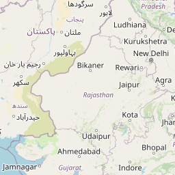
Over the past 30 days, Pakistan has recorded 4 earthquakes of magnitude 2.5 or greater in our tracker. 4 landed between M4.0 and M4.9. By depth: 4 shallow (<70 km). 2 of the epicenters were offshore. 1 event produced at least one felt report, totalling 1 citizen submissions to the USGS Did You Feel It? system. Focal depths ranged from 10.0 km to 48.2 km. All 4 solutions have been reviewed by a USGS seismologist.
Each row in the table below includes a narrative summary of the event, ordered by time. Use the column headers to sort or filter by magnitude.
| Time ↓ | Mag ↕ | Location ↕ | Depth ↕ | Felt ↕ | MMI | Alert | Status | Details |
|---|---|---|---|---|---|---|---|---|
2026-09-02 2026-09-02 01:47:21 UTC | 4.2mb | 24 km NW of Ḩukūmatī Azrah, Afghanistan 34.324°, 69.450° | 10.0 km | - | - | - | ✓ Reviewed | USGS → |
Seismographs logged a magnitude 4.2 earthquake 24 km NW of Ḩukūmatī Azrah, Afghanistan with origin time 01:47 UTC on September 2, 2026. The event was offshore. See the M4.2 event page for the full report, ShakeMap, and citizen-reported intensity data. | ||||||||
2026-08-31 2026-08-31 22:01:38 UTC | 4.3mb | 23 km NNE of Jalālābād, Afghanistan 34.602°, 70.587° | 48.2 km | - | - | - | ✓ Reviewed | USGS → |
A magnitude 4.3 earthquake was recorded 23 km NNE of Jalālābād, Afghanistan on August 31, 2026 at 22:01 UTC. This is the deepest earthquake in the current dataset — a shallow crustal event. See the M4.3 event page for the full report, ShakeMap, and citizen-reported intensity data. | ||||||||
2026-08-25 2026-08-25 01:18:46 UTC | 4.9mb | 4 km NNE of Jalālābād, Afghanistan 34.462°, 70.463° | 10.0 km | 1 | V | yellow | ✓ Reviewed | USGS → |
On August 25, 2026 at 01:18 UTC, a magnitude 4.9 earthquake struck 4 km NNE of Jalālābād, Afghanistan. The USGS PAGER system assigned a yellow alert level for this event, signalling local impact possible. It is the largest earthquake currently listed for Pakistan over the past 30 days. See the M4.9 event page for the full report, ShakeMap, and citizen-reported intensity data. | ||||||||
2026-08-21 2026-08-21 21:54:47 UTC | 4.1mb | 26 km S of Tagāb, Afghanistan 34.616°, 69.669° | 10.0 km | - | - | - | ✓ Reviewed | USGS → |
On August 21, 2026, Pakistan registered a magnitude 4.1 earthquake 26 km S of Tagāb, Afghanistan at 21:54 UTC. The event was offshore. See the M4.1 event page for the full report, ShakeMap, and citizen-reported intensity data. | ||||||||
4 km NNE of Jalālābād, Afghanistan
2026-08-25
37 km NE of Bāzārak, Afghanistan
2026-02-20
Data from USGS Earthquake Hazards Program. Updated every 5 minutes.
Pakistan straddles the boundary between the Indian and Eurasian plates. The 2005 Kashmir earthquake killed over 80,000 people.
In 2026, Pakistan has recorded 38 earthquakes of magnitude 2.5 or greater so far. The largest earthquake in Pakistan in 2026 was a magnitude 5.8 event near Bāzārak, Afghanistan.
Over the past 30 days, there have been 4 recorded earthquakes in this region. The largest recent earthquake was a magnitude 4.9 event near 4 km NNE of Jalālābād, Afghanistan.
In the past 30 days, 4 earthquakes have been recorded in the Pakistan region.
The largest recent earthquake in the Pakistan area was a magnitude 4.9 event that occurred 4 km NNE of Jalālābād, Afghanistan.
Afghanistan lies within the complex collision zone between the Indian and Eurasi...
Tajikistan is one of the most seismically active countries in Central Asia, loca...
Uzbekistan lies in the seismically active region of Central Asia with major faul...
Kyrgyzstan lies in the tectonically active Tien Shan mountain range with frequen...