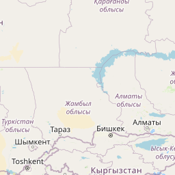
Seismic Activity in Kyrgyzstan
Over the past 30 days, there have been 6 recorded earthquakes in this region. The largest recent earthquake was a magnitude 4.4 event near 48 km NNE of Sarykemer, Kazakhstan.
Over the past 30 days, Kyrgyzstan has recorded 6 earthquakes of magnitude 2.5 or greater in our tracker. 6 landed between M4.0 and M4.9. By depth: 5 shallow (<70 km), 1 intermediate (70–300 km). 3 of the epicenters were offshore. 1 event produced at least one felt report, totalling 2 citizen submissions to the USGS Did You Feel It? system. Focal depths ranged from 10.0 km to 119.6 km. All 6 solutions have been reviewed by a USGS seismologist.
Leading the list is a magnitude 4.4 event near 48 km NNE of Sarykemer, Kazakhstan at 10.0 km depth. The second-ranked event, at magnitude 4.4 near 59 km ENE of Kyzyl-Eshme, Kyrgyzstan, trails by 0.0 magnitude units — a narrow gap, indicating two comparably energetic events in the current window. Rounding out the top three is a magnitude 4.4 earthquake near 69 km SSE of Karakenja, Tajikistan.
Each row in the table below includes a narrative summary of the event, ordered by time. Use the column headers to sort or filter by magnitude.
| Time ↓ | Mag ↕ | Location ↕ | Depth ↕ | Felt ↕ | MMI | Alert | Status | Details |
|---|---|---|---|---|---|---|---|---|
1 day ago 2026-07-03 23:40:55 UTC | 4.4mb | 48 km NNE of Sarykemer, Kazakhstan 43.409°, 71.713° | 10.0 km | - | - | - | ✓ Reviewed | USGS → |
On July 3, 2026 at 23:40 UTC, a magnitude 4.4 earthquake struck 48 km NNE of Sarykemer, Kazakhstan. It is the largest earthquake currently listed for Kyrgyzstan over the past 30 days. At just 10.0 km, it was the shallowest earthquake in the current dataset — a shallow crustal event. The epicenter is at 43.409°, 71.713°. The solution has been reviewed by a USGS seismologist and is considered finalized. See the M4.4 event page for the full report, ShakeMap, and citizen-reported intensity data. | ||||||||
1 day ago 2026-07-03 09:35:53 UTC | 4.4mb | 59 km ENE of Kyzyl-Eshme, Kyrgyzstan 39.751°, 72.921° | 10.0 km | - | - | - | ✓ Reviewed | USGS → |
A magnitude 4.4 earthquake was recorded 59 km ENE of Kyzyl-Eshme, Kyrgyzstan on July 3, 2026 at 09:35 UTC. At just 10.0 km, it was the shallowest earthquake in the current dataset — a shallow crustal event. It ranks as the second largest event in the current dataset. Geolocation places the event at 39.751°N, 72.921°E. The solution has been reviewed by a USGS seismologist and is considered finalized. See the M4.4 event page for the full report, ShakeMap, and citizen-reported intensity data. | ||||||||
3 days ago 2026-07-02 01:20:13 UTC | 4.2mb | 64 km NW of Murghob, Tajikistan 38.522°, 73.385° | 119.6 km | - | - | - | ✓ Reviewed | USGS → |
At 01:20 UTC on July 2, 2026, a magnitude 4.2 tremor occurred 64 km NW of Murghob, Tajikistan. At 119.6 km, this is the deepest earthquake in the current dataset — firmly in the intermediate depth category. It ranks as the fifth largest event in the current dataset. The offshore location combined with this depth is characteristic of seismicity along descending slabs. Geolocation places the event at 38.522°N, 73.385°E. The solution has been reviewed by a USGS seismologist and is considered finalized. See the M4.2 event page for the full report, ShakeMap, and citizen-reported intensity data. | ||||||||
4 days ago 2026-06-30 10:32:27 UTC | 4.0mwr | 121 km W of Kashgar, China 39.614°, 74.589° | 19.2 km | - | - | - | ✓ Reviewed | USGS → |
The USGS recorded this magnitude 4.0 earthquake 121 km W of Kashgar, China at 10:32 UTC on June 30, 2026. At a depth of 19.2 km, the event was shallow crustal. The event was offshore — common for earthquakes along subduction zones and transform plate boundaries. Coordinates: 39.614°, 74.589°. The solution has been reviewed by a USGS seismologist and is considered finalized. See the M4.0 event page for the full report, ShakeMap, and citizen-reported intensity data. | ||||||||
2026-06-24 2026-06-24 16:07:02 UTC | 4.3mb | 10 km W of Quvasoy, Uzbekistan 40.310°, 71.864° | 19.0 km | 2 | - | - | ✓ Reviewed | USGS → |
On June 24, 2026, Kyrgyzstan registered a magnitude 4.3 earthquake 10 km W of Quvasoy, Uzbekistan at 16:07 UTC. It ranks as the fourth largest event in the current dataset. A small number of nearby observers (2) submitted felt reports to the USGS. This was a shallow crustal earthquake, focused at 19.0 km depth. The event was offshore — common for earthquakes along subduction zones and transform plate boundaries. The epicenter is at 40.310°, 71.864°. See the M4.3 event page for the full report, ShakeMap, and citizen-reported intensity data. | ||||||||
2026-06-05 2026-06-05 14:12:33 UTC | 4.4mb | 69 km SSE of Karakenja, Tajikistan 38.698°, 71.941° | 10.0 km | - | - | - | ✓ Reviewed | USGS → |
Seismographs logged a magnitude 4.4 earthquake 69 km SSE of Karakenja, Tajikistan with origin time 14:12 UTC on June 5, 2026. At just 10.0 km, it was the shallowest earthquake in the current dataset — a shallow crustal event. It ranks as the third largest event in the current dataset. Coordinates: 38.698°, 71.941°. The solution has been reviewed by a USGS seismologist and is considered finalized. See the M4.4 event page for the full report, ShakeMap, and citizen-reported intensity data. | ||||||||
48 km NNE of Sarykemer, Kazakhstan
1 day ago
57 km WNW of Murghob, Tajikistan
2026-01-08
Data from USGS Earthquake Hazards Program. Updated every 5 minutes.
Kyrgyzstan lies in the tectonically active Tien Shan mountain range with frequent earthquakes from ongoing continental collision.
In 2026, Kyrgyzstan has recorded 26 earthquakes of magnitude 2.5 or greater so far. The largest earthquake in Kyrgyzstan in 2026 was a magnitude 5.4 event near Murghob, Tajikistan.
Over the past 30 days, there have been 6 recorded earthquakes in this region. The largest recent earthquake was a magnitude 4.4 event near 48 km NNE of Sarykemer, Kazakhstan.
In the past 30 days, 6 earthquakes have been recorded in the Kyrgyzstan region.
The largest recent earthquake in the Kyrgyzstan area was a magnitude 4.4 event that occurred 48 km NNE of Sarykemer, Kazakhstan.
Residents should secure heavy furniture, create an emergency kit with supplies for 72 hours, develop a family communication plan, and practice "Drop, Cover, and Hold On" during earthquake drills. Visit our preparedness section for detailed guides.
Tajikistan is one of the most seismically active countries in Central Asia, loca...
Uzbekistan lies in the seismically active region of Central Asia with major faul...
Afghanistan lies within the complex collision zone between the Indian and Eurasi...
Kazakhstan experiences earthquakes primarily in its southern and eastern mountai...