Seismic Activity in Solomon Islands
Over the past 30 days, there have been 7 recorded earthquakes in this region. The largest recent earthquake was a magnitude 5.2 event near 139 km E of Kirakira, Solomon Islands.
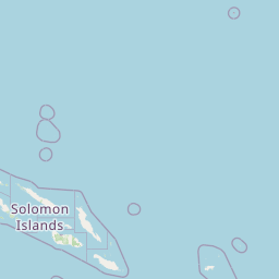
Over the past 30 days, Solomon Islands has recorded 7 earthquakes of magnitude 2.5 or greater in our tracker. 2 reached magnitude 5.0 or higher. 5 landed between M4.0 and M4.9. By depth: 6 shallow (<70 km), 1 intermediate (70–300 km). 6 of the epicenters were offshore. Focal depths ranged from 10.0 km to 80.9 km. All 7 solutions have been reviewed by a USGS seismologist.
Leading the list is a magnitude 5.2 event near 139 km E of Kirakira, Solomon Islands at 10.0 km depth. The second-ranked event, at magnitude 5.1 near 100 km E of Kirakira, Solomon Islands, trails by 0.1 magnitude units — a narrow gap, indicating two comparably energetic events in the current window. Rounding out the top three is a magnitude 4.8 earthquake near 121 km W of Buala, Solomon Islands.
Each row in the table below includes a narrative summary of the event, ordered by time. Use the column headers to sort or filter by magnitude.
| Time ↓ | Mag ↕ | Location ↕ | Depth ↕ | Felt ↕ | MMI | Alert | Status | Details |
|---|---|---|---|---|---|---|---|---|
2026-06-27 2026-06-27 11:23:02 UTC | 5.2mww | 139 km E of Kirakira, Solomon Islands -10.655°, 163.181° | 10.0 km | - | - | - | ✓ Reviewed | USGS → |
On June 27, 2026 at 11:23 UTC, a magnitude 5.2 earthquake struck 139 km E of Kirakira, Solomon Islands. It is the largest earthquake currently listed for Solomon Islands over the past 30 days. At just 10.0 km, it was the shallowest earthquake in the current dataset — a shallow crustal event. The event was offshore — common for earthquakes along subduction zones and transform plate boundaries. The epicenter is at -10.655°, 163.181°. The solution has been reviewed by a USGS seismologist and is considered finalized. See the M5.2 event page for the full report, ShakeMap, and citizen-reported intensity data. | ||||||||
2026-06-27 2026-06-27 00:03:23 UTC | 5.1mb | 100 km E of Kirakira, Solomon Islands -10.609°, 162.828° | 10.0 km | - | - | - | ✓ Reviewed | USGS → |
A magnitude 5.1 earthquake was recorded 100 km E of Kirakira, Solomon Islands on June 27, 2026 at 00:03 UTC. At just 10.0 km, it was the shallowest earthquake in the current dataset — a shallow crustal event. It ranks as the second largest event in the current dataset. The event was offshore — common for earthquakes along subduction zones and transform plate boundaries. Geolocation places the event at -10.609°N, 162.828°E. The solution has been reviewed by a USGS seismologist and is considered finalized. See the M5.1 event page for the full report, ShakeMap, and citizen-reported intensity data. | ||||||||
2026-06-17 2026-06-17 00:02:24 UTC | 4.5mb | 122 km NW of Malango, Solomon Islands -9.078°, 158.795° | 35.0 km | - | - | - | ✓ Reviewed | USGS → |
The USGS recorded this magnitude 4.5 earthquake 122 km NW of Malango, Solomon Islands at 00:02 UTC on June 17, 2026. At a depth of 35.0 km, the event was shallow crustal. The event was offshore — common for earthquakes along subduction zones and transform plate boundaries. Coordinates: -9.078°, 158.795°. The solution has been reviewed by a USGS seismologist and is considered finalized. See the M4.5 event page for the full report, ShakeMap, and citizen-reported intensity data. | ||||||||
2026-06-12 2026-06-12 14:20:45 UTC | 4.7mb | 135 km SW of Buala, Solomon Islands -8.980°, 158.690° | 10.0 km | - | - | - | ✓ Reviewed | USGS → |
On June 12, 2026, Solomon Islands registered a magnitude 4.7 earthquake 135 km SW of Buala, Solomon Islands at 14:20 UTC. At just 10.0 km, it was the shallowest earthquake in the current dataset — a shallow crustal event. It ranks as the fourth largest event in the current dataset. The event was offshore — common for earthquakes along subduction zones and transform plate boundaries. The epicenter is at -8.980°, 158.690°. The solution has been reviewed by a USGS seismologist and is considered finalized. See the M4.7 event page for the full report, ShakeMap, and citizen-reported intensity data. | ||||||||
2026-06-06 2026-06-06 08:52:05 UTC | 4.6mb | 44 km WNW of Kirakira, Solomon Islands -10.343°, 161.532° | 80.9 km | - | - | - | ✓ Reviewed | USGS → |
At 08:52 UTC on June 6, 2026, a magnitude 4.6 tremor occurred 44 km WNW of Kirakira, Solomon Islands. At 80.9 km, this is the deepest earthquake in the current dataset — firmly in the intermediate depth category. It ranks as the fifth largest event in the current dataset. Geolocation places the event at -10.343°N, 161.532°E. The solution has been reviewed by a USGS seismologist and is considered finalized. See the M4.6 event page for the full report, ShakeMap, and citizen-reported intensity data. | ||||||||
2026-06-06 2026-06-06 00:09:06 UTC | 4.5mb | 66 km W of Buala, Solomon Islands -8.158°, 158.984° | 10.0 km | - | - | - | ✓ Reviewed | USGS → |
This magnitude 4.5 event was detected 66 km W of Buala, Solomon Islands on June 6, 2026, with origin time 00:09 UTC. At just 10.0 km, it was the shallowest earthquake in the current dataset — a shallow crustal event. The event was offshore — common for earthquakes along subduction zones and transform plate boundaries. The epicenter is at -8.158°, 158.984°. The solution has been reviewed by a USGS seismologist and is considered finalized. See the M4.5 event page for the full report, ShakeMap, and citizen-reported intensity data. | ||||||||
2026-06-05 2026-06-05 18:52:35 UTC | 4.8mb | 121 km W of Buala, Solomon Islands -8.096°, 158.490° | 10.0 km | - | - | - | ✓ Reviewed | USGS → |
Seismographs logged a magnitude 4.8 earthquake 121 km W of Buala, Solomon Islands with origin time 18:52 UTC on June 5, 2026. At just 10.0 km, it was the shallowest earthquake in the current dataset — a shallow crustal event. It ranks as the third largest event in the current dataset. The event was offshore — common for earthquakes along subduction zones and transform plate boundaries. Coordinates: -8.096°, 158.490°. The solution has been reviewed by a USGS seismologist and is considered finalized. See the M4.8 event page for the full report, ShakeMap, and citizen-reported intensity data. | ||||||||
139 km E of Kirakira, Solomon Islands
2026-06-27
170 km SE of Kirakira, Solomon Islands
2026-03-06
Data from USGS Earthquake Hazards Program. Updated every 5 minutes.
The Solomon Islands sit on a complex tectonic boundary experiencing frequent earthquakes and tsunamis from nearby subduction zones.
In 2026, Solomon Islands has recorded 89 earthquakes of magnitude 2.5 or greater so far. The largest earthquake in Solomon Islands in 2026 was a magnitude 6.2 event near Kirakira, Solomon Islands.
Over the past 30 days, there have been 7 recorded earthquakes in this region. The largest recent earthquake was a magnitude 5.2 event near 139 km E of Kirakira, Solomon Islands.
In the past 30 days, 7 earthquakes have been recorded in the Solomon Islands region.
The largest recent earthquake in the Solomon Islands area was a magnitude 5.2 event that occurred 139 km E of Kirakira, Solomon Islands.
Residents should secure heavy furniture, create an emergency kit with supplies for 72 hours, develop a family communication plan, and practice "Drop, Cover, and Hold On" during earthquake drills. Visit our preparedness section for detailed guides.
Vanuatu lies along the Pacific Ring of Fire with the Australian Plate subducting...
Papua New Guinea sits on the Pacific Ring of Fire at the collision zone of multi...
Fiji lies in a tectonically complex region where the Pacific and Australian plat...
Australia experiences intraplate earthquakes throughout the continent. The 1989 ...