Seismic Activity in Fiji
Over the past 30 days, there have been 16 recorded earthquakes in this region. The largest recent earthquake was a magnitude 5.6 event near 224 km S of Suva, Fiji.
Over the past 30 days, Fiji has recorded 16 earthquakes of magnitude 2.5 or greater in our tracker. 1 reached magnitude 5.0 or higher. 15 landed between M4.0 and M4.9. By depth: 16 deep-focus (>300 km). 8 of the epicenters were offshore. Focal depths ranged from 404.4 km to 624.5 km. All 16 solutions have been reviewed by a USGS seismologist.
Leading the list is a magnitude 5.6 event near 224 km S of Suva, Fiji at 536.7 km depth and triggered a green PAGER alert. The second-ranked event, at magnitude 4.6 near 236 km E of Levuka, Fiji, trails by 1.0 magnitude units — a meaningful gap that makes the leader clearly dominant in energy release. Rounding out the top three is a magnitude 4.6 earthquake near Fiji region.
Each row in the table below includes a narrative summary of the event, ordered by time. Use the column headers to sort or filter by magnitude.
| Time ↓ | Mag ↕ | Location ↕ | Depth ↕ | Felt ↕ | MMI | Alert | Status | Details |
|---|---|---|---|---|---|---|---|---|
3 hours ago 2026-07-04 22:26:56 UTC | 4.5mb | Fiji region -21.186°, -179.239° | 624.5 km | - | - | - | ✓ Reviewed | USGS → |
On July 4, 2026, Fiji registered a magnitude 4.5 earthquake in the Fiji region at 22:26 UTC. At 624.5 km, this is the deepest earthquake in the current dataset — firmly in the deep-focus category. It ranks as the fourth largest event in the current dataset. The epicenter is at -21.186°, -179.239°. The solution has been reviewed by a USGS seismologist and is considered finalized. See the M4.5 event page for the full report, ShakeMap, and citizen-reported intensity data. | ||||||||
1 day ago 2026-07-04 00:00:50 UTC | 4.5mb | Fiji region -19.934°, -178.202° | 576.2 km | - | - | - | ✓ Reviewed | USGS → |
At 00:00 UTC on July 4, 2026, a magnitude 4.5 tremor occurred in the Fiji region. At 576.2 km, this deep-focus earthquake originated far below the brittle crust, deep inside the mantle. It ranks as the fifth largest event in the current dataset. Geolocation places the event at -19.934°N, -178.202°E. The solution has been reviewed by a USGS seismologist and is considered finalized. See the M4.5 event page for the full report, ShakeMap, and citizen-reported intensity data. | ||||||||
3 days ago 2026-07-01 10:42:43 UTC | 5.6mww | 224 km S of Suva, Fiji -20.147°, 178.688° | 536.7 km | - | II | green | ✓ Reviewed | USGS → |
On July 1, 2026 at 10:42 UTC, a magnitude 5.6 earthquake struck 224 km S of Suva, Fiji. The USGS PAGER system assigned a green alert level for this event, signalling no significant casualties or damage expected. It is the largest earthquake currently listed for Fiji over the past 30 days. At 536.7 km, this deep-focus earthquake originated far below the brittle crust, deep inside the mantle. Maximum shaking intensity peaked at MMI 2.4 (weak). The offshore location combined with this depth is characteristic of seismicity along descending slabs. The epicenter is at -20.147°, 178.688°. The solution has been reviewed by a USGS seismologist and is considered finalized. See the M5.6 event page for the full report, ShakeMap, and citizen-reported intensity data. | ||||||||
5 days ago 2026-06-29 21:38:36 UTC | 4.6mb | 236 km E of Levuka, Fiji -17.975°, -178.450° | 616.8 km | - | - | - | ✓ Reviewed | USGS → |
A magnitude 4.6 earthquake was recorded 236 km E of Levuka, Fiji on June 29, 2026 at 21:38 UTC. At 616.8 km, this deep-focus earthquake originated far below the brittle crust, deep inside the mantle. It ranks as the second largest event in the current dataset. The offshore location combined with this depth is characteristic of seismicity along descending slabs. Geolocation places the event at -17.975°N, -178.450°E. The solution has been reviewed by a USGS seismologist and is considered finalized. See the M4.6 event page for the full report, ShakeMap, and citizen-reported intensity data. | ||||||||
2026-06-27 2026-06-27 20:59:34 UTC | 4.1mb | Fiji region -17.065°, -177.288° | 404.4 km | - | - | - | ✓ Reviewed | USGS → |
On June 27, 2026, Fiji registered a magnitude 4.1 earthquake in the Fiji region at 20:59 UTC. At just 404.4 km, it was the shallowest earthquake in the current dataset — a deep-focus event. Geolocation places the event at -17.065°N, -177.288°E. The solution has been reviewed by a USGS seismologist and is considered finalized. See the M4.1 event page for the full report, ShakeMap, and citizen-reported intensity data. | ||||||||
2026-06-27 2026-06-27 12:35:16 UTC | 4.5mb | 200 km ENE of Levuka, Fiji -17.653°, -178.839° | 531.4 km | - | - | - | ✓ Reviewed | USGS → |
The USGS recorded this magnitude 4.5 earthquake 200 km ENE of Levuka, Fiji at 12:35 UTC on June 27, 2026. At 531.4 km, this deep-focus earthquake originated far below the brittle crust, deep inside the mantle. Coordinates: -17.653°, -178.839°. The solution has been reviewed by a USGS seismologist and is considered finalized. See the M4.5 event page for the full report, ShakeMap, and citizen-reported intensity data. | ||||||||
2026-06-15 2026-06-15 08:00:17 UTC | 4.3mb | 284 km E of Levuka, Fiji -17.966°, -177.998° | 590.3 km | - | - | - | ✓ Reviewed | USGS → |
June 15, 2026 brought a magnitude 4.3 earthquake 284 km E of Levuka, Fiji, logged at 08:00 UTC. At 590.3 km, this deep-focus earthquake originated far below the brittle crust, deep inside the mantle. The offshore location combined with this depth is characteristic of seismicity along descending slabs. The epicenter is at -17.966°, -177.998°. The solution has been reviewed by a USGS seismologist and is considered finalized. See the M4.3 event page for the full report, ShakeMap, and citizen-reported intensity data. | ||||||||
2026-06-13 2026-06-13 16:25:29 UTC | 4.2mb | 295 km E of Levuka, Fiji -18.060°, -177.891° | 558.7 km | - | - | - | ✓ Reviewed | USGS → |
Seismographs logged a magnitude 4.2 earthquake 295 km E of Levuka, Fiji with origin time 16:25 UTC on June 13, 2026. At 558.7 km, this deep-focus earthquake originated far below the brittle crust, deep inside the mantle. The offshore location combined with this depth is characteristic of seismicity along descending slabs. The epicenter is at -18.060°, -177.891°. The solution has been reviewed by a USGS seismologist and is considered finalized. See the M4.2 event page for the full report, ShakeMap, and citizen-reported intensity data. | ||||||||
2026-06-12 2026-06-12 14:52:30 UTC | 4.5mb | 208 km E of Levuka, Fiji -17.802°, -178.734° | 580.8 km | - | - | - | ✓ Reviewed | USGS → |
This magnitude 4.5 event was detected 208 km E of Levuka, Fiji on June 12, 2026, with origin time 14:52 UTC. At 580.8 km, this deep-focus earthquake originated far below the brittle crust, deep inside the mantle. The offshore location combined with this depth is characteristic of seismicity along descending slabs. The epicenter is at -17.802°, -178.734°. The solution has been reviewed by a USGS seismologist and is considered finalized. See the M4.5 event page for the full report, ShakeMap, and citizen-reported intensity data. | ||||||||
2026-06-12 2026-06-12 05:42:07 UTC | 4.6mb | Fiji region -19.738°, -177.785° | 552.9 km | - | - | - | ✓ Reviewed | USGS → |
Seismographs logged a magnitude 4.6 earthquake in the Fiji region with origin time 05:42 UTC on June 12, 2026. At 552.9 km, this deep-focus earthquake originated far below the brittle crust, deep inside the mantle. It ranks as the third largest event in the current dataset. Coordinates: -19.738°, -177.785°. The solution has been reviewed by a USGS seismologist and is considered finalized. See the M4.6 event page for the full report, ShakeMap, and citizen-reported intensity data. | ||||||||
2026-06-10 2026-06-10 20:07:45 UTC | 4.0mb | 219 km E of Levuka, Fiji -17.793°, -178.634° | 585.3 km | - | - | - | ✓ Reviewed | USGS → |
At 20:07 UTC on June 10, 2026, a magnitude 4.0 tremor occurred 219 km E of Levuka, Fiji. At 585.3 km, this deep-focus earthquake originated far below the brittle crust, deep inside the mantle. The offshore location combined with this depth is characteristic of seismicity along descending slabs. Coordinates: -17.793°, -178.634°. The solution has been reviewed by a USGS seismologist and is considered finalized. See the M4.0 event page for the full report, ShakeMap, and citizen-reported intensity data. | ||||||||
2026-06-07 2026-06-07 22:39:14 UTC | 4.0mb | 217 km E of Levuka, Fiji -17.767°, -178.658° | 559.2 km | - | - | - | ✓ Reviewed | USGS → |
The USGS recorded this magnitude 4.0 earthquake 217 km E of Levuka, Fiji at 22:39 UTC on June 7, 2026. At 559.2 km, this deep-focus earthquake originated far below the brittle crust, deep inside the mantle. The offshore location combined with this depth is characteristic of seismicity along descending slabs. The epicenter is at -17.767°, -178.658°. The solution has been reviewed by a USGS seismologist and is considered finalized. See the M4.0 event page for the full report, ShakeMap, and citizen-reported intensity data. | ||||||||
2026-06-07 2026-06-07 22:17:49 UTC | 4.5mb | Fiji region -20.797°, -178.666° | 588.3 km | - | - | - | ✓ Reviewed | USGS → |
Reports of a magnitude 4.5 earthquake in the Fiji region came in on June 7, 2026 at 22:17 UTC. At 588.3 km, this deep-focus earthquake originated far below the brittle crust, deep inside the mantle. Geolocation places the event at -20.797°N, -178.666°E. The solution has been reviewed by a USGS seismologist and is considered finalized. See the M4.5 event page for the full report, ShakeMap, and citizen-reported intensity data. | ||||||||
2026-06-07 2026-06-07 13:19:31 UTC | 4.3mb | Fiji region -20.835°, -178.700° | 580.1 km | - | - | - | ✓ Reviewed | USGS → |
On June 7, 2026 at 13:19 UTC, a magnitude 4.3 earthquake struck in the Fiji region. At 580.1 km, this deep-focus earthquake originated far below the brittle crust, deep inside the mantle. Geolocation places the event at -20.835°N, -178.700°E. The solution has been reviewed by a USGS seismologist and is considered finalized. See the M4.3 event page for the full report, ShakeMap, and citizen-reported intensity data. | ||||||||
2026-06-05 2026-06-05 22:08:11 UTC | 4.5mb | 31 km N of Nasinu, Fiji -17.784°, 178.534° | 563.1 km | - | - | - | ✓ Reviewed | USGS → |
A magnitude 4.5 seismic event took place 31 km N of Nasinu, Fiji on June 5, 2026 at 22:08 UTC. At 563.1 km, this deep-focus earthquake originated far below the brittle crust, deep inside the mantle. The offshore location combined with this depth is characteristic of seismicity along descending slabs. Coordinates: -17.784°, 178.534°. The solution has been reviewed by a USGS seismologist and is considered finalized. See the M4.5 event page for the full report, ShakeMap, and citizen-reported intensity data. | ||||||||
2026-06-05 2026-06-05 07:54:16 UTC | 4.3mb | Fiji region -18.654°, -177.667° | 608.6 km | - | - | - | ✓ Reviewed | USGS → |
A magnitude 4.3 earthquake was recorded in the Fiji region on June 5, 2026 at 07:54 UTC. At 608.6 km, this deep-focus earthquake originated far below the brittle crust, deep inside the mantle. Coordinates: -18.654°, -177.667°. The solution has been reviewed by a USGS seismologist and is considered finalized. See the M4.3 event page for the full report, ShakeMap, and citizen-reported intensity data. | ||||||||
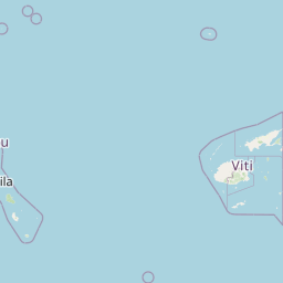
224 km S of Suva, Fiji
3 days ago
south of the Fiji Islands
2026-02-22
Data from USGS Earthquake Hazards Program. Updated every 5 minutes.
Fiji lies in a tectonically complex region where the Pacific and Australian plates interact, producing regular earthquake activity.
In 2026, Fiji has recorded 154 earthquakes of magnitude 2.5 or greater so far. The largest earthquake in Fiji in 2026 was a magnitude 6.0 event near south of the Fiji Islands.
Over the past 30 days, there have been 16 recorded earthquakes in this region. The largest recent earthquake was a magnitude 5.6 event near 224 km S of Suva, Fiji.
In the past 30 days, 16 earthquakes have been recorded in the Fiji region.
The largest recent earthquake in the Fiji area was a magnitude 5.6 event that occurred 224 km S of Suva, Fiji.
Residents should secure heavy furniture, create an emergency kit with supplies for 72 hours, develop a family communication plan, and practice "Drop, Cover, and Hold On" during earthquake drills. Visit our preparedness section for detailed guides.
Vanuatu lies along the Pacific Ring of Fire with the Australian Plate subducting...
The Solomon Islands sit on a complex tectonic boundary experiencing frequent ear...
New Zealand lies along the boundary between the Pacific and Australian plates. T...
Papua New Guinea sits on the Pacific Ring of Fire at the collision zone of multi...