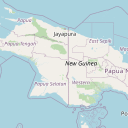
Seismic Activity in Papua New Guinea
Over the past 30 days, there have been 18 recorded earthquakes in this region. The largest recent earthquake was a magnitude 5.1 event near 135 km N of Lae, Papua New Guinea.
Over the past 30 days, Papua New Guinea has recorded 18 earthquakes of magnitude 2.5 or greater in our tracker. 1 reached magnitude 5.0 or higher. 17 landed between M4.0 and M4.9. By depth: 7 shallow (<70 km), 11 intermediate (70–300 km). 9 of the epicenters were offshore. 2 events produced at least one felt report, totalling 2 citizen submissions to the USGS Did You Feel It? system. Focal depths ranged from 19.4 km to 205.2 km. All 18 solutions have been reviewed by a USGS seismologist.
Leading the list is a magnitude 5.1 event near 135 km N of Lae, Papua New Guinea at 182.8 km depth. The second-ranked event, at magnitude 4.9 near 20 km NW of Finschhafen, Papua New Guinea, trails by 0.2 magnitude units — a narrow gap, indicating two comparably energetic events in the current window. Rounding out the top three is a magnitude 4.7 earthquake near 39 km SW of Kandrian, Papua New Guinea.
Each row in the table below includes a narrative summary of the event, ordered by time. Use the column headers to sort or filter by magnitude.
| Time ↓ | Mag ↕ | Location ↕ | Depth ↕ | Felt ↕ | MMI | Alert | Status | Details |
|---|---|---|---|---|---|---|---|---|
10 hours ago 2026-07-05 19:10:14 UTC | 4.6mb | 185 km W of Abepura, Indonesia -2.713°, 138.968° | 19.4 km | - | - | - | ✓ Reviewed | USGS → |
On July 5, 2026, Papua New Guinea registered a magnitude 4.6 earthquake 185 km W of Abepura, Indonesia at 19:10 UTC. At just 19.4 km, it was the shallowest earthquake in the current dataset — a shallow crustal event. It ranks as the fourth largest event in the current dataset. The event was offshore — common for earthquakes along subduction zones and transform plate boundaries. The epicenter is at -2.713°, 138.968°. The solution has been reviewed by a USGS seismologist and is considered finalized. See the M4.6 event page for the full report, ShakeMap, and citizen-reported intensity data. | ||||||||
1 day ago 2026-07-04 07:50:23 UTC | 5.1mb | 135 km N of Lae, Papua New Guinea -5.505°, 147.103° | 182.8 km | - | - | - | ✓ Reviewed | USGS → |
On July 4, 2026 at 07:50 UTC, a magnitude 5.1 earthquake struck 135 km N of Lae, Papua New Guinea. It is the largest earthquake currently listed for Papua New Guinea over the past 30 days. The hypocenter lay at 182.8 km, placing this in the intermediate depth category. The offshore location combined with this depth is characteristic of seismicity along descending slabs. The epicenter is at -5.505°, 147.103°. The solution has been reviewed by a USGS seismologist and is considered finalized. See the M5.1 event page for the full report, ShakeMap, and citizen-reported intensity data. | ||||||||
2026-06-28 2026-06-28 18:45:21 UTC | 4.7mb | 39 km SW of Kandrian, Papua New Guinea -6.498°, 149.341° | 30.0 km | - | - | - | ✓ Reviewed | USGS → |
Seismographs logged a magnitude 4.7 earthquake 39 km SW of Kandrian, Papua New Guinea with origin time 18:45 UTC on June 28, 2026. It ranks as the third largest event in the current dataset. The event originated approximately 30.0 km below the surface, classifying it as shallow crustal. The event was offshore — common for earthquakes along subduction zones and transform plate boundaries. Coordinates: -6.498°, 149.341°. The solution has been reviewed by a USGS seismologist and is considered finalized. See the M4.7 event page for the full report, ShakeMap, and citizen-reported intensity data. | ||||||||
2026-06-28 2026-06-28 02:59:20 UTC | 4.9mb | 20 km NW of Finschhafen, Papua New Guinea -6.439°, 147.708° | 73.1 km | 1 | - | - | ✓ Reviewed | USGS → |
A magnitude 4.9 earthquake was recorded 20 km NW of Finschhafen, Papua New Guinea on June 28, 2026 at 02:59 UTC. It ranks as the second largest event in the current dataset. A small number of nearby observers (1) submitted felt reports to the USGS. At a depth of 73.1 km, the event was intermediate depth. The offshore location combined with this depth is characteristic of seismicity along descending slabs. Geolocation places the event at -6.439°N, 147.708°E. See the M4.9 event page for the full report, ShakeMap, and citizen-reported intensity data. | ||||||||
2026-06-23 2026-06-23 19:27:08 UTC | 4.5mb | 51 km WSW of Kandrian, Papua New Guinea -6.328°, 149.097° | 58.7 km | - | - | - | ✓ Reviewed | USGS → |
The USGS recorded this magnitude 4.5 earthquake 51 km WSW of Kandrian, Papua New Guinea at 19:27 UTC on June 23, 2026. At a depth of 58.7 km, the event was shallow crustal. Coordinates: -6.328°, 149.097°. The solution has been reviewed by a USGS seismologist and is considered finalized. See the M4.5 event page for the full report, ShakeMap, and citizen-reported intensity data. | ||||||||
2026-06-22 2026-06-22 18:24:24 UTC | 4.3mb | 27 km NNE of Bulolo, Papua New Guinea -6.986°, 146.766° | 110.0 km | - | - | - | ✓ Reviewed | USGS → |
A magnitude 4.3 earthquake was recorded 27 km NNE of Bulolo, Papua New Guinea on June 22, 2026 at 18:24 UTC. This was a intermediate depth earthquake, focused at 110.0 km depth. Coordinates: -6.986°, 146.766°. The solution has been reviewed by a USGS seismologist and is considered finalized. See the M4.3 event page for the full report, ShakeMap, and citizen-reported intensity data. | ||||||||
2026-06-19 2026-06-19 16:37:23 UTC | 4.6mb | 108 km NNE of Finschhafen, Papua New Guinea -5.742°, 148.384° | 157.9 km | - | - | - | ✓ Reviewed | USGS → |
At 16:37 UTC on June 19, 2026, a magnitude 4.6 tremor occurred 108 km NNE of Finschhafen, Papua New Guinea. It ranks as the fifth largest event in the current dataset. The hypocenter lay at 157.9 km, placing this in the intermediate depth category. Geolocation places the event at -5.742°N, 148.384°E. The solution has been reviewed by a USGS seismologist and is considered finalized. See the M4.6 event page for the full report, ShakeMap, and citizen-reported intensity data. | ||||||||
2026-06-16 2026-06-16 17:03:30 UTC | 4.3mb | 40 km SE of Vanimo, Papua New Guinea -2.949°, 141.559° | 24.2 km | - | - | - | ✓ Reviewed | USGS → |
Seismographs logged a magnitude 4.3 earthquake 40 km SE of Vanimo, Papua New Guinea with origin time 17:03 UTC on June 16, 2026. The hypocenter lay at 24.2 km, placing this in the shallow crustal category. The event was offshore — common for earthquakes along subduction zones and transform plate boundaries. The epicenter is at -2.949°, 141.559°. The solution has been reviewed by a USGS seismologist and is considered finalized. See the M4.3 event page for the full report, ShakeMap, and citizen-reported intensity data. | ||||||||
2026-06-15 2026-06-15 22:18:39 UTC | 4.2mb | 72 km WNW of Kandrian, Papua New Guinea -6.026°, 148.913° | 77.5 km | - | - | - | ✓ Reviewed | USGS → |
At 22:18 UTC on June 15, 2026, a magnitude 4.2 tremor occurred 72 km WNW of Kandrian, Papua New Guinea. The event originated approximately 77.5 km below the surface, classifying it as intermediate depth. Coordinates: -6.026°, 148.913°. The solution has been reviewed by a USGS seismologist and is considered finalized. See the M4.2 event page for the full report, ShakeMap, and citizen-reported intensity data. | ||||||||
2026-06-15 2026-06-15 01:03:41 UTC | 4.2mb | 108 km NNE of Lae, Papua New Guinea -5.772°, 147.241° | 96.9 km | - | - | - | ✓ Reviewed | USGS → |
The USGS recorded this magnitude 4.2 earthquake 108 km NNE of Lae, Papua New Guinea at 01:03 UTC on June 15, 2026. This was a intermediate depth earthquake, focused at 96.9 km depth. The epicenter is at -5.772°, 147.241°. The solution has been reviewed by a USGS seismologist and is considered finalized. See the M4.2 event page for the full report, ShakeMap, and citizen-reported intensity data. | ||||||||
2026-06-14 2026-06-14 14:07:13 UTC | 4.4mb | 82 km WSW of Kandrian, Papua New Guinea -6.382°, 148.822° | 46.9 km | - | - | - | ✓ Reviewed | USGS → |
A magnitude 4.4 seismic event took place 82 km WSW of Kandrian, Papua New Guinea on June 14, 2026 at 14:07 UTC. The hypocenter lay at 46.9 km, placing this in the shallow crustal category. Coordinates: -6.382°, 148.822°. The solution has been reviewed by a USGS seismologist and is considered finalized. See the M4.4 event page for the full report, ShakeMap, and citizen-reported intensity data. | ||||||||
2026-06-12 2026-06-12 21:38:33 UTC | 4.3mb | 131 km N of Lae, Papua New Guinea -5.538°, 147.014° | 181.5 km | - | - | - | ✓ Reviewed | USGS → |
On June 12, 2026, Papua New Guinea registered a magnitude 4.3 earthquake 131 km N of Lae, Papua New Guinea at 21:38 UTC. At a depth of 181.5 km, the event was intermediate depth. The offshore location combined with this depth is characteristic of seismicity along descending slabs. Geolocation places the event at -5.538°N, 147.014°E. The solution has been reviewed by a USGS seismologist and is considered finalized. See the M4.3 event page for the full report, ShakeMap, and citizen-reported intensity data. | ||||||||
2026-06-12 2026-06-12 02:24:33 UTC | 4.5mb | 23 km NNE of Goroka, Papua New Guinea -5.887°, 145.468° | 92.9 km | - | - | - | ✓ Reviewed | USGS → |
This magnitude 4.5 event was detected 23 km NNE of Goroka, Papua New Guinea on June 12, 2026, with origin time 02:24 UTC. The event originated approximately 92.9 km below the surface, classifying it as intermediate depth. The epicenter is at -5.887°, 145.468°. The solution has been reviewed by a USGS seismologist and is considered finalized. See the M4.5 event page for the full report, ShakeMap, and citizen-reported intensity data. | ||||||||
2026-06-09 2026-06-09 17:55:00 UTC | 4.4mb | 127 km N of Lae, Papua New Guinea -5.589°, 147.179° | 205.2 km | - | - | - | ✓ Reviewed | USGS → |
June 9, 2026 brought a magnitude 4.4 earthquake 127 km N of Lae, Papua New Guinea, logged at 17:55 UTC. At 205.2 km, this is the deepest earthquake in the current dataset — firmly in the intermediate depth category. The offshore location combined with this depth is characteristic of seismicity along descending slabs. The epicenter is at -5.589°, 147.179°. The solution has been reviewed by a USGS seismologist and is considered finalized. See the M4.4 event page for the full report, ShakeMap, and citizen-reported intensity data. | ||||||||
2026-06-08 2026-06-08 14:21:46 UTC | 4.5mb | 58 km SE of Angoram, Papua New Guinea -4.448°, 144.429° | 147.0 km | - | - | - | ✓ Reviewed | USGS → |
Reports of a magnitude 4.5 earthquake 58 km SE of Angoram, Papua New Guinea came in on June 8, 2026 at 14:21 UTC. This was a intermediate depth earthquake, focused at 147.0 km depth. The offshore location combined with this depth is characteristic of seismicity along descending slabs. Geolocation places the event at -4.448°N, 144.429°E. The solution has been reviewed by a USGS seismologist and is considered finalized. See the M4.5 event page for the full report, ShakeMap, and citizen-reported intensity data. | ||||||||
2026-06-07 2026-06-07 05:06:01 UTC | 4.2mb | 87 km WSW of Kandrian, Papua New Guinea -6.449°, 148.792° | 61.5 km | - | - | - | ✓ Reviewed | USGS → |
This magnitude 4.2 event was detected 87 km WSW of Kandrian, Papua New Guinea on June 7, 2026, with origin time 05:06 UTC. The hypocenter lay at 61.5 km, placing this in the shallow crustal category. Geolocation places the event at -6.449°N, 148.792°E. The solution has been reviewed by a USGS seismologist and is considered finalized. See the M4.2 event page for the full report, ShakeMap, and citizen-reported intensity data. | ||||||||
2026-06-07 2026-06-07 03:28:07 UTC | 4.1mb | 82 km W of Kandrian, Papua New Guinea -6.342°, 148.815° | 40.3 km | - | - | - | ✓ Reviewed | USGS → |
Reports of a magnitude 4.1 earthquake 82 km W of Kandrian, Papua New Guinea came in on June 7, 2026 at 03:28 UTC. At a depth of 40.3 km, the event was shallow crustal. The event was offshore — common for earthquakes along subduction zones and transform plate boundaries. Coordinates: -6.342°, 148.815°. The solution has been reviewed by a USGS seismologist and is considered finalized. See the M4.1 event page for the full report, ShakeMap, and citizen-reported intensity data. | ||||||||
2026-06-06 2026-06-06 19:04:34 UTC | 4.4mb | 90 km WNW of Kandrian, Papua New Guinea -6.006°, 148.751° | 78.7 km | 1 | - | - | ✓ Reviewed | USGS → |
On June 6, 2026 at 19:04 UTC, a magnitude 4.4 earthquake struck 90 km WNW of Kandrian, Papua New Guinea. A small number of nearby observers (1) submitted felt reports to the USGS. The event originated approximately 78.7 km below the surface, classifying it as intermediate depth. Geolocation places the event at -6.006°N, 148.751°E. The solution has been reviewed by a USGS seismologist and is considered finalized. See the M4.4 event page for the full report, ShakeMap, and citizen-reported intensity data. | ||||||||
135 km N of Lae, Papua New Guinea
1 day ago
24 km ESE of Madang, Papua New Guinea
2026-01-20
Data from USGS Earthquake Hazards Program. Updated every 5 minutes.
Papua New Guinea sits on the Pacific Ring of Fire at the collision zone of multiple tectonic plates, experiencing frequent large earthquakes.
In 2026, Papua New Guinea has recorded 214 earthquakes of magnitude 2.5 or greater so far. The largest earthquake in Papua New Guinea in 2026 was a magnitude 5.9 event near Madang, Papua New Guinea.
Over the past 30 days, there have been 18 recorded earthquakes in this region. The largest recent earthquake was a magnitude 5.1 event near 135 km N of Lae, Papua New Guinea.
In the past 30 days, 18 earthquakes have been recorded in the Papua New Guinea region.
The largest recent earthquake in the Papua New Guinea area was a magnitude 5.1 event that occurred 135 km N of Lae, Papua New Guinea.
Residents should secure heavy furniture, create an emergency kit with supplies for 72 hours, develop a family communication plan, and practice "Drop, Cover, and Hold On" during earthquake drills. Visit our preparedness section for detailed guides.
The Solomon Islands sit on a complex tectonic boundary experiencing frequent ear...
Australia experiences intraplate earthquakes throughout the continent. The 1989 ...
Vanuatu lies along the Pacific Ring of Fire with the Australian Plate subducting...
Indonesia's location along major subduction zones makes it one of the most earth...