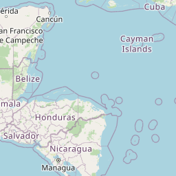
Seismic Activity in Nicaragua
Over the past 30 days, there have been 3 recorded earthquakes in this region. The largest recent earthquake was a magnitude 5.2 event near 7 km NE of Villa El Carmen, Nicaragua.
Over the past 30 days, Nicaragua has recorded 3 earthquakes of magnitude 2.5 or greater in our tracker. 2 reached magnitude 5.0 or higher. 1 landed between M4.0 and M4.9. By depth: 1 shallow (<70 km), 2 intermediate (70–300 km). 3 of the epicenters were offshore. 2 events produced at least one felt report, totalling 106 citizen submissions to the USGS Did You Feel It? system. Focal depths ranged from 65.5 km to 164.1 km. All 3 solutions have been reviewed by a USGS seismologist.
Leading the list is a magnitude 5.2 event near 7 km NE of Villa El Carmen, Nicaragua at 120.5 km depth, which drew 11 felt reports from the public. The second-ranked event, at magnitude 5.0 near 10 km NW of Sardinal, Costa Rica, trails by 0.2 magnitude units — a narrow gap, indicating two comparably energetic events in the current window. Rounding out the top three is a magnitude 4.1 earthquake near 9 km W of Cárdenas, Nicaragua.
Each row in the table below includes a narrative summary of the event, ordered by time. Use the column headers to sort or filter by magnitude.
| Time ↓ | Mag ↕ | Location ↕ | Depth ↕ | Felt ↕ | MMI | Alert | Status | Details |
|---|---|---|---|---|---|---|---|---|
2026-06-26 2026-06-26 11:57:25 UTC | 5.2mww | 7 km NE of Villa El Carmen, Nicaragua 12.031°, -86.457° | 120.5 km | 11 | - | - | ✓ Reviewed | USGS → |
On June 26, 2026 at 11:57 UTC, a magnitude 5.2 earthquake struck 7 km NE of Villa El Carmen, Nicaragua. It is the largest earthquake currently listed for Nicaragua over the past 30 days. 11 people reported feeling the earthquake via the USGS Did You Feel It? system. The hypocenter lay at 120.5 km, placing this in the intermediate depth category. The offshore location combined with this depth is characteristic of seismicity along descending slabs. The epicenter is at 12.031°, -86.457°. The solution has been reviewed by a USGS seismologist and is considered finalized. See the M5.2 event page for the full report, ShakeMap, and citizen-reported intensity data. | ||||||||
2026-06-10 2026-06-10 03:01:35 UTC | 5.0mb | 10 km NW of Sardinal, Costa Rica 10.588°, -85.714° | 65.5 km | 95 | - | - | ✓ Reviewed | USGS → |
A magnitude 5.0 earthquake was recorded 10 km NW of Sardinal, Costa Rica on June 10, 2026 at 03:01 UTC. Of every earthquake currently listed for Nicaragua, this one generated the most felt reports from the public. Nearby residents submitted 95 felt reports to the USGS DYFI platform. At a depth of 65.5 km, the event was shallow crustal. The event was offshore — common for earthquakes along subduction zones and transform plate boundaries. Geolocation places the event at 10.588°N, -85.714°E. The solution has been reviewed by a USGS seismologist and is considered finalized. See the M5.0 event page for the full report, ShakeMap, and citizen-reported intensity data. | ||||||||
2026-06-09 2026-06-09 16:06:30 UTC | 4.1mb | 9 km W of Cárdenas, Nicaragua 11.197°, -85.596° | 164.1 km | - | - | - | ✓ Reviewed | USGS → |
Seismographs logged a magnitude 4.1 earthquake 9 km W of Cárdenas, Nicaragua with origin time 16:06 UTC on June 9, 2026. The event originated approximately 164.1 km below the surface, classifying it as intermediate depth. The offshore location combined with this depth is characteristic of seismicity along descending slabs. Coordinates: 11.197°, -85.596°. The solution has been reviewed by a USGS seismologist and is considered finalized. See the M4.1 event page for the full report, ShakeMap, and citizen-reported intensity data. | ||||||||
7 km NE of Villa El Carmen, Nicaragua
2026-06-26
2 km WSW of Ciudad Sandino, Nicaragua
2026-03-26
Data from USGS Earthquake Hazards Program. Updated every 5 minutes.
Nicaragua lies along the Central American volcanic arc where the Cocos Plate subducts beneath the Caribbean Plate, producing frequent seismic activity.
In 2026, Nicaragua has recorded 34 earthquakes of magnitude 2.5 or greater so far. The largest earthquake in Nicaragua in 2026 was a magnitude 5.5 event near Ciudad Sandino, Nicaragua.
Over the past 30 days, there have been 3 recorded earthquakes in this region. The largest recent earthquake was a magnitude 5.2 event near 7 km NE of Villa El Carmen, Nicaragua.
In the past 30 days, 3 earthquakes have been recorded in the Nicaragua region.
The largest recent earthquake in the Nicaragua area was a magnitude 5.2 event that occurred 7 km NE of Villa El Carmen, Nicaragua.
Residents should secure heavy furniture, create an emergency kit with supplies for 72 hours, develop a family communication plan, and practice "Drop, Cover, and Hold On" during earthquake drills. Visit our preparedness section for detailed guides.
Honduras sits near the boundary between the Caribbean and North American plates....
Costa Rica sits where the Cocos Plate subducts beneath the Caribbean Plate, caus...
El Salvador experiences regular earthquakes from the nearby Middle America Trenc...
Guatemala lies at the junction of three tectonic plates and experiences frequent...