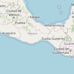
Seismic Activity in Guatemala
Over the past 30 days, there have been 14 recorded earthquakes in this region. The largest recent earthquake was a magnitude 4.9 event near 1 km E of El Palmarcito, Mexico.
Over the past 30 days, Guatemala has recorded 14 earthquakes of magnitude 2.5 or greater in our tracker. 14 landed between M4.0 and M4.9. By depth: 11 shallow (<70 km), 3 intermediate (70–300 km). 6 of the epicenters were offshore. 3 events produced at least one felt report, totalling 10 citizen submissions to the USGS Did You Feel It? system. Focal depths ranged from 10.0 km to 181.7 km. All 14 solutions have been reviewed by a USGS seismologist.
Leading the list is a magnitude 4.9 event near 1 km E of El Palmarcito, Mexico at 93.5 km depth. The second-ranked event, at magnitude 4.9 near 33 km SSW of El Rosario, El Salvador, trails by 0.0 magnitude units — a narrow gap, indicating two comparably energetic events in the current window. Rounding out the top three is a magnitude 4.7 earthquake near 56 km S of Puerto San José, Guatemala.
Each row in the table below includes a narrative summary of the event, ordered by time. Use the column headers to sort or filter by magnitude.
| Time ↓ | Mag ↕ | Location ↕ | Depth ↕ | Felt ↕ | MMI | Alert | Status | Details |
|---|---|---|---|---|---|---|---|---|
2026-06-26 2026-06-26 04:59:01 UTC | 4.1mb | 46 km SW of Puerto Madero, Mexico 14.395°, -92.691° | 35.0 km | - | - | - | ✓ Reviewed | USGS → |
On June 26, 2026 at 04:59 UTC, a magnitude 4.1 earthquake struck 46 km SW of Puerto Madero, Mexico. The event originated approximately 35.0 km below the surface, classifying it as shallow crustal. The event was offshore — common for earthquakes along subduction zones and transform plate boundaries. Geolocation places the event at 14.395°N, -92.691°E. The solution has been reviewed by a USGS seismologist and is considered finalized. See the M4.1 event page for the full report, ShakeMap, and citizen-reported intensity data. | ||||||||
2026-06-25 2026-06-25 11:32:53 UTC | 4.1mb | 53 km SSW of Nueva Concepción, Guatemala 13.733°, -91.436° | 35.0 km | - | - | - | ✓ Reviewed | USGS → |
A magnitude 4.1 earthquake was recorded 53 km SSW of Nueva Concepción, Guatemala on June 25, 2026 at 11:32 UTC. This was a shallow crustal earthquake, focused at 35.0 km depth. Coordinates: 13.733°, -91.436°. The solution has been reviewed by a USGS seismologist and is considered finalized. See the M4.1 event page for the full report, ShakeMap, and citizen-reported intensity data. | ||||||||
2026-06-24 2026-06-24 12:16:31 UTC | 4.9mb | 1 km E of El Palmarcito, Mexico 15.495°, -93.197° | 93.5 km | - | - | - | ✓ Reviewed | USGS → |
On June 24, 2026 at 12:16 UTC, a magnitude 4.9 earthquake struck 1 km E of El Palmarcito, Mexico. It is the largest earthquake currently listed for Guatemala over the past 30 days. The hypocenter lay at 93.5 km, placing this in the intermediate depth category. The offshore location combined with this depth is characteristic of seismicity along descending slabs. The epicenter is at 15.495°, -93.197°. The solution has been reviewed by a USGS seismologist and is considered finalized. See the M4.9 event page for the full report, ShakeMap, and citizen-reported intensity data. | ||||||||
2026-06-23 2026-06-23 17:31:23 UTC | 4.4mb | 36 km S of Acajutla, El Salvador 13.269°, -89.878° | 56.6 km | - | - | - | ✓ Reviewed | USGS → |
At 17:31 UTC on June 23, 2026, a magnitude 4.4 tremor occurred 36 km S of Acajutla, El Salvador. It ranks as the fifth largest event in the current dataset. The hypocenter lay at 56.6 km, placing this in the shallow crustal category. The event was offshore — common for earthquakes along subduction zones and transform plate boundaries. Geolocation places the event at 13.269°N, -89.878°E. The solution has been reviewed by a USGS seismologist and is considered finalized. See the M4.4 event page for the full report, ShakeMap, and citizen-reported intensity data. | ||||||||
2026-06-22 2026-06-22 09:11:51 UTC | 4.3mb | 55 km SSE of Iztapa, Guatemala 13.450°, -90.574° | 55.1 km | 1 | - | - | ✓ Reviewed | USGS → |
Reports of a magnitude 4.3 earthquake 55 km SSE of Iztapa, Guatemala came in on June 22, 2026 at 09:11 UTC. This event falls inside the aftershock decay of a nearby magnitude 4.7 earthquake that occurred about 5 hours earlier. A small number of nearby observers (1) submitted felt reports to the USGS. This was a shallow crustal earthquake, focused at 55.1 km depth. Geolocation places the event at 13.450°N, -90.574°E. The solution has been reviewed by a USGS seismologist and is considered finalized. See the M4.3 event page for the full report, ShakeMap, and citizen-reported intensity data. | ||||||||
2026-06-22 2026-06-22 04:00:26 UTC | 4.7mb | 56 km S of Puerto San José, Guatemala 13.425°, -90.754° | 45.8 km | 1 | - | - | ✓ Reviewed | USGS → |
Seismographs logged a magnitude 4.7 earthquake 56 km S of Puerto San José, Guatemala with origin time 04:00 UTC on June 22, 2026. It ranks as the third largest event in the current dataset. A small number of nearby observers (1) submitted felt reports to the USGS. The event originated approximately 45.8 km below the surface, classifying it as shallow crustal. The event was offshore — common for earthquakes along subduction zones and transform plate boundaries. Coordinates: 13.425°, -90.754°. See the M4.7 event page for the full report, ShakeMap, and citizen-reported intensity data. | ||||||||
2026-06-21 2026-06-21 13:27:00 UTC | 4.5mb | 66 km S of Puerto San José, Guatemala 13.327°, -90.799° | 35.0 km | - | - | - | ✓ Reviewed | USGS → |
On June 21, 2026, Guatemala registered a magnitude 4.5 earthquake 66 km S of Puerto San José, Guatemala at 13:27 UTC. It ranks as the fourth largest event in the current dataset. This was a shallow crustal earthquake, focused at 35.0 km depth. The event was offshore — common for earthquakes along subduction zones and transform plate boundaries. The epicenter is at 13.327°, -90.799°. The solution has been reviewed by a USGS seismologist and is considered finalized. See the M4.5 event page for the full report, ShakeMap, and citizen-reported intensity data. | ||||||||
2026-06-21 2026-06-21 06:30:46 UTC | 4.3mb | 60 km SSW of Puerto San José, Guatemala 13.434°, -91.072° | 35.0 km | - | - | - | ✓ Reviewed | USGS → |
A magnitude 4.3 seismic event took place 60 km SSW of Puerto San José, Guatemala on June 21, 2026 at 06:30 UTC. The hypocenter lay at 35.0 km, placing this in the shallow crustal category. Coordinates: 13.434°, -91.072°. The solution has been reviewed by a USGS seismologist and is considered finalized. See the M4.3 event page for the full report, ShakeMap, and citizen-reported intensity data. | ||||||||
2026-06-20 2026-06-20 21:47:39 UTC | 4.1mb | 60 km SSE of Champerico, Guatemala 13.765°, -91.764° | 43.6 km | - | - | - | ✓ Reviewed | USGS → |
Seismographs logged a magnitude 4.1 earthquake 60 km SSE of Champerico, Guatemala with origin time 21:47 UTC on June 20, 2026. The hypocenter lay at 43.6 km, placing this in the shallow crustal category. The epicenter is at 13.765°, -91.764°. The solution has been reviewed by a USGS seismologist and is considered finalized. See the M4.1 event page for the full report, ShakeMap, and citizen-reported intensity data. | ||||||||
2026-06-20 2026-06-20 17:51:47 UTC | 4.4mb | 78 km SSW of Acajutla, El Salvador 13.001°, -90.228° | 35.0 km | - | - | - | ✓ Reviewed | USGS → |
The USGS recorded this magnitude 4.4 earthquake 78 km SSW of Acajutla, El Salvador at 17:51 UTC on June 20, 2026. At a depth of 35.0 km, the event was shallow crustal. Coordinates: 13.001°, -90.228°. The solution has been reviewed by a USGS seismologist and is considered finalized. See the M4.4 event page for the full report, ShakeMap, and citizen-reported intensity data. | ||||||||
2026-06-20 2026-06-20 08:33:48 UTC | 4.3mb | 4 km SSW of Chalatenango, El Salvador 13.992°, -88.951° | 181.7 km | - | - | - | ✓ Reviewed | USGS → |
June 20, 2026 brought a magnitude 4.3 earthquake 4 km SSW of Chalatenango, El Salvador, logged at 08:33 UTC. At 181.7 km, this is the deepest earthquake in the current dataset — firmly in the intermediate depth category. The epicenter is at 13.992°, -88.951°. The solution has been reviewed by a USGS seismologist and is considered finalized. See the M4.3 event page for the full report, ShakeMap, and citizen-reported intensity data. | ||||||||
2026-06-07 2026-06-07 15:33:57 UTC | 4.0mb | 10 km N of Champerico, Guatemala 14.391°, -91.923° | 96.2 km | - | - | - | ✓ Reviewed | USGS → |
On June 7, 2026, Guatemala registered a magnitude 4.0 earthquake 10 km N of Champerico, Guatemala at 15:33 UTC. At a depth of 96.2 km, the event was intermediate depth. The offshore location combined with this depth is characteristic of seismicity along descending slabs. Geolocation places the event at 14.391°N, -91.923°E. The solution has been reviewed by a USGS seismologist and is considered finalized. See the M4.0 event page for the full report, ShakeMap, and citizen-reported intensity data. | ||||||||
2026-06-07 2026-06-07 02:28:42 UTC | 4.4mb | 101 km SSW of Acajutla, El Salvador 12.780°, -90.258° | 10.0 km | - | - | - | ✓ Reviewed | USGS → |
This magnitude 4.4 event was detected 101 km SSW of Acajutla, El Salvador on June 7, 2026, with origin time 02:28 UTC. At just 10.0 km, it was the shallowest earthquake in the current dataset — a shallow crustal event. The epicenter is at 12.780°, -90.258°. The solution has been reviewed by a USGS seismologist and is considered finalized. See the M4.4 event page for the full report, ShakeMap, and citizen-reported intensity data. | ||||||||
2026-06-05 2026-06-05 12:27:27 UTC | 4.9mww | 33 km SSW of El Rosario, El Salvador 13.225°, -89.162° | 67.3 km | 8 | - | - | ✓ Reviewed | USGS → |
A magnitude 4.9 earthquake was recorded 33 km SSW of El Rosario, El Salvador on June 5, 2026 at 12:27 UTC. It ranks as the second largest event in the current dataset. A small number of nearby observers (8) submitted felt reports to the USGS. At a depth of 67.3 km, the event was shallow crustal. Geolocation places the event at 13.225°N, -89.162°E. The solution has been reviewed by a USGS seismologist and is considered finalized. See the M4.9 event page for the full report, ShakeMap, and citizen-reported intensity data. | ||||||||
1 km E of El Palmarcito, Mexico
2026-06-24
13 km WNW of Omoa, Honduras
2026-01-16
Data from USGS Earthquake Hazards Program. Updated every 5 minutes.
Guatemala lies at the junction of three tectonic plates and experiences frequent earthquakes. The 1976 earthquake killed over 23,000 people.
In 2026, Guatemala has recorded 74 earthquakes of magnitude 2.5 or greater so far. The largest earthquake in Guatemala in 2026 was a magnitude 5.2 event near Omoa, Honduras.
Over the past 30 days, there have been 14 recorded earthquakes in this region. The largest recent earthquake was a magnitude 4.9 event near 1 km E of El Palmarcito, Mexico.
In the past 30 days, 14 earthquakes have been recorded in the Guatemala region.
The largest recent earthquake in the Guatemala area was a magnitude 4.9 event that occurred 1 km E of El Palmarcito, Mexico.
Residents should secure heavy furniture, create an emergency kit with supplies for 72 hours, develop a family communication plan, and practice "Drop, Cover, and Hold On" during earthquake drills. Visit our preparedness section for detailed guides.
El Salvador experiences regular earthquakes from the nearby Middle America Trenc...
Honduras sits near the boundary between the Caribbean and North American plates....
Nicaragua lies along the Central American volcanic arc where the Cocos Plate sub...
Costa Rica sits where the Cocos Plate subducts beneath the Caribbean Plate, caus...