Seismic Activity in Costa Rica
Over the past 30 days, there have been 4 recorded earthquakes in this region. The largest recent earthquake was a magnitude 5.0 event near 44 km SSE of Quepos, Costa Rica.
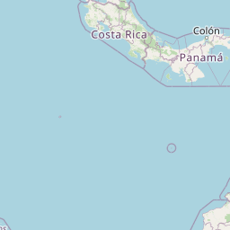
Over the past 30 days, Costa Rica has recorded 4 earthquakes of magnitude 2.5 or greater in our tracker. 1 reached magnitude 5.0 or higher. 2 landed between M4.0 and M4.9. The remaining 1 fell in the M2.5–M3.9 band. By depth: 4 shallow (<70 km). 3 of the epicenters were offshore. 4 events produced at least one felt report, totalling 48 citizen submissions to the USGS Did You Feel It? system. Focal depths ranged from 10.0 km to 35.0 km. All 4 solutions have been reviewed by a USGS seismologist.
Each row in the table below includes a narrative summary of the event, ordered by time. Use the column headers to sort or filter by magnitude.
| Time ↓ | Mag ↕ | Location ↕ | Depth ↕ | Felt ↕ | MMI | Alert | Status | Details |
|---|---|---|---|---|---|---|---|---|
2026-09-18 2026-09-18 22:09:36 UTC | 3.9mb | 8 km W of Cañas Gordas, Panama 8.741°, -82.993° | 10.0 km | 3 | - | - | ✓ Reviewed | USGS → |
On September 18, 2026, Costa Rica registered a magnitude 3.9 earthquake 8 km W of Cañas Gordas, Panama at 22:09 UTC. The event was offshore. See the M3.9 event page for the full report, ShakeMap, and citizen-reported intensity data. | ||||||||
2026-09-12 2026-09-12 01:59:50 UTC | 4.7mb | 0 km NE of Manaca Civil, Panama 8.329°, -82.816° | 10.0 km | 36 | - | - | ✓ Reviewed | USGS → |
A magnitude 4.7 earthquake was recorded 0 km NE of Manaca Civil, Panama on September 12, 2026 at 01:59 UTC. The event was offshore. See the M4.7 event page for the full report, ShakeMap, and citizen-reported intensity data. | ||||||||
2026-09-10 2026-09-10 18:04:04 UTC | 4.6mb | 28 km S of Quepos, Costa Rica 9.172°, -84.147° | 35.0 km | 1 | - | - | ✓ Reviewed | USGS → |
Seismographs logged a magnitude 4.6 earthquake 28 km S of Quepos, Costa Rica with origin time 18:04 UTC on September 10, 2026. Coming 10 hours after a magnitude 5.0 earthquake in the immediate vicinity, it is most likely an aftershock of that larger rupture. This is the deepest earthquake in the current dataset — a shallow crustal event. See the M4.6 event page for the full report, ShakeMap, and citizen-reported intensity data. | ||||||||
2026-09-10 2026-09-10 08:26:53 UTC | 5.0mww | 44 km SSE of Quepos, Costa Rica 9.057°, -84.017° | 10.0 km | 8 | - | - | ✓ Reviewed | USGS → |
On September 10, 2026 at 08:26 UTC, a magnitude 5.0 earthquake struck 44 km SSE of Quepos, Costa Rica. It is the largest earthquake currently listed for Costa Rica over the past 30 days. See the M5.0 event page for the full report, ShakeMap, and citizen-reported intensity data. | ||||||||
44 km SSE of Quepos, Costa Rica
2026-09-10
72 km SW of Tamarindo, Costa Rica
2026-04-15
Data from USGS Earthquake Hazards Program. Updated every 5 minutes.
Costa Rica sits where the Cocos Plate subducts beneath the Caribbean Plate, causing frequent earthquakes along the Pacific coast.
In 2026, Costa Rica has recorded 46 earthquakes of magnitude 2.5 or greater so far. The largest earthquake in Costa Rica in 2026 was a magnitude 5.7 event near Tamarindo, Costa Rica.
Over the past 30 days, there have been 4 recorded earthquakes in this region. The largest recent earthquake was a magnitude 5.0 event near 44 km SSE of Quepos, Costa Rica.
In the past 30 days, 4 earthquakes have been recorded in the Costa Rica region.
The largest recent earthquake in the Costa Rica area was a magnitude 5.0 event that occurred 44 km SSE of Quepos, Costa Rica.
Panama lies at the junction of the Cocos, Nazca, Caribbean, and South American p...
Nicaragua lies along the Central American volcanic arc where the Cocos Plate sub...
Honduras sits near the boundary between the Caribbean and North American plates....
El Salvador experiences regular earthquakes from the nearby Middle America Trenc...