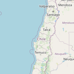
Seismic Activity in Chile
Over the past 30 days, there have been 15 recorded earthquakes in this region. The largest recent earthquake was a magnitude 5.0 event near 43 km SW of Ovalle, Chile.
Over the past 30 days, Chile has recorded 15 earthquakes of magnitude 2.5 or greater in our tracker. 1 reached magnitude 5.0 or higher. 14 landed between M4.0 and M4.9. By depth: 11 shallow (<70 km), 4 intermediate (70–300 km). 5 of the epicenters were offshore. 6 events produced at least one felt report, totalling 15 citizen submissions to the USGS Did You Feel It? system. Focal depths ranged from 10.0 km to 109.7 km. All 15 solutions have been reviewed by a USGS seismologist.
Leading the list is a magnitude 5.0 event near 43 km SW of Ovalle, Chile at 49.8 km depth, which drew 4 felt reports from the public. The second-ranked event, at magnitude 4.8 near 26 km WSW of Ovalle, Chile, trails by 0.2 magnitude units — a narrow gap, indicating two comparably energetic events in the current window. Rounding out the top three is a magnitude 4.6 earthquake near 45 km W of Santa Cruz, Chile.
Each row in the table below includes a narrative summary of the event, ordered by time. Use the column headers to sort or filter by magnitude.
| Time ↓ | Mag ↕ | Location ↕ | Depth ↕ | Felt ↕ | MMI | Alert | Status | Details |
|---|---|---|---|---|---|---|---|---|
1 day ago 2026-07-04 03:09:33 UTC | 5.0mww | 43 km SW of Ovalle, Chile -30.913°, -71.479° | 49.8 km | 4 | - | - | ✓ Reviewed | USGS → |
On July 4, 2026 at 03:09 UTC, a magnitude 5.0 earthquake struck 43 km SW of Ovalle, Chile. It is the largest earthquake currently listed for Chile over the past 30 days. A small number of nearby observers (4) submitted felt reports to the USGS. The hypocenter lay at 49.8 km, placing this in the shallow crustal category. The event was offshore — common for earthquakes along subduction zones and transform plate boundaries. The epicenter is at -30.913°, -71.479°. See the M5.0 event page for the full report, ShakeMap, and citizen-reported intensity data. | ||||||||
3 days ago 2026-07-02 00:25:19 UTC | 4.5mb | 150 km WSW of Lebu, Chile -38.135°, -75.231° | 10.0 km | - | - | - | ✓ Reviewed | USGS → |
At 00:25 UTC on July 2, 2026, a magnitude 4.5 tremor occurred 150 km WSW of Lebu, Chile. At just 10.0 km, it was the shallowest earthquake in the current dataset — a shallow crustal event. It ranks as the fifth largest event in the current dataset. Geolocation places the event at -38.135°N, -75.231°E. The solution has been reviewed by a USGS seismologist and is considered finalized. See the M4.5 event page for the full report, ShakeMap, and citizen-reported intensity data. | ||||||||
3 days ago 2026-07-01 19:52:02 UTC | 4.4mb | 15 km NNE of Tomé, Chile -36.491°, -72.873° | 45.8 km | 2 | - | - | ✓ Reviewed | USGS → |
Reports of a magnitude 4.4 earthquake 15 km NNE of Tomé, Chile came in on July 1, 2026 at 19:52 UTC. A small number of nearby observers (2) submitted felt reports to the USGS. This was a shallow crustal earthquake, focused at 45.8 km depth. Geolocation places the event at -36.491°N, -72.873°E. The solution has been reviewed by a USGS seismologist and is considered finalized. See the M4.4 event page for the full report, ShakeMap, and citizen-reported intensity data. | ||||||||
2026-06-28 2026-06-28 03:12:06 UTC | 4.4mb | 32 km ENE of Caucete, Argentina -31.547°, -67.964° | 109.7 km | - | - | - | ✓ Reviewed | USGS → |
A magnitude 4.4 seismic event took place 32 km ENE of Caucete, Argentina on June 28, 2026 at 03:12 UTC. At 109.7 km, this is the deepest earthquake in the current dataset — firmly in the intermediate depth category. Coordinates: -31.547°, -67.964°. The solution has been reviewed by a USGS seismologist and is considered finalized. See the M4.4 event page for the full report, ShakeMap, and citizen-reported intensity data. | ||||||||
2026-06-24 2026-06-24 10:36:34 UTC | 4.5mb | 8 km NNE of La Serena, Chile -29.829°, -71.215° | 59.4 km | 1 | - | - | ✓ Reviewed | USGS → |
The USGS recorded this magnitude 4.5 earthquake 8 km NNE of La Serena, Chile at 10:36 UTC on June 24, 2026. A small number of nearby observers (1) submitted felt reports to the USGS. At a depth of 59.4 km, the event was shallow crustal. Coordinates: -29.829°, -71.215°. The solution has been reviewed by a USGS seismologist and is considered finalized. See the M4.5 event page for the full report, ShakeMap, and citizen-reported intensity data. | ||||||||
2026-06-20 2026-06-20 19:45:25 UTC | 4.3mb | 5 km SE of Molina, Chile -35.148°, -71.242° | 94.4 km | - | - | - | ✓ Reviewed | USGS → |
On June 20, 2026 at 19:45 UTC, a magnitude 4.3 earthquake struck 5 km SE of Molina, Chile. The event originated approximately 94.4 km below the surface, classifying it as intermediate depth. The offshore location combined with this depth is characteristic of seismicity along descending slabs. Geolocation places the event at -35.148°N, -71.242°E. The solution has been reviewed by a USGS seismologist and is considered finalized. See the M4.3 event page for the full report, ShakeMap, and citizen-reported intensity data. | ||||||||
2026-06-20 2026-06-20 01:32:08 UTC | 4.2mb | 13 km SSE of Llaillay, Chile -32.953°, -70.917° | 80.4 km | 4 | - | - | ✓ Reviewed | USGS → |
A magnitude 4.2 earthquake was recorded 13 km SSE of Llaillay, Chile on June 20, 2026 at 01:32 UTC. A small number of nearby observers (4) submitted felt reports to the USGS. This was a intermediate depth earthquake, focused at 80.4 km depth. Coordinates: -32.953°, -70.917°. The solution has been reviewed by a USGS seismologist and is considered finalized. See the M4.2 event page for the full report, ShakeMap, and citizen-reported intensity data. | ||||||||
2026-06-17 2026-06-17 09:51:35 UTC | 4.8mb | 26 km WSW of Ovalle, Chile -30.676°, -71.465° | 38.8 km | - | - | - | ✓ Reviewed | USGS → |
A magnitude 4.8 earthquake was recorded 26 km WSW of Ovalle, Chile on June 17, 2026 at 09:51 UTC. It ranks as the second largest event in the current dataset. At a depth of 38.8 km, the event was shallow crustal. Geolocation places the event at -30.676°N, -71.465°E. The solution has been reviewed by a USGS seismologist and is considered finalized. See the M4.8 event page for the full report, ShakeMap, and citizen-reported intensity data. | ||||||||
2026-06-14 2026-06-14 22:54:06 UTC | 4.1mwr | 34 km NNW of Valparaíso, Chile -32.735°, -71.734° | 33.2 km | 2 | - | - | ✓ Reviewed | USGS → |
At 22:54 UTC on June 14, 2026, a magnitude 4.1 tremor occurred 34 km NNW of Valparaíso, Chile. A small number of nearby observers (2) submitted felt reports to the USGS. The event originated approximately 33.2 km below the surface, classifying it as shallow crustal. Coordinates: -32.735°, -71.734°. The solution has been reviewed by a USGS seismologist and is considered finalized. See the M4.1 event page for the full report, ShakeMap, and citizen-reported intensity data. | ||||||||
2026-06-13 2026-06-13 22:29:11 UTC | 4.6mb | 45 km W of Santa Cruz, Chile -34.659°, -71.857° | 40.8 km | - | - | - | ✓ Reviewed | USGS → |
Seismographs logged a magnitude 4.6 earthquake 45 km W of Santa Cruz, Chile with origin time 22:29 UTC on June 13, 2026. It ranks as the third largest event in the current dataset. The event originated approximately 40.8 km below the surface, classifying it as shallow crustal. The event was offshore — common for earthquakes along subduction zones and transform plate boundaries. Coordinates: -34.659°, -71.857°. The solution has been reviewed by a USGS seismologist and is considered finalized. See the M4.6 event page for the full report, ShakeMap, and citizen-reported intensity data. | ||||||||
2026-06-13 2026-06-13 12:04:14 UTC | 4.6mwr | 25 km WSW of Ovalle, Chile -30.658°, -71.457° | 59.6 km | 2 | - | - | ✓ Reviewed | USGS → |
On June 13, 2026, Chile registered a magnitude 4.6 earthquake 25 km WSW of Ovalle, Chile at 12:04 UTC. It ranks as the fourth largest event in the current dataset. A small number of nearby observers (2) submitted felt reports to the USGS. This was a shallow crustal earthquake, focused at 59.6 km depth. The epicenter is at -30.658°, -71.457°. The solution has been reviewed by a USGS seismologist and is considered finalized. See the M4.6 event page for the full report, ShakeMap, and citizen-reported intensity data. | ||||||||
2026-06-13 2026-06-13 09:56:31 UTC | 4.4mb | 30 km E of Salamanca, Chile -31.817°, -70.648° | 108.3 km | - | - | - | ✓ Reviewed | USGS → |
June 13, 2026 brought a magnitude 4.4 earthquake 30 km E of Salamanca, Chile, logged at 09:56 UTC. At a depth of 108.3 km, the event was intermediate depth. The offshore location combined with this depth is characteristic of seismicity along descending slabs. The epicenter is at -31.817°, -70.648°. The solution has been reviewed by a USGS seismologist and is considered finalized. See the M4.4 event page for the full report, ShakeMap, and citizen-reported intensity data. | ||||||||
2026-06-09 2026-06-09 21:20:13 UTC | 4.5mb | 22 km WSW of Ovalle, Chile -30.687°, -71.417° | 48.5 km | - | - | - | ✓ Reviewed | USGS → |
This magnitude 4.5 event was detected 22 km WSW of Ovalle, Chile on June 9, 2026, with origin time 21:20 UTC. The event originated approximately 48.5 km below the surface, classifying it as shallow crustal. The epicenter is at -30.687°, -71.417°. The solution has been reviewed by a USGS seismologist and is considered finalized. See the M4.5 event page for the full report, ShakeMap, and citizen-reported intensity data. | ||||||||
2026-06-09 2026-06-09 21:06:10 UTC | 4.2mb | 36 km NW of Valparaíso, Chile -32.808°, -71.909° | 35.2 km | - | - | - | ✓ Reviewed | USGS → |
Seismographs logged a magnitude 4.2 earthquake 36 km NW of Valparaíso, Chile with origin time 21:06 UTC on June 9, 2026. The hypocenter lay at 35.2 km, placing this in the shallow crustal category. The event was offshore — common for earthquakes along subduction zones and transform plate boundaries. The epicenter is at -32.808°, -71.909°. The solution has been reviewed by a USGS seismologist and is considered finalized. See the M4.2 event page for the full report, ShakeMap, and citizen-reported intensity data. | ||||||||
2026-06-08 2026-06-08 06:13:52 UTC | 4.2mb | 57 km WNW of La Ligua, Chile -32.254°, -71.790° | 26.7 km | - | - | - | ✓ Reviewed | USGS → |
On June 8, 2026, Chile registered a magnitude 4.2 earthquake 57 km WNW of La Ligua, Chile at 06:13 UTC. At a depth of 26.7 km, the event was shallow crustal. Geolocation places the event at -32.254°N, -71.790°E. The solution has been reviewed by a USGS seismologist and is considered finalized. See the M4.2 event page for the full report, ShakeMap, and citizen-reported intensity data. | ||||||||
43 km SW of Ovalle, Chile
1 day ago
71 km W of Vallenar, Chile
2026-03-13
Data from USGS Earthquake Hazards Program. Updated every 5 minutes.
Chile lies along the Pacific Ring of Fire and has experienced some of history's largest earthquakes, including the 1960 Valdivia earthquake, the most powerful ever recorded.
In 2026, Chile has recorded 124 earthquakes of magnitude 2.5 or greater so far. The largest earthquake in Chile in 2026 was a magnitude 6.2 event near Vallenar, Chile.
Over the past 30 days, there have been 15 recorded earthquakes in this region. The largest recent earthquake was a magnitude 5.0 event near 43 km SW of Ovalle, Chile.
In the past 30 days, 15 earthquakes have been recorded in the Chile region.
The largest recent earthquake in the Chile area was a magnitude 5.0 event that occurred 43 km SW of Ovalle, Chile.
Residents should secure heavy furniture, create an emergency kit with supplies for 72 hours, develop a family communication plan, and practice "Drop, Cover, and Hold On" during earthquake drills. Visit our preparedness section for detailed guides.
Argentina experiences earthquakes primarily in its western Andean regions where ...
Bolivia experiences deep earthquakes from the subducting Nazca Plate. The 1994 d...
Peru lies along the Pacific Ring of Fire where the Nazca Plate subducts beneath ...
Ecuador's location along the Nazca-South American plate boundary results in freq...