Seismic Activity in Bangladesh
Over the past 30 days, there have been 3 recorded earthquakes in this region. The largest recent earthquake was a magnitude 4.5 event near 19 km SSE of Kakching, India.
Over the past 30 days, Bangladesh has recorded 3 earthquakes of magnitude 2.5 or greater in our tracker. 3 landed between M4.0 and M4.9. By depth: 3 shallow (<70 km). 2 events produced at least one felt report, totalling 59 citizen submissions to the USGS Did You Feel It? system. Focal depths ranged from 10.0 km to 52.1 km. All 3 solutions have been reviewed by a USGS seismologist.
Leading the list is a magnitude 4.5 event near 19 km SSE of Kakching, India at 52.1 km depth. The second-ranked event, at magnitude 4.4 near 11 km WSW of Narsingdi, Bangladesh, trails by 0.1 magnitude units — a narrow gap, indicating two comparably energetic events in the current window. Rounding out the top three is a magnitude 4.4 earthquake near 20 km NNE of Lakhipur, India.
Each row in the table below includes a narrative summary of the event, ordered by time. Use the column headers to sort or filter by magnitude.
| Time ↓ | Mag ↕ | Location ↕ | Depth ↕ | Felt ↕ | MMI | Alert | Status | Details |
|---|---|---|---|---|---|---|---|---|
2026-06-22 2026-06-22 15:28:52 UTC | 4.4mb | 11 km WSW of Narsingdi, Bangladesh 23.870°, 90.622° | 10.0 km | 57 | IV | green | ✓ Reviewed | USGS → |
A magnitude 4.4 earthquake was recorded 11 km WSW of Narsingdi, Bangladesh on June 22, 2026 at 15:28 UTC. Of every earthquake currently listed for Bangladesh, this one generated the most felt reports from the public. The USGS PAGER system assigned a green alert level for this event, signalling no significant casualties or damage expected. Nearby residents submitted 57 felt reports to the USGS DYFI platform. On the Modified Mercalli scale, shaking reached 4.6 — considered moderate. At a depth of 10.0 km, the event was shallow crustal. Geolocation places the event at 23.870°N, 90.622°E. The solution has been reviewed by a USGS seismologist and is considered finalized. See the M4.4 event page for the full report, ShakeMap, and citizen-reported intensity data. | ||||||||
2026-06-18 2026-06-18 15:29:24 UTC | 4.5mb | 19 km SSE of Kakching, India 24.348°, 94.085° | 52.1 km | - | - | - | ✓ Reviewed | USGS → |
On June 18, 2026 at 15:29 UTC, a magnitude 4.5 earthquake struck 19 km SSE of Kakching, India. It is the largest earthquake currently listed for Bangladesh over the past 30 days. The hypocenter lay at 52.1 km, placing this in the shallow crustal category. The epicenter is at 24.348°, 94.085°. The solution has been reviewed by a USGS seismologist and is considered finalized. See the M4.5 event page for the full report, ShakeMap, and citizen-reported intensity data. | ||||||||
2026-06-11 2026-06-11 15:40:35 UTC | 4.4mb | 20 km NNE of Lakhipur, India 24.968°, 93.064° | 48.2 km | 2 | - | - | ✓ Reviewed | USGS → |
Seismographs logged a magnitude 4.4 earthquake 20 km NNE of Lakhipur, India with origin time 15:40 UTC on June 11, 2026. A small number of nearby observers (2) submitted felt reports to the USGS. The event originated approximately 48.2 km below the surface, classifying it as shallow crustal. Coordinates: 24.968°, 93.064°. The solution has been reviewed by a USGS seismologist and is considered finalized. See the M4.4 event page for the full report, ShakeMap, and citizen-reported intensity data. | ||||||||
19 km SSE of Kakching, India
2026-06-18
13 km NNE of Morigaon, India
2026-01-04
Data from USGS Earthquake Hazards Program. Updated every 5 minutes.
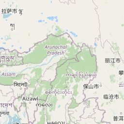
Bangladesh sits on the active plate boundary where the Indian Plate subducts beneath the Burma Plate. Dense population increases earthquake vulnerability.
In 2026, Bangladesh has recorded 16 earthquakes of magnitude 2.5 or greater so far. The largest earthquake in Bangladesh in 2026 was a magnitude 5.2 event near Morigaon, India.
Over the past 30 days, there have been 3 recorded earthquakes in this region. The largest recent earthquake was a magnitude 4.5 event near 19 km SSE of Kakching, India.
In the past 30 days, 3 earthquakes have been recorded in the Bangladesh region.
The largest recent earthquake in the Bangladesh area was a magnitude 4.5 event that occurred 19 km SSE of Kakching, India.
Residents should secure heavy furniture, create an emergency kit with supplies for 72 hours, develop a family communication plan, and practice "Drop, Cover, and Hold On" during earthquake drills. Visit our preparedness section for detailed guides.
Bhutan lies in the Himalayan collision zone where the Indian Plate pushes beneat...
Myanmar lies along the Burma Plate boundary with multiple active fault systems i...
Nepal sits atop the collision zone between the Indian and Eurasian plates that c...
India's collision with the Eurasian plate created the Himalayas and continues to...