M5.0 Earthquake 136 km SE of Gizo, Solomon Islands — September 14, 2026
2026-09-14 16:15:05 UTC (2026-09-14) · approx. 3:15 AM UTC+11 local
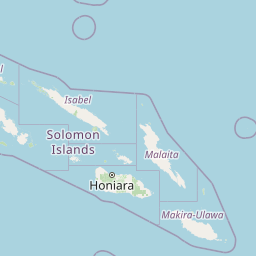
On September 14, 2026 at 16:15 UTC, a magnitude 5.0 shallow crustal earthquake struck 136 km SE of Gizo, Solomon Islands, at a depth of 10.0 km and coordinates -8.9306°, 157.7658°. This earthquake was detected by 64 seismic stations with excellent location accuracy and was assigned a USGS significance rating of 385, placing it among routine seismic activity.
Physical scale: An earthquake of magnitude 5.0 releases seismic energy equivalent to roughly 477 metric tons of TNT. Empirical fault-scaling laws (Wells & Coppersmith, 1994) estimate the subsurface rupture length at approximately 1.7 km — a useful intuition for the size of the slip patch on the fault.
Earthquake Details
157.7658°E
Technical Information
Common Questions
How strong was the magnitude 5.0 earthquake near Gizo, Solomon Islands?
The magnitude 5.0 earthquake that struck 136 km SE of Gizo, Solomon Islands on September 14, 2026 at 16:15 UTC had a depth of 10.0 km. For context, this was a moderate earthquake that could be widely felt.
Where did the earthquake occur?
The earthquake epicenter was located at -8.9306°, 157.7658°, which is 136 km SE of Gizo, Solomon Islands.
Were there aftershocks?
Aftershock activity is monitored continuously by the USGS. Aftershock sequences from magnitude 5.0 earthquakes can continue for days to weeks and gradually diminish over time.
Authoritative source: USGS event page (event ID: us7000thea). All scientific values on this page are sourced verbatim from the USGS feed.
Cite this page: EarthquakeTracker.org. (2026, September 14, 2026). M5.0 Earthquake 136 km SE of Gizo, Solomon Islands — September 14, 2026. Retrieved October 15, 2026 from https://www.earthquaketracker.org/earthquakes/event/us7000thea/