M5.0 Earthquake 24 km SSE of Sātkhira, Bangladesh — February 27, 2026
2026-02-27 07:52:28 UTC (2026-02-27) · approx. 1:52 PM UTC+6 local
Felt by 230 people across surrounding communities. Maximum shaking intensity MMI 7.0 (very strong).
On February 27, 2026 at 07:52 UTC, a magnitude 5.0 shallow crustal earthquake struck 24 km SSE of Sātkhira, Bangladesh, at a depth of 36.8 km and coordinates 22.5058°, 89.1665°. The earthquake was reported felt by 230 peopleacross surrounding communities, with a maximum shaking intensity of Modified Mercalli Intensity (MMI) 7.0 (very strong). The USGS PAGER system issued a yellow alert level for this event, indicating local impact possible. This earthquake was detected by 83 seismic stations with excellent location accuracy and was assigned a USGS significance rating of 772, making it a moderate-impact event. The nearest populated place is Taki (population 40,113).
Physical scale: An earthquake of magnitude 5.0 releases seismic energy equivalent to roughly 477 metric tons of TNT. Empirical fault-scaling laws (Wells & Coppersmith, 1994) estimate the subsurface rupture length at approximately 1.7 km — a useful intuition for the size of the slip patch on the fault.
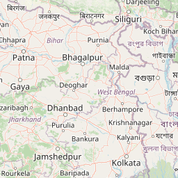
Nearest Populated Places
What the Shaking Felt Like
At MMI 7.0 (very strong), people in the most strongly affected areas would have experienced: Strong shaking felt by everyone. Heavy furniture may move. Books fall from shelves. Plaster and chimneys may crack. Damage is generally slight in well-built structures.
ShakeMap — predicted shaking intensity
Modeled ground-motion intensity contoured on the Modified Mercalli scale (MMI). Computed by the USGS from the moment-tensor solution and regional ground-motion prediction equations.
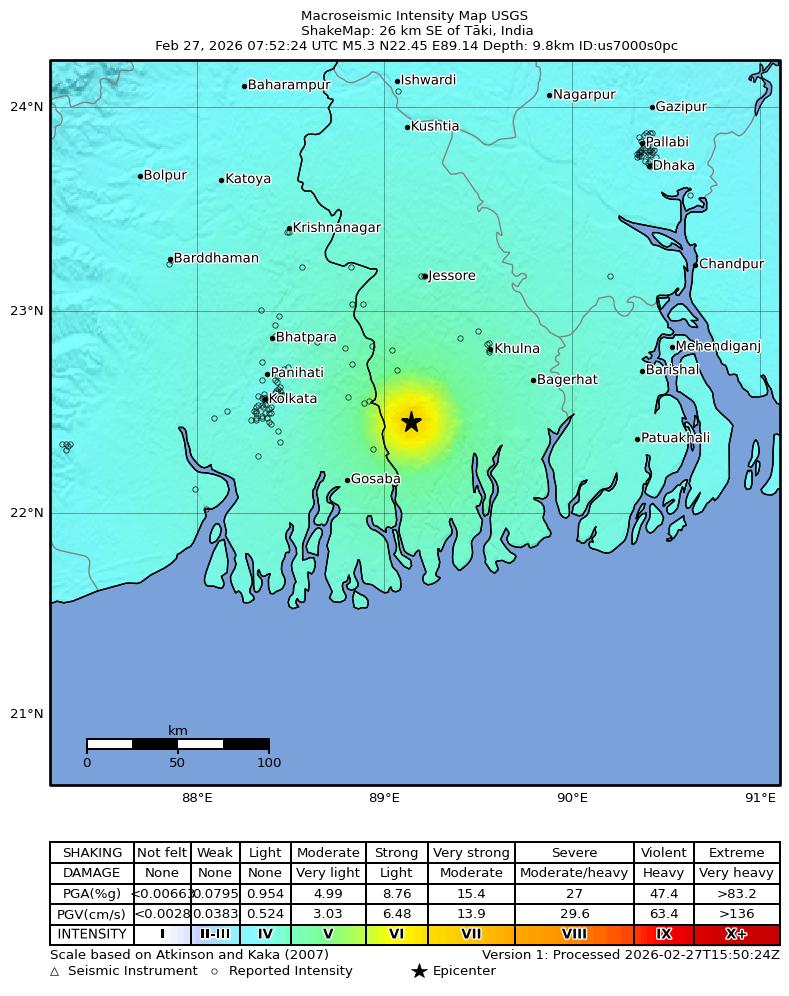
Source: U.S. Geological Survey ShakeMap. View interactive ShakeMap on USGS
Did You Feel It? — community-reported shaking
Aggregated felt-report intensity from 230 citizen responses to the USGS Did You Feel It? system. Each colored zone represents the average MMI from reports in that area.
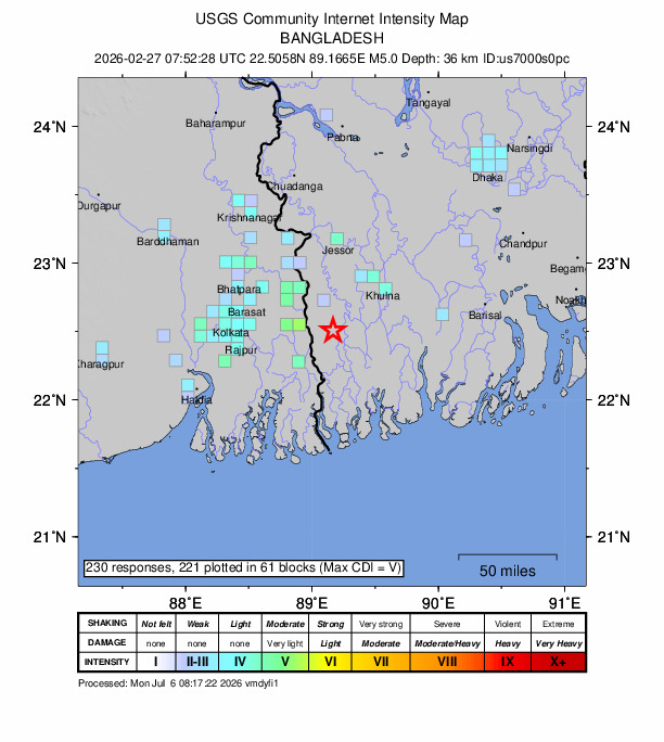
Source: U.S. Geological Survey Did You Feel It?. View on USGS · submit your own report
Population exposure (USGS PAGER)
Estimated population that experienced each level of shaking. Based on the USGS PAGER rapid impact assessment, which combines ShakeMap output with global population grids.
| Shaking intensity (MMI) | Description | Population exposed |
|---|---|---|
| MMI 4 | light | 145,567,744 |
| MMI 5 | moderate | 10,439,792 |
| MMI 6 | strong | 1,099,384 |
| MMI 7 | very strong | 106,000 |
Earthquake Details
89.1665°E
Technical Information
Common Questions
How strong was the magnitude 5.0 earthquake near Sātkhira, Bangladesh?
The magnitude 5.0 earthquake that struck 24 km SSE of Sātkhira, Bangladesh on February 27, 2026 at 07:52 UTC had a depth of 36.8 km. It was felt by 230 people with maximum shaking intensity of MMI 7.0 (very strong). For context, this was a moderate earthquake that could be widely felt.
Where did the earthquake occur?
The earthquake epicenter was located at 22.5058°, 89.1665°, which is 24 km SSE of Sātkhira, Bangladesh. The nearest populated place is Taki (population 40,113).
Were there aftershocks?
Aftershock activity is monitored continuously by the USGS. Aftershock sequences from magnitude 5.0 earthquakes can continue for days to weeks and gradually diminish over time.
What should I do after an earthquake?
If you were in the affected area: check yourself and others for injuries, inspect your home for damage, and be prepared for aftershocks. For detailed guidance, see our earthquake safety guide and emergency planning resources.
Authoritative source: USGS event page (event ID: us7000s0pc). All scientific values on this page are sourced verbatim from the USGS feed.
Cite this page: EarthquakeTracker.org. (2026, February 27, 2026). M5.0 Earthquake 24 km SSE of Sātkhira, Bangladesh — February 27, 2026. Retrieved July 6, 2026 from https://www.earthquaketracker.org/earthquakes/event/us7000s0pc/