2.8
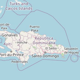
M2.8 Earthquake 87 km NE of Miches, Dominican Republic — April 25, 2026
2026-04-25 11:58:24 UTC (2026-04-25) · approx. 6:58 AM UTC-5 local
MagnitudeM2.8(ml)
Time11:58 UTC≈ 6:58 AM UTC-5
Depth10.0 kmshallow crustal
Coordinates19.534°, -68.444°
Felt byNo felt reports
Status✓ Reviewed by USGS
Earthquake Details
Magnitude
2.8 ml
Depth
10.0 km
shallow crustal
Location
19.5344°N
-68.4444°E
-68.4444°E
Technical Information
Event ID
us6000ssti
Event Type
earthquake
Status
✓ Reviewed
Significance
121
Stations Used
12
Azimuthal Gap
219.0°
Min Station Distance
1.016°
RMS Residual
0.63 sec
Last Updated
2026-05-07 07:22:05 UTC
Nearby Earthquakes (Last 7 Days)
3.13.14.23.62.93.23.33.43.23.8
85 km NNW of Charlotte Amalie, U.S. Virgin Islands
5 hours ago · 20.8 km deep
85 km N of Culebra, Puerto Rico
23 hours ago · 6.5 km deep
88 km N of Culebra, Puerto Rico
1 day ago · 26.0 km deep
76 km N of Culebra, Puerto Rico
1 day ago · 61.0 km deep
93 km N of Culebra, Puerto Rico
1 day ago · 33.0 km deep
87 km N of Culebra, Puerto Rico
1 day ago · 7.0 km deep
76 km N of Culebra, Puerto Rico
1 day ago · 67.7 km deep
81 km N of Culebra, Puerto Rico
1 day ago · 85.1 km deep
84 km NNE of Cruz Bay, U.S. Virgin Islands
1 day ago · 15.7 km deep
120 km NE of Cruz Bay, U.S. Virgin Islands
1 day ago · 35.0 km deep
Actions
Understanding This Data
Magnitude 2.8 earthquakes are typically only recorded by instruments.
Authoritative source: USGS event page (event ID: us6000ssti). All scientific values on this page are sourced verbatim from the USGS feed.
Cite this page: EarthquakeTracker.org. (2026, April 25, 2026). M2.8 Earthquake 87 km NE of Miches, Dominican Republic — April 25, 2026. Retrieved May 19, 2026 from https://www.earthquaketracker.org/earthquakes/event/us6000ssti/