2.7
M2.7 Earthquake 107 km NE of Miches, Dominican Republic — February 19, 2026
2026-02-19 23:32:49 UTC (2026-02-19) · approx. 6:32 PM UTC-5 local
MagnitudeM2.7(ml)
Time23:32 UTC≈ 6:32 PM UTC-5
Depth10.0 kmshallow crustal
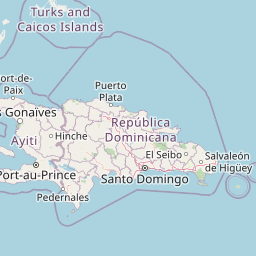
Coordinates19.535°, -68.211°
Felt byNo felt reports
Status✓ Reviewed by USGS
Earthquake Details
Magnitude
2.7 ml
Depth
10.0 km
shallow crustal
Location
19.5351°N
-68.2106°E
-68.2106°E
Technical Information
Event ID
us6000sabe
Event Type
earthquake
Status
✓ Reviewed
Significance
112
Stations Used
13
Azimuthal Gap
219.0°
Min Station Distance
1.487°
RMS Residual
0.25 sec
Last Updated
2026-05-12 17:28:02 UTC
Nearby Earthquakes (Last 7 Days)
2.94.42.83.13.83.12.73.23.74.0
112 km NE of Cruz Bay, U.S. Virgin Islands
3 hours ago · 16.6 km deep
150 km NNE of Cruz Bay, U.S. Virgin Islands
6 hours ago · 45.0 km deep
15 km NNE of Dorado, Puerto Rico
7 hours ago · 54.2 km deep
0 km WNW of Monserrate, Puerto Rico
11 hours ago · 89.0 km deep
134 km NNE of Cruz Bay, U.S. Virgin Islands
15 hours ago · 87.0 km deep
47 km NNW of Charlotte Amalie, U.S. Virgin Islands
2 days ago · 35.7 km deep
41 km N of Brenas, Puerto Rico
2 days ago · 30.7 km deep
94 km SSW of Pole Ojea, Puerto Rico
2 days ago · 22.0 km deep
36 km SSE of Punta Cana, Dominican Republic
2 days ago · 79.0 km deep
65 km N of Hatillo, Puerto Rico
2 days ago · 39.0 km deep
Actions
Understanding This Data
Magnitude 2.7 earthquakes are typically only recorded by instruments.
Authoritative source: USGS event page (event ID: us6000sabe). All scientific values on this page are sourced verbatim from the USGS feed.
Cite this page: EarthquakeTracker.org. (2026, February 19, 2026). M2.7 Earthquake 107 km NE of Miches, Dominican Republic — February 19, 2026. Retrieved May 12, 2026 from https://www.earthquaketracker.org/earthquakes/event/us6000sabe/