2.9
M2.9 Earthquake 36 km NE of Samaná, Dominican Republic — June 22, 2026
2026-06-22 09:58:59 UTC (2 hours ago) · approx. 4:58 AM UTC-5 local
MagnitudeM2.9(ml)
Time09:58 UTC≈ 4:58 AM UTC-5
Depth35.0 kmshallow crustal
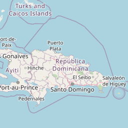
Coordinates19.410°, -69.067°
Felt byNo felt reports
Status✓ Reviewed by USGS
Earthquake Details
Magnitude
2.9 ml
Depth
35.0 km
shallow crustal
Location
19.4102°N
-69.0669°E
-69.0669°E
Technical Information
Event ID
us7000sv6w
Event Type
earthquake
Status
✓ Reviewed
Significance
129
Stations Used
16
Azimuthal Gap
191.0°
Min Station Distance
0.166°
RMS Residual
0.75 sec
Last Updated
2026-06-22 12:06:54 UTC
Nearby Earthquakes (Last 7 Days)
3.32.52.83.23.23.13.13.42.93.6
64 km N of Culebra, Puerto Rico
5 hours ago · 23.7 km deep
1 km NNE of Guayanilla, Puerto Rico
9 hours ago · 16.1 km deep
2 km NNE of Guayanilla, Puerto Rico
13 hours ago · 15.7 km deep
39 km N of Culebra, Puerto Rico
1 day ago · 74.7 km deep
66 km NW of Rincón, Puerto Rico
1 day ago · 17.5 km deep
70 km NNW of Charlotte Amalie, U.S. Virgin Islands
1 day ago · 19.9 km deep
95 km N of Charlotte Amalie, U.S. Virgin Islands
2 days ago · 4.4 km deep
30 km S of Boca de Yuma, Dominican Republic
2 days ago · 70.3 km deep
53 km NNE of Cruz Bay, U.S. Virgin Islands
2 days ago · 7.0 km deep
132 km NNE of Cruz Bay, U.S. Virgin Islands
2 days ago · 50.0 km deep
Actions
Understanding This Data
Magnitude 2.9 earthquakes are typically only recorded by instruments.
Authoritative source: USGS event page (event ID: us7000sv6w). All scientific values on this page are sourced verbatim from the USGS feed.
Cite this page: EarthquakeTracker.org. (2026, June 22, 2026). M2.9 Earthquake 36 km NE of Samaná, Dominican Republic — June 22, 2026. Retrieved June 22, 2026 from https://www.earthquaketracker.org/earthquakes/event/us7000sv6w/