2.4
M2.4 Earthquake 80 km ENE of Lime Village, Alaska — June 18, 2026
2026-06-18 16:32:31 UTC (2026-06-18) · approx. 6:32 AM UTC-10 local
MagnitudeM2.4(ml)
Time16:32 UTC≈ 6:32 AM UTC-10
Depth10.0 kmshallow crustal
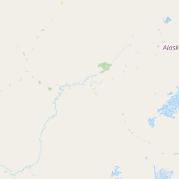
Coordinates61.694°, -154.093°
Felt byNo felt reports
Status✓ Reviewed by USGS
Earthquake Details
Magnitude
2.4 ml
Depth
10.0 km
shallow crustal
Location
61.6940°N
-154.0930°E
-154.0930°E
Technical Information
Event ID
aka2026lzotuc
Event Type
earthquake
Status
✓ Reviewed
Significance
89
Stations Used
39
Azimuthal Gap
41.0°
Min Station Distance
0.700°
RMS Residual
1.20 sec
Last Updated
2026-06-18 16:49:22 UTC
Nearby Earthquakes (Last 7 Days)
3.03.52.62.82.52.62.63.22.52.9
9 km WSW of Pedro Bay, Alaska
7 min ago · 192.5 km deep
72 km NE of Lake Minchumina, Alaska
59 min ago · 0.6 km deep
84 km NW of Aleneva, Alaska
2 hours ago · 82.6 km deep
39 km SSW of Nanwalek, Alaska
7 hours ago · 58.2 km deep
19 km ESE of Susitna North, Alaska
13 hours ago · 14.5 km deep
28 km NW of Ninilchik, Alaska
18 hours ago · 85.2 km deep
61 km W of Tyonek, Alaska
22 hours ago · 127.7 km deep
30 km ESE of Pedro Bay, Alaska
1 day ago · 132.0 km deep
10 km ENE of Kaltag, Alaska
1 day ago · 4.1 km deep
3 km S of Meadow Lakes, Alaska
1 day ago · 17.9 km deep
Actions
Understanding This Data
Magnitude 2.4 earthquakes are typically only recorded by instruments.
Authoritative source: USGS event page (event ID: aka2026lzotuc). All scientific values on this page are sourced verbatim from the USGS feed.
Cite this page: EarthquakeTracker.org. (2026, June 18, 2026). M2.4 Earthquake 80 km ENE of Lime Village, Alaska — June 18, 2026. Retrieved June 25, 2026 from https://www.earthquaketracker.org/earthquakes/event/aka2026lzotuc/