Earthquakes in Anchorage, Alaska
Last earthquake: 37 minutes ago · 340 in past 30 days · Largest: M3.8 · Population 291K
Last updated: June 13, 2026 at 01:03 PM UTC · Data: USGS Earthquake Hazards Program
Yes — M3.3 earthquake 3 hours ago 30 km SSE of Skwentna, Alaska.
Quick Facts — Earthquakes in Anchorage
- Population
- 291K
- Seismic activity level
- very high
- Nearest major fault
- Castle Mountain Fault (50 km)
- Largest recorded nearby
- M9.2 (1964 Great Alaska earthquake)
- 30-year probability M6.7+
- 90% (NSHM)
- Earthquakes past 30 days
- 340
- Last significant (M2.5+)
- 3 hours ago
- 2026 total (M1.0+)
- 2448
Anchorage experienced a magnitude 3.3 earthquake 3 hours ago 30 km SSE of Skwentna, Alaska, at a depth of 80.3 km. Over the past 7 days, 86 earthquakes (M1.0+) have been recorded within 150 km.
Anchorage sits in the very high category for U.S. seismic activity. The largest earthquake in or near Anchorage since records began was the magnitude 9.2 1964 Great Alaska earthquake, which struck approximately 120 km east of the city.
According to the U.S. Geological Survey's National Seismic Hazard Model, there is approximately a 90% probability of a magnitude 6.7 or greater earthquake within 100 km of Anchorage in the next 30 years, and a 60% probability of a magnitude 7.0 or greater event. The largest credible earthquake predicted for the Anchorage area is a magnitude 7.5 event on the Castle Mountain Fault, which lies 50 km from downtown Anchorage. Source: USGS Alaska Earthquake Center; USGS NSHM 2023
Anchorage sits in a region characterized by Pacific Plate subduction beneath the North American Plate, producing frequent megathrust and crustal earthquakes along the Aleutian arc. Beyond the Castle Mountain Fault, secondary fault systems include the Aleutian Subduction Zone and Denali Fault. View all earthquakes in Alaska.
2026 Activity vs Historical Average
Recent Significant Earthquakes Near Anchorage
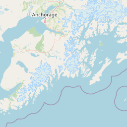
Earthquake Map — Anchorage Area
Fault Lines Near Anchorage
| Fault Name | Type | Distance | Max Credible Mag | Last Major Rupture |
|---|---|---|---|---|
| Castle Mountain Fault | right-lateral strike-slip | 50 km | M7.5 | 1984 (M5.7) |
| Aleutian Subduction Zone | subduction zone | 80 km | M9.2 | 1964 (M9.2 Great Alaska) |
| Denali Fault | right-lateral strike-slip | 200 km | M8.0 | 2002 (M7.9) |
| Border Ranges Fault | thrust | 30 km | M7.0 | paleoseismic data limited |
Recent Earthquakes (Last 30 Days)
Dataset at a glance — Anchorage
Over the past 30 days, Anchorage has recorded 340 earthquakes of magnitude 2.5 or greater in our tracker. The remaining 34 fell in the M2.5–M3.9 band. By depth: 272 shallow (<70 km), 68 intermediate (70–300 km). 155 of the epicenters were offshore. 62 events produced at least one felt report, totalling 193 citizen submissions to the USGS Did You Feel It? system. Focal depths ranged from 0.0 km to 140.1 km. 317 of the 340 solutions have been reviewed by a USGS seismologist; the remaining 23 are automatic and may be refined.
Leading the list is a magnitude 3.8 event near 9 km N of Susitna, Alaska at 30.5 km depth, which drew 117 felt reports from the public. The second-ranked event, at magnitude 3.8 near 27 km SW of Petersville, Alaska, trails by 0.0 magnitude units — a narrow gap, indicating two comparably energetic events in the current window. Rounding out the top three is a magnitude 3.7 earthquake near 48 km NNE of Chickaloon, Alaska.
Each row in the table below includes a narrative summary of the event, ordered by time. Use the column headers to sort or filter by magnitude.
| Time ↓ | Mag ↕ | Location ↕ | Depth ↕ | Felt ↕ | MMI | Alert | Status | Details |
|---|---|---|---|---|---|---|---|---|
3 hours ago 2026-06-13 09:57:24 UTC | 3.3ml | 30 km SSE of Skwentna, Alaska 61.756°, -151.103° | 80.3 km | - | - | - | Auto | USGS → |
The USGS recorded this magnitude 3.3 earthquake 30 km SSE of Skwentna, Alaska at 09:57 UTC on June 13, 2026. At a depth of 80.3 km, the event was intermediate depth. Coordinates: 61.756°, -151.103°. The automatic solution is preliminary and may be refined as additional station data arrives. See the M3.3 event page for the full report, ShakeMap, and citizen-reported intensity data. | ||||||||
2 days ago 2026-06-11 12:31:29 UTC | 2.6ml | 36 km WNW of Clam Gulch, Alaska 60.378°, -151.989° | 91.6 km | 1 | - | - | ✓ Reviewed | USGS → |
Reports of a magnitude 2.6 earthquake 36 km WNW of Clam Gulch, Alaska came in on June 11, 2026 at 12:31 UTC. A small number of nearby observers (1) submitted felt reports to the USGS. At a depth of 91.6 km, the event was intermediate depth. Coordinates: 60.378°, -151.989°. The solution has been reviewed by a USGS seismologist and is considered finalized. See the M2.6 event page for the full report, ShakeMap, and citizen-reported intensity data. | ||||||||
2 days ago 2026-06-10 18:35:44 UTC | 2.7ml | 12 km NNE of Susitna, Alaska 61.641°, -150.389° | 29.7 km | 1 | - | - | Auto | USGS → |
At 18:35 UTC on June 10, 2026, a magnitude 2.7 tremor occurred 12 km NNE of Susitna, Alaska. Coming 68 hours after a magnitude 3.8 earthquake in the immediate vicinity, it is most likely an aftershock of that larger rupture. A small number of nearby observers (1) submitted felt reports to the USGS. The event originated approximately 29.7 km below the surface, classifying it as shallow crustal. Coordinates: 61.641°, -150.389°. The automatic solution is preliminary and may be refined as additional station data arrives. See the M2.7 event page for the full report, ShakeMap, and citizen-reported intensity data. | ||||||||
3 days ago 2026-06-09 23:34:14 UTC | 2.6ml | 20 km W of Point MacKenzie, Alaska 61.363°, -150.369° | 43.1 km | 1 | - | - | ✓ Reviewed | USGS → |
A magnitude 2.6 seismic event took place 20 km W of Point MacKenzie, Alaska on June 9, 2026 at 23:34 UTC. It arrived roughly 15 hours after a larger magnitude 3.0 mainshock in the same 20 km area, placing it within the typical aftershock window. A small number of nearby observers (1) submitted felt reports to the USGS. The event originated approximately 43.1 km below the surface, classifying it as shallow crustal. The event was offshore — common for earthquakes along subduction zones and transform plate boundaries. The epicenter is at 61.363°, -150.369°. The solution has been reviewed by a USGS seismologist and is considered finalized. See the M2.6 event page for the full report, ShakeMap, and citizen-reported intensity data. | ||||||||
4 days ago 2026-06-09 08:25:47 UTC | 3.0ml | 20 km SSE of Susitna, Alaska 61.373°, -150.367° | 45.4 km | 5 | II | - | ✓ Reviewed | USGS → |
Reports of a magnitude 3.0 earthquake 20 km SSE of Susitna, Alaska came in on June 9, 2026 at 08:25 UTC. In the 72 hours after this event, the USGS recorded 4 smaller earthquakes within 20 km, consistent with an ongoing aftershock sequence rooted here. On the Modified Mercalli scale, shaking reached 2.3 — considered weak. A small number of nearby observers (5) submitted felt reports to the USGS. This was a shallow crustal earthquake, focused at 45.4 km depth. Geolocation places the event at 61.373°N, -150.367°E. See the M3.0 event page for the full report, ShakeMap, and citizen-reported intensity data. | ||||||||
4 days ago 2026-06-08 17:37:28 UTC | 3.7ml | 48 km NNE of Chickaloon, Alaska 62.203°, -148.132° | 10.0 km | 2 | III | - | ✓ Reviewed | USGS → |
Seismographs logged a magnitude 3.7 earthquake 48 km NNE of Chickaloon, Alaska with origin time 17:37 UTC on June 8, 2026. In the 72 hours after this event, the USGS recorded 8 smaller earthquakes within 20 km, consistent with an ongoing aftershock sequence rooted here. Peak ground motion corresponded to MMI 3.7, classified as light shaking. It ranks as the third largest event in the current dataset. A small number of nearby observers (2) submitted felt reports to the USGS. The event originated approximately 10.0 km below the surface, classifying it as shallow crustal. See the M3.7 event page for the full report, ShakeMap, and citizen-reported intensity data. | ||||||||
5 days ago 2026-06-08 02:08:50 UTC | 2.6ml | 0 km SE of Big Lake, Alaska 61.516°, -149.942° | 31.6 km | 1 | - | - | ✓ Reviewed | USGS → |
June 8, 2026 brought a magnitude 2.6 earthquake 0 km SE of Big Lake, Alaska, logged at 02:08 UTC. In the 72 hours after this event, the USGS recorded 3 smaller earthquakes within 20 km, consistent with an ongoing aftershock sequence rooted here. A small number of nearby observers (1) submitted felt reports to the USGS. This was a shallow crustal earthquake, focused at 31.6 km depth. The event was offshore — common for earthquakes along subduction zones and transform plate boundaries. Geolocation places the event at 61.516°N, -149.942°E. See the M2.6 event page for the full report, ShakeMap, and citizen-reported intensity data. | ||||||||
5 days ago 2026-06-07 22:12:17 UTC | 3.8ml | 9 km N of Susitna, Alaska 61.629°, -150.506° | 30.5 km | 117 | III | - | ✓ Reviewed | USGS → |
On June 7, 2026 at 22:12 UTC, a magnitude 3.8 earthquake struck 9 km N of Susitna, Alaska. Of every earthquake currently listed for Anchorage, this one generated the most felt reports from the public. The USGS received 117 felt reports from nearby residents — a notable response for an event of this magnitude. It is the largest earthquake currently listed for Anchorage over the past 30 days. Maximum shaking intensity peaked at MMI 3.3 (light). The hypocenter lay at 30.5 km, placing this in the shallow crustal category. The event was offshore — common for earthquakes along subduction zones and transform plate boundaries. The epicenter is at 61.629°, -150.506°. The solution has been reviewed by a USGS seismologist and is considered finalized. See the M3.8 event page for the full report, ShakeMap, and citizen-reported intensity data. | ||||||||
6 days ago 2026-06-07 06:42:57 UTC | 3.0ml | 48 km NNE of Chickaloon, Alaska 62.207°, -148.137° | 10.0 km | 1 | - | - | ✓ Reviewed | USGS → |
A magnitude 3.0 seismic event took place 48 km NNE of Chickaloon, Alaska on June 7, 2026 at 06:42 UTC. In the 72 hours after this event, the USGS recorded 10 smaller earthquakes within 20 km, consistent with an ongoing aftershock sequence rooted here. A small number of nearby observers (1) submitted felt reports to the USGS. The hypocenter lay at 10.0 km, placing this in the shallow crustal category. Coordinates: 62.207°, -148.137°. The solution has been reviewed by a USGS seismologist and is considered finalized. See the M3.0 event page for the full report, ShakeMap, and citizen-reported intensity data. | ||||||||
2026-06-06 2026-06-06 04:32:47 UTC | 2.6ml | 55 km ENE of Susitna North, Alaska 62.288°, -148.825° | 18.0 km | 1 | - | - | ✓ Reviewed | USGS → |
On June 6, 2026 at 04:32 UTC, a magnitude 2.6 earthquake struck 55 km ENE of Susitna North, Alaska. A small number of nearby observers (1) submitted felt reports to the USGS. The hypocenter lay at 18.0 km, placing this in the shallow crustal category. Coordinates: 62.288°, -148.825°. The solution has been reviewed by a USGS seismologist and is considered finalized. See the M2.6 event page for the full report, ShakeMap, and citizen-reported intensity data. | ||||||||
2026-06-05 2026-06-05 15:59:15 UTC | 2.7ml | 44 km SSW of Skwentna, Alaska 61.598°, -151.598° | 85.9 km | 1 | - | - | ✓ Reviewed | USGS → |
The USGS recorded this magnitude 2.7 earthquake 44 km SSW of Skwentna, Alaska at 15:59 UTC on June 5, 2026. A small number of nearby observers (1) submitted felt reports to the USGS. This was a intermediate depth earthquake, focused at 85.9 km depth. The epicenter is at 61.598°, -151.598°. The solution has been reviewed by a USGS seismologist and is considered finalized. See the M2.7 event page for the full report, ShakeMap, and citizen-reported intensity data. | ||||||||
2026-06-04 2026-06-04 16:09:37 UTC | 2.6ml | 23 km SSE of Susitna North, Alaska 61.975°, -149.622° | 22.0 km | 1 | - | - | ✓ Reviewed | USGS → |
A magnitude 2.6 earthquake was recorded 23 km SSE of Susitna North, Alaska on June 4, 2026 at 16:09 UTC. A small number of nearby observers (1) submitted felt reports to the USGS. At a depth of 22.0 km, the event was shallow crustal. The epicenter is at 61.975°, -149.622°. The solution has been reviewed by a USGS seismologist and is considered finalized. See the M2.6 event page for the full report, ShakeMap, and citizen-reported intensity data. | ||||||||
2026-06-02 2026-06-02 06:26:27 UTC | 2.6ml | 4 km NW of Chase, Alaska 62.479°, -150.152° | 10.0 km | 3 | - | - | ✓ Reviewed | USGS → |
Seismographs logged a magnitude 2.6 earthquake 4 km NW of Chase, Alaska with origin time 06:26 UTC on June 2, 2026. A small number of nearby observers (3) submitted felt reports to the USGS. The event originated approximately 10.0 km below the surface, classifying it as shallow crustal. The event was offshore — common for earthquakes along subduction zones and transform plate boundaries. Geolocation places the event at 62.479°N, -150.152°E. The solution has been reviewed by a USGS seismologist and is considered finalized. See the M2.6 event page for the full report, ShakeMap, and citizen-reported intensity data. | ||||||||
2026-06-01 2026-06-01 19:28:17 UTC | 2.9ml | 30 km NNE of Skwentna, Alaska 62.225°, -151.103° | 80.3 km | 1 | - | - | ✓ Reviewed | USGS → |
On June 1, 2026 at 19:28 UTC, a magnitude 2.9 earthquake struck 30 km NNE of Skwentna, Alaska. A small number of nearby observers (1) submitted felt reports to the USGS. The event originated approximately 80.3 km below the surface, classifying it as intermediate depth. Geolocation places the event at 62.225°N, -151.103°E. The solution has been reviewed by a USGS seismologist and is considered finalized. See the M2.9 event page for the full report, ShakeMap, and citizen-reported intensity data. | ||||||||
2026-05-31 2026-05-31 12:02:29 UTC | 2.5ml | 10 km NE of Skwentna, Alaska 62.068°, -151.286° | 77.4 km | - | - | - | ✓ Reviewed | USGS → |
This magnitude 2.5 event was detected 10 km NE of Skwentna, Alaska on May 31, 2026, with origin time 12:02 UTC. The event originated approximately 77.4 km below the surface, classifying it as intermediate depth. The offshore location combined with this depth is characteristic of seismicity along descending slabs. Coordinates: 62.068°, -151.286°. The solution has been reviewed by a USGS seismologist and is considered finalized. See the M2.5 event page for the full report, ShakeMap, and citizen-reported intensity data. | ||||||||
2026-05-30 2026-05-30 03:38:01 UTC | 2.6ml | 17 km NE of Susitna North, Alaska 62.284°, -149.650° | 55.7 km | 1 | - | - | ✓ Reviewed | USGS → |
On May 30, 2026, Anchorage registered a magnitude 2.6 earthquake 17 km NE of Susitna North, Alaska at 03:38 UTC. A small number of nearby observers (1) submitted felt reports to the USGS. This was a shallow crustal earthquake, focused at 55.7 km depth. The event was offshore — common for earthquakes along subduction zones and transform plate boundaries. Coordinates: 62.284°, -149.650°. The solution has been reviewed by a USGS seismologist and is considered finalized. See the M2.6 event page for the full report, ShakeMap, and citizen-reported intensity data. | ||||||||
2026-05-30 2026-05-30 02:56:09 UTC | 2.8ml | 23 km NNW of Glacier View, Alaska 61.990°, -147.878° | 21.9 km | 1 | - | - | ✓ Reviewed | USGS → |
Seismographs logged a magnitude 2.8 earthquake 23 km NNW of Glacier View, Alaska with origin time 02:56 UTC on May 30, 2026. A small number of nearby observers (1) submitted felt reports to the USGS. The hypocenter lay at 21.9 km, placing this in the shallow crustal category. The epicenter is at 61.990°, -147.878°. The solution has been reviewed by a USGS seismologist and is considered finalized. See the M2.8 event page for the full report, ShakeMap, and citizen-reported intensity data. | ||||||||
2026-05-30 2026-05-30 02:38:17 UTC | 2.8ml | 21 km W of Susitna, Alaska 61.553°, -150.912° | 74.7 km | 1 | - | - | ✓ Reviewed | USGS → |
On May 30, 2026, Anchorage registered a magnitude 2.8 earthquake 21 km W of Susitna, Alaska at 02:38 UTC. A small number of nearby observers (1) submitted felt reports to the USGS. At a depth of 74.7 km, the event was intermediate depth. The offshore location combined with this depth is characteristic of seismicity along descending slabs. Geolocation places the event at 61.553°N, -150.912°E. The solution has been reviewed by a USGS seismologist and is considered finalized. See the M2.8 event page for the full report, ShakeMap, and citizen-reported intensity data. | ||||||||
2026-05-28 2026-05-28 02:24:37 UTC | 2.5ml | 6 km E of Salamatof, Alaska 60.614°, -151.202° | 66.0 km | - | - | - | ✓ Reviewed | USGS → |
Reports of a magnitude 2.5 earthquake 6 km E of Salamatof, Alaska came in on May 28, 2026 at 02:24 UTC. This was a shallow crustal earthquake, focused at 66.0 km depth. The event was offshore — common for earthquakes along subduction zones and transform plate boundaries. The epicenter is at 60.614°, -151.202°. The solution has been reviewed by a USGS seismologist and is considered finalized. See the M2.5 event page for the full report, ShakeMap, and citizen-reported intensity data. | ||||||||
2026-05-28 2026-05-28 00:16:48 UTC | 3.4ml | 24 km ESE of Kasilof, Alaska 60.270°, -150.849° | 65.7 km | 2 | II | - | ✓ Reviewed | USGS → |
On May 28, 2026, Anchorage registered a magnitude 3.4 earthquake 24 km ESE of Kasilof, Alaska at 00:16 UTC. Maximum shaking intensity peaked at MMI 2.5 (weak). It ranks as the fourth largest event in the current dataset. A small number of nearby observers (2) submitted felt reports to the USGS. This was a shallow crustal earthquake, focused at 65.7 km depth. The epicenter is at 60.270°, -150.849°. See the M3.4 event page for the full report, ShakeMap, and citizen-reported intensity data. | ||||||||
2026-05-27 2026-05-27 19:56:37 UTC | 2.5ml | 2 km N of Tanaina, Alaska 61.648°, -149.432° | 29.0 km | 2 | - | - | ✓ Reviewed | USGS → |
A magnitude 2.5 seismic event took place 2 km N of Tanaina, Alaska on May 27, 2026 at 19:56 UTC. In the 72 hours after this event, the USGS recorded 3 smaller earthquakes within 20 km, consistent with an ongoing aftershock sequence rooted here. A small number of nearby observers (2) submitted felt reports to the USGS. The hypocenter lay at 29.0 km, placing this in the shallow crustal category. The event was offshore — common for earthquakes along subduction zones and transform plate boundaries. Geolocation places the event at 61.648°N, -149.432°E. See the M2.5 event page for the full report, ShakeMap, and citizen-reported intensity data. | ||||||||
2026-05-26 2026-05-26 19:37:16 UTC | 2.6ml | 38 km SW of Skwentna, Alaska 61.783°, -151.972° | 113.4 km | - | - | - | ✓ Reviewed | USGS → |
At 19:37 UTC on May 26, 2026, a magnitude 2.6 tremor occurred 38 km SW of Skwentna, Alaska. The hypocenter lay at 113.4 km, placing this in the intermediate depth category. The offshore location combined with this depth is characteristic of seismicity along descending slabs. The epicenter is at 61.783°, -151.972°. The solution has been reviewed by a USGS seismologist and is considered finalized. See the M2.6 event page for the full report, ShakeMap, and citizen-reported intensity data. | ||||||||
2026-05-26 2026-05-26 16:34:16 UTC | 3.1ml | 63 km NW of Tatitlek, Alaska 61.234°, -147.582° | 7.7 km | 1 | - | - | ✓ Reviewed | USGS → |
This magnitude 3.1 event was detected 63 km NW of Tatitlek, Alaska on May 26, 2026, with origin time 16:34 UTC. A small number of nearby observers (1) submitted felt reports to the USGS. The event originated approximately 7.7 km below the surface, classifying it as shallow crustal. The event was offshore — common for earthquakes along subduction zones and transform plate boundaries. The epicenter is at 61.234°, -147.582°. The solution has been reviewed by a USGS seismologist and is considered finalized. See the M3.1 event page for the full report, ShakeMap, and citizen-reported intensity data. | ||||||||
2026-05-25 2026-05-25 16:16:58 UTC | 2.6ml | 33 km NNW of Susitna, Alaska 61.817°, -150.762° | 58.3 km | 1 | - | - | ✓ Reviewed | USGS → |
The USGS recorded this magnitude 2.6 earthquake 33 km NNW of Susitna, Alaska at 16:16 UTC on May 25, 2026. A small number of nearby observers (1) submitted felt reports to the USGS. At a depth of 58.3 km, the event was shallow crustal. Geolocation places the event at 61.817°N, -150.762°E. The solution has been reviewed by a USGS seismologist and is considered finalized. See the M2.6 event page for the full report, ShakeMap, and citizen-reported intensity data. | ||||||||
2026-05-25 2026-05-25 07:50:08 UTC | 2.7ml | 22 km NW of Cooper Landing, Alaska 60.646°, -150.095° | 44.0 km | 1 | - | - | ✓ Reviewed | USGS → |
This magnitude 2.7 event was detected 22 km NW of Cooper Landing, Alaska on May 25, 2026, with origin time 07:50 UTC. A small number of nearby observers (1) submitted felt reports to the USGS. The hypocenter lay at 44.0 km, placing this in the shallow crustal category. The event was offshore — common for earthquakes along subduction zones and transform plate boundaries. Geolocation places the event at 60.646°N, -150.095°E. The solution has been reviewed by a USGS seismologist and is considered finalized. See the M2.7 event page for the full report, ShakeMap, and citizen-reported intensity data. | ||||||||
2026-05-23 2026-05-23 23:09:35 UTC | 2.5ml | 53 km NE of Susitna North, Alaska 62.454°, -149.029° | 23.3 km | 1 | - | - | ✓ Reviewed | USGS → |
May 23, 2026 brought a magnitude 2.5 earthquake 53 km NE of Susitna North, Alaska, logged at 23:09 UTC. A small number of nearby observers (1) submitted felt reports to the USGS. At a depth of 23.3 km, the event was shallow crustal. The event was offshore — common for earthquakes along subduction zones and transform plate boundaries. Coordinates: 62.454°, -149.029°. The solution has been reviewed by a USGS seismologist and is considered finalized. See the M2.5 event page for the full report, ShakeMap, and citizen-reported intensity data. | ||||||||
2026-05-22 2026-05-22 20:51:44 UTC | 2.5ml | 8 km SSW of Big Lake, Alaska 61.457°, -150.026° | 44.5 km | - | - | - | ✓ Reviewed | USGS → |
On May 22, 2026 at 20:51 UTC, a magnitude 2.5 earthquake struck 8 km SSW of Big Lake, Alaska. The event originated approximately 44.5 km below the surface, classifying it as shallow crustal. The epicenter is at 61.457°, -150.026°. The solution has been reviewed by a USGS seismologist and is considered finalized. See the M2.5 event page for the full report, ShakeMap, and citizen-reported intensity data. | ||||||||
2026-05-21 2026-05-21 22:57:51 UTC | 2.5ml | 12 km WSW of Salamatof, Alaska 60.558°, -151.510° | 75.4 km | 1 | - | - | ✓ Reviewed | USGS → |
A magnitude 2.5 earthquake was recorded 12 km WSW of Salamatof, Alaska on May 21, 2026 at 22:57 UTC. A small number of nearby observers (1) submitted felt reports to the USGS. This was a intermediate depth earthquake, focused at 75.4 km depth. Geolocation places the event at 60.558°N, -151.510°E. The solution has been reviewed by a USGS seismologist and is considered finalized. See the M2.5 event page for the full report, ShakeMap, and citizen-reported intensity data. | ||||||||
2026-05-20 2026-05-20 16:04:21 UTC | 2.5ml | 2 km E of Big Lake, Alaska 61.518°, -149.905° | 36.8 km | - | - | - | ✓ Reviewed | USGS → |
Seismographs logged a magnitude 2.5 earthquake 2 km E of Big Lake, Alaska with origin time 16:04 UTC on May 20, 2026. The hypocenter lay at 36.8 km, placing this in the shallow crustal category. The event was offshore — common for earthquakes along subduction zones and transform plate boundaries. Coordinates: 61.518°, -149.905°. The solution has been reviewed by a USGS seismologist and is considered finalized. See the M2.5 event page for the full report, ShakeMap, and citizen-reported intensity data. | ||||||||
2026-05-20 2026-05-20 11:05:03 UTC | 2.9ml | 33 km NW of Willow, Alaska 61.980°, -150.430° | 64.6 km | 1 | - | - | ✓ Reviewed | USGS → |
A magnitude 2.9 earthquake was recorded 33 km NW of Willow, Alaska on May 20, 2026 at 11:05 UTC. A small number of nearby observers (1) submitted felt reports to the USGS. This was a shallow crustal earthquake, focused at 64.6 km depth. The event was offshore — common for earthquakes along subduction zones and transform plate boundaries. Coordinates: 61.980°, -150.430°. The solution has been reviewed by a USGS seismologist and is considered finalized. See the M2.9 event page for the full report, ShakeMap, and citizen-reported intensity data. | ||||||||
Common Questions About Earthquakes in Anchorage
How often do earthquakes happen in Anchorage?
Anchorage experiences frequent earthquake activity. The area averages 250 earthquakes of magnitude 3.0 or greater per year, with 4 reaching magnitude 5.0 or higher. In the past 30 days, 340 earthquakes (M1.0+) have been recorded within 150 km of the city.
What was the biggest earthquake to hit Anchorage?
The largest earthquake in or near Anchorage since records began was the magnitude 9.2 1964 Great Alaska earthquake in 1964, which struck approximately 120 km east of the city.
What is the earthquake risk in Anchorage?
Earthquakes cannot be predicted with precision. However, the U.S. Geological Survey estimates there is approximately a 90% probability of a magnitude 6.7 or greater earthquake within 100 km of Anchorage in the next 30 years. The most likely source is the Castle Mountain Fault, which has a maximum credible magnitude of 7.5.
What fault lines are near Anchorage?
The Castle Mountain Fault runs approximately 50 km from Anchorage and is the most significant local seismic threat, with a maximum credible magnitude of 7.5. Other nearby faults include the Aleutian Subduction Zone (80 km), the Denali Fault (200 km), the Border Ranges Fault (30 km).
Was there an earthquake in Anchorage today?
Yes — a magnitude 3.3 earthquake was recorded 3 hours ago 30 km SSE of Skwentna, Alaska, within 150 km of Anchorage.
How do I prepare for an earthquake in Anchorage?
If you feel shaking, immediately Drop, Cover, and Hold On. Drop to your hands and knees, take cover under a sturdy desk or table, and hold on until shaking stops. Stay away from windows and exterior walls. Given the proximity of the Castle Mountain Fault (max credible M7.5), residents should have an earthquake emergency kit prepared. See our earthquake safety guide and emergency planning resources.
About This Page
This page is maintained by Earthquake Tracker, an independent seismic activity reporting service. Earthquake data is sourced from the U.S. Geological Survey (USGS) Earthquake Hazards Program and updated every hour. Probability estimates use the USGS National Seismic Hazard Model (NSHM 2023). Historical earthquake data is sourced from the USGS Historical Earthquake Catalog. Fault information comes from the USGS Quaternary Fault and Fold Database and SCEC Community Fault Model.
Last data refresh: 2026-06-13T13:03:41.776Z · Last reviewed: June 13, 2026