2.5
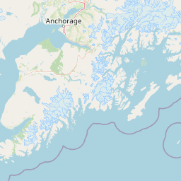
M2.5 Earthquake 8 km SSW of Big Lake, Alaska — May 22, 2026
2026-05-22 20:51:44 UTC (2026-05-22) · approx. 10:51 AM UTC-10 local
MagnitudeM2.5(ml)
Time20:51 UTC≈ 10:51 AM UTC-10
Depth44.5 kmshallow crustal
Coordinates61.457°, -150.026°
Felt byNo felt reports
Status✓ Reviewed by USGS
Earthquake Details
Magnitude
2.5 ml
Depth
44.5 km
shallow crustal
Location
61.4570°N
-150.0260°E
-150.0260°E
Technical Information
Event ID
aka2026kcavgb
Event Type
earthquake
Status
✓ Reviewed
Significance
96
Stations Used
91
Azimuthal Gap
33.0°
Min Station Distance
0.300°
RMS Residual
0.90 sec
Last Updated
2026-05-27 07:13:26 UTC
Nearby Earthquakes (Last 7 Days)
2.52.82.52.52.52.62.52.83.03.1
24 km SW of Susitna, Alaska
11 hours ago · 61.6 km deep
17 km NNE of Houston, Alaska
1 day ago · 18.3 km deep
25 km W of Happy Valley, Alaska
2 days ago · 90.7 km deep
30 km WSW of Anchor Point, Alaska
2 days ago · 77.0 km deep
7 km NW of Susitna North, Alaska
3 days ago · 0.7 km deep
61 km ENE of Pedro Bay, Alaska
3 days ago · 129.4 km deep
65 km WNW of Happy Valley, Alaska
4 days ago · 121.4 km deep
35 km SW of Skwentna, Alaska
4 days ago · 108.5 km deep
70 km WNW of Ninilchik, Alaska
4 days ago · 127.0 km deep
50 km W of Happy Valley, Alaska
5 days ago · 104.6 km deep
Actions
Understanding This Data
Magnitude 2.5 earthquakes are typically only recorded by instruments.
Authoritative source: USGS event page (event ID: aka2026kcavgb). All scientific values on this page are sourced verbatim from the USGS feed.
Cite this page: EarthquakeTracker.org. (2026, May 22, 2026). M2.5 Earthquake 8 km SSW of Big Lake, Alaska — May 22, 2026. Retrieved May 27, 2026 from https://www.earthquaketracker.org/earthquakes/event/aka2026kcavgb/