Earthquakes in San Francisco, California
Last earthquake: 2 hours ago · 112 in past 30 days · Largest: M3.1 · Population 874K
Last updated: October 3, 2026 at 09:48 AM UTC · Data: USGS Earthquake Hazards Program
No significant earthquakes recorded near San Francisco recently. Last M2.5+: 3 days ago.
Quick Facts — Earthquakes in San Francisco
- Population
- 874K
- Seismic activity level
- very high
- Nearest major fault
- San Andreas Fault (Peninsula segment) (12 km)
- Largest recorded nearby
- M7.9 (1906 San Francisco earthquake)
- 30-year probability M6.7+
- 72% (UCERF3)
- Earthquakes past 30 days
- 112
- Last significant (M2.5+)
- 3 days ago
- 2026 total (M1.0+)
- 981
The San Francisco area averages about 8 magnitude 4.0+ earthquakes per year and has recorded 112 earthquakes (M1.0+) within 75 km in the past 30 days. The most recent significant earthquake (M3.0+) was a magnitude 3.1 event 21 days ago 9 km ENE of Blackhawk, CA.
San Francisco sits in the very high category for U.S. seismic activity. The largest earthquake in or near San Francisco since records began was the magnitude 7.9 1906 San Francisco earthquake, which struck approximately 5 km offshore of the city.
According to the U.S. Geological Survey's UCERF3 model, there is approximately a 72% probability of a magnitude 6.7 or greater earthquake within 100 km of San Francisco in the next 30 years, and a 51% probability of a magnitude 7.0 or greater event. The largest credible earthquake predicted for the San Francisco area is a magnitude 7.9 event on the San Andreas Fault (Peninsula segment), which lies 12 km from downtown San Francisco. Source: UCERF3 (Field et al. 2015), Table 7 — SF Bay region
San Francisco sits in a region characterized by the San Andreas transform fault system, where the Pacific and North American plates slide past each other at roughly 46 mm per year. Beyond the San Andreas Fault (Peninsula segment), secondary fault systems include the Hayward Fault and Calaveras Fault. View all earthquakes in California.
2026 Activity vs Historical Average
Recent Significant Earthquakes Near San Francisco
Earthquake Map — San Francisco Area
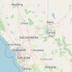
Fault Lines Near San Francisco
| Fault Name | Type | Distance | Max Credible Mag | Last Major Rupture |
|---|---|---|---|---|
| San Andreas Fault (Peninsula segment) | right-lateral strike-slip | 12 km | M7.9 | 1906 (M7.9 San Francisco) |
| Hayward Fault | right-lateral strike-slip | 20 km | M7.0 | 1868 (M6.8) |
| Calaveras Fault | right-lateral strike-slip | 50 km | M7.0 | 1984 (M6.2 Morgan Hill) |
| Rodgers Creek Fault | right-lateral strike-slip | 50 km | M7.1 | paleoseismic — last major ~1700 CE |
| San Gregorio Fault | right-lateral strike-slip | 25 km | M7.4 | paleoseismic data limited |
Recent Earthquakes (Last 30 Days)
Dataset at a glance — San Francisco
Over the past 30 days, San Francisco has recorded 112 earthquakes of magnitude 2.5 or greater in our tracker. The remaining 4 fell in the M2.5–M3.9 band. By depth: 112 shallow (<70 km). 61 of the epicenters were offshore. 18 events produced at least one felt report, totalling 768 citizen submissions to the USGS Did You Feel It? system. Focal depths ranged from -0.7 km to 17.3 km. 86 of the 112 solutions have been reviewed by a USGS seismologist; the remaining 26 are automatic and may be refined.
Each row in the table below includes a narrative summary of the event, ordered by time. Use the column headers to sort or filter by magnitude.
| Time ↓ | Mag ↕ | Location ↕ | Depth ↕ | Felt ↕ | MMI | Alert | Status | Details |
|---|---|---|---|---|---|---|---|---|
3 days ago 2026-09-29 16:06:37 UTC | 2.6md | 6 km W of Yountville, CA 38.399°, -122.424° | 8.3 km | 51 | - | - | Auto | USGS → |
Seismographs logged a magnitude 2.6 earthquake 6 km W of Yountville, CA with origin time 16:06 UTC on September 29, 2026. The event was offshore. See the M2.6 event page for the full report, ShakeMap, and citizen-reported intensity data. | ||||||||
2026-09-19 2026-09-19 10:52:05 UTC | 2.5md | 10 km ENE of Milpitas, CA 37.467°, -121.802° | 3.2 km | 9 | - | - | ✓ Reviewed | USGS → |
On September 19, 2026, San Francisco registered a magnitude 2.5 earthquake 10 km ENE of Milpitas, CA at 10:52 UTC. This very shallow event was close enough to the surface that even modest magnitudes can produce significant local shaking. See the M2.5 event page for the full report, ShakeMap, and citizen-reported intensity data. | ||||||||
2026-09-14 2026-09-14 13:47:28 UTC | 3.0ml | 9 km SW of Brentwood, CA 37.875°, -121.810° | 16.9 km | 52 | - | - | Auto | USGS → |
A magnitude 3.0 earthquake was recorded 9 km SW of Brentwood, CA on September 14, 2026 at 13:47 UTC. This event falls inside the aftershock decay of a nearby magnitude 3.1 earthquake that occurred about 54 hours earlier. The event was offshore. See the M3.0 event page for the full report, ShakeMap, and citizen-reported intensity data. | ||||||||
2026-09-12 2026-09-12 07:25:55 UTC | 3.1ml | 9 km ENE of Blackhawk, CA 37.863°, -121.821° | 15.9 km | 257 | - | - | ✓ Reviewed | USGS → |
On September 12, 2026 at 07:25 UTC, a magnitude 3.1 earthquake struck 9 km ENE of Blackhawk, CA. In the 72 hours after this event, the USGS recorded 4 smaller earthquakes within 20 km, consistent with an ongoing aftershock sequence rooted here. See the M3.1 event page for the full report, ShakeMap, and citizen-reported intensity data. | ||||||||
Common Questions About Earthquakes in San Francisco
How often do earthquakes happen in San Francisco?
San Francisco experiences frequent earthquake activity. The area averages 75 earthquakes of magnitude 3.0 or greater per year, with 0.9 reaching magnitude 5.0 or higher. In the past 30 days, 112 earthquakes (M1.0+) have been recorded within 75 km of the city.
What was the biggest earthquake to hit San Francisco?
The largest earthquake in or near San Francisco since records began was the magnitude 7.9 1906 San Francisco earthquake in 1906, which struck approximately 5 km offshore of the city.
What is the earthquake risk in San Francisco?
Earthquakes cannot be predicted with precision. However, the U.S. Geological Survey estimates there is approximately a 72% probability of a magnitude 6.7 or greater earthquake within 100 km of San Francisco in the next 30 years. The most likely source is the San Andreas Fault (Peninsula segment), which has a maximum credible magnitude of 7.9.
What fault lines are near San Francisco?
The San Andreas Fault (Peninsula segment) runs approximately 12 km from San Francisco and is the most significant local seismic threat, with a maximum credible magnitude of 7.9. Other nearby faults include the Hayward Fault (20 km), the Calaveras Fault (50 km), the Rodgers Creek Fault (50 km).
Was there an earthquake in San Francisco today?
No earthquakes of magnitude 2.5 or greater have been recorded near San Francisco in the past 24 hours. The most recent M2.5+ event was 3 days ago.
About This Page
This page is maintained by Earthquake Tracker, an independent seismic activity reporting service. Earthquake data is sourced from the U.S. Geological Survey (USGS) Earthquake Hazards Program and updated every hour. Probability estimates use the USGS Uniform California Earthquake Rupture Forecast (UCERF3) for California cities. Historical earthquake data is sourced from the USGS Historical Earthquake Catalog. Fault information comes from the USGS Quaternary Fault and Fold Database and SCEC Community Fault Model.
Last data refresh: October 3, 2026 at 09:48 AM UTC