Earthquakes in Kansas

0 earthquakes in the last 24 hours• Latest significant: M3.0

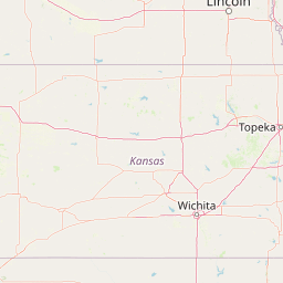
Earthquake Map

Map showing earthquake epicenter at 39.01°, -98.48°

Recent Earthquakes (Last 30 Days)

Dataset at a glance — Kansas

Over the past 30 days, Kansas has recorded 4 earthquakes of magnitude 2.5 or greater in our tracker. The remaining 4 fell in the M2.5–M3.9 band. By depth: 4 shallow (<70 km). 1 of the epicenters were offshore. 1 event produced at least one felt report, totalling 8 citizen submissions to the USGS Did You Feel It? system. Focal depths ranged from 5.0 km to 10.0 km. All 4 solutions have been reviewed by a USGS seismologist.

Each row in the table below includes a narrative summary of the event, ordered by time. Use the column headers to sort or filter by magnitude.

Showing 4 of 4
Time ↓Mag ↕Location ↕Depth ↕Felt ↕MMIAlertStatusDetails
2026-10-15
2026-10-15 17:18:54 UTC
2.7mb_lg
7 km SSW of Luray, Kansas
39.053°, -98.735°
8.6 km---✓ ReviewedUSGS →
A magnitude 2.7 earthquake was recorded 7 km SSW of Luray, Kansas on October 15, 2026 at 17:18 UTC. See the M2.7 event page for the full report, ShakeMap, and citizen-reported intensity data.
2026-10-08
2026-10-08 20:40:36 UTC
2.6mb_lg
7 km ENE of Assaria, Kansas
38.714°, -97.526°
5.0 km---✓ ReviewedUSGS →
Seismographs logged a magnitude 2.6 earthquake 7 km ENE of Assaria, Kansas with origin time 20:40 UTC on October 8, 2026. See the M2.6 event page for the full report, ShakeMap, and citizen-reported intensity data.
2026-09-28
2026-09-28 22:54:45 UTC
3.0mb_lg
2 km SSW of Bogue, Kansas
39.341°, -99.705°
5.0 km8--✓ ReviewedUSGS →
On September 28, 2026 at 22:54 UTC, a magnitude 3.0 earthquake struck 2 km SSW of Bogue, Kansas. It is the largest earthquake currently listed for Kansas over the past 30 days. See the M3.0 event page for the full report, ShakeMap, and citizen-reported intensity data.
2026-09-28
2026-09-28 22:50:25 UTC
2.5mb_lg
9 km SE of Hill City, Kansas
39.304°, -99.773°
10.0 km---✓ ReviewedUSGS →
On September 28, 2026, Kansas registered a magnitude 2.5 earthquake 9 km SE of Hill City, Kansas at 22:50 UTC. This is the deepest earthquake in the current dataset — a shallow crustal event. See the M2.5 event page for the full report, ShakeMap, and citizen-reported intensity data.
Legend:
Mag: Magnitude (magType = ml, mb, mw, etc.)
Felt: Number of DYFI felt reports
MMI: Modified Mercalli Intensity (I-X+)
Alert: PAGER alert level
Depth: Shallow (<70km), Intermediate, Deep (>300km)
Status: Auto = preliminary, Reviewed = verified by seismologist
Click any row to see additional technical details.

Earthquake Statistics

Last 24 Hours0
Last 30 Days4
2026 (M2.5+)16

Largest (30 Days)
M3.0

2 km SSW of Bogue, Kansas

2026-09-28

Largest in 2026
M4.1

4 km E of Cowles, Nebraska

2026-03-01

Seismic Risk Level
Low

Data from USGS Earthquake Hazards Program. Updated every 5 minutes.

About Kansas

Kansas has experienced increased seismic activity in recent years, particularly in the south-central region, linked to wastewater injection from oil and gas operations.

Kansas Earthquakes 2026

In 2026, Kansas has recorded 16 earthquakes of magnitude 2.5 or greater so far. The largest earthquake in Kansas in 2026 was a magnitude 4.1 event near Cowles, Nebraska.

Seismic Activity in Kansas

Kansas has a Low seismic risk level based on historical earthquake data and proximity to active fault lines.

Over the past 30 days, there have been 4 recorded earthquakes in this region. The largest recent earthquake was a magnitude 3.0 event near 2 km SSW of Bogue, Kansas.

Frequently Asked Questions

How many earthquakes occur in Kansas?

In the past 30 days, 4 earthquakes have been recorded in the Kansas region.

What was the biggest recent earthquake in Kansas?

The largest recent earthquake in the Kansas area was a magnitude 3.0 event that occurred 2 km SSW of Bogue, Kansas.