Earthquakes in Illinois

0 earthquakes in the last 24 hours• Latest significant: M2.9

Earthquake Map

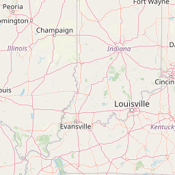
Map showing earthquake epicenter at 40.63°, -89.40°

Recent Earthquakes (Last 30 Days)

Dataset at a glance — Illinois

Over the past 30 days, Illinois has recorded 1 earthquake of magnitude 2.5 or greater in our tracker. The remaining 1 fell in the M2.5–M3.9 band. By depth: 1 shallow (<70 km). 1 event produced at least one felt report, totalling 610 citizen submissions to the USGS Did You Feel It? system. All 1 solutions have been reviewed by a USGS seismologist.

Each row in the table below includes a narrative summary of the event, ordered by time. Use the column headers to sort or filter by magnitude.

Showing 1 of 1
Time Mag Location Depth Felt MMIAlertStatusDetails
2026-07-08
2026-07-08 19:38:43 UTC
2.9mb_lg
20 km ENE of Kenilworth, Illinois
42.186°, -87.503°
5.0 km610III-✓ ReviewedUSGS →
On July 8, 2026 at 19:38 UTC, a magnitude 2.9 earthquake struck 20 km ENE of Kenilworth, Illinois. See the M2.9 event page for the full report, ShakeMap, and citizen-reported intensity data.
Legend:
Mag: Magnitude (magType = ml, mb, mw, etc.)
Felt: Number of DYFI felt reports
MMI: Modified Mercalli Intensity (I-X+)
Alert: PAGER alert level
Depth: Shallow (<70km), Intermediate, Deep (>300km)
Status: Auto = preliminary, Reviewed = verified by seismologist
Click any row to see additional technical details.

Earthquake Statistics

Last 24 Hours0
Last 30 Days1
2026 (M2.5+)2

Largest (30 Days)
M2.9

20 km ENE of Kenilworth, Illinois

2026-07-08

Largest in 2026
M3.8

4 km NW of Ohlman, Illinois

2026-01-20

Seismic Risk Level
Moderate

Data from USGS Earthquake Hazards Program. Updated every 5 minutes.

About Illinois

Southern Illinois lies near the New Madrid Seismic Zone. The region experiences small earthquakes regularly and faces risk from larger events on this fault system.

Major Faults:

Illinois Earthquakes 2026

In 2026, Illinois has recorded 2 earthquakes of magnitude 2.5 or greater so far. The largest earthquake in Illinois in 2026 was a magnitude 3.8 event near Ohlman, Illinois.

Seismic Activity in Illinois

Illinois has a Moderate seismic risk level based on historical earthquake data and proximity to active fault lines.

Over the past 30 days, there have been 1 recorded earthquakes in this region. The largest recent earthquake was a magnitude 2.9 event near 20 km ENE of Kenilworth, Illinois.

Frequently Asked Questions

How many earthquakes occur in Illinois?

In the past 30 days, 1 earthquakes have been recorded in the Illinois region.

What was the biggest recent earthquake in Illinois?

The largest recent earthquake in the Illinois area was a magnitude 2.9 event that occurred 20 km ENE of Kenilworth, Illinois.