M5.6 Earthquake in the Vanuatu region — June 3, 2026
2026-06-03 10:20:37 UTC (2026-06-03) · approx. 10:20 PM UTC+12 local
On June 3, 2026 at 10:20 UTC, a magnitude 5.6 shallow crustal earthquake struck in the Vanuatu region, at a depth of 10.0 km and coordinates -20.4715°, 173.0803°. The USGS PAGER system issued a green alert level for this event, indicating no significant casualties or damage expected. This earthquake was detected by 99 seismic stations with excellent location accuracy and was assigned a USGS significance rating of 482, placing it among routine seismic activity.
Physical scale: An earthquake of magnitude 5.6 releases seismic energy equivalent to roughly 4 kilotons of TNT. Empirical fault-scaling laws (Wells & Coppersmith, 1994) estimate the subsurface rupture length at approximately 4.4 km — a useful intuition for the size of the slip patch on the fault.
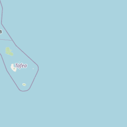
The epicenter is located in Vanuatu, a region characterized by the New Hebrides subduction zone, where the Australian Plate subducts eastward at approximately 90 mm per year. View all earthquakes in Vanuatu.
Learn more: Magnitude scale · Aftershock sequences
ShakeMap — predicted shaking intensity
Modeled ground-motion intensity contoured on the Modified Mercalli scale (MMI). Computed by the USGS from the moment-tensor solution and regional ground-motion prediction equations.
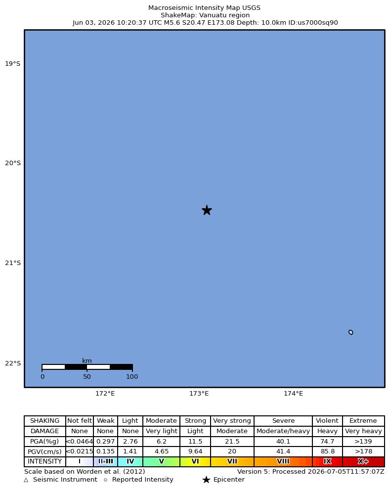
Source: U.S. Geological Survey ShakeMap. View interactive ShakeMap on USGS
Earthquake Details
173.0803°E
Technical Information
Nearby Earthquakes (Last 7 Days)
Common Questions
How strong was the magnitude 5.6 earthquake in the Vanuatu region?
The magnitude 5.6 earthquake that struck in the Vanuatu region on June 3, 2026 at 10:20 UTC had a depth of 10.0 km. For context, this was a moderate earthquake that could be widely felt.
Where did the earthquake occur?
The earthquake epicenter was located at -20.4715°, 173.0803°, which is in the Vanuatu region. View all earthquakes in Vanuatu.
Were there aftershocks?
Aftershock activity is monitored continuously by the USGS. Aftershock sequences from magnitude 5.6 earthquakes can continue for days to weeks and gradually diminish over time.
Has Vanuatu had earthquakes this big before?
The largest recorded earthquake in Vanuatu was the M7.9 Vanuatu earthquake of October 7, 2009. Today's magnitude 5.6 event is significantly smaller than that historical record.
Authoritative source: USGS event page (event ID: us7000sq90). All scientific values on this page are sourced verbatim from the USGS feed.
Cite this page: EarthquakeTracker.org. (2026, June 3, 2026). M5.6 Earthquake in the Vanuatu region — June 3, 2026. Retrieved July 8, 2026 from https://www.earthquaketracker.org/earthquakes/event/us7000sq90/