2.3
M2.3 Earthquake 82 km W of Miramichi, Canada — April 27, 2026
2026-04-27 21:31:39 UTC (2026-04-27) · approx. 5:31 PM UTC-4 local
MagnitudeM2.3(mb_lg)
Time21:31 UTC≈ 5:31 PM UTC-4
Depth12.1 kmshallow crustal
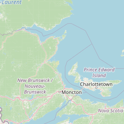
Coordinates47.021°, -66.582°
Felt byNo felt reports
Status✓ Reviewed by USGS
Earthquake Details
Magnitude
2.3 mb_lg
Depth
12.1 km
shallow crustal
Location
47.0212°N
-66.5821°E
-66.5821°E
Technical Information
Event ID
us7000sgjm
Event Type
earthquake
Status
✓ Reviewed
Significance
81
Stations Used
15
Azimuthal Gap
122.0°
Min Station Distance
1.689°
RMS Residual
1.27 sec
Last Updated
2026-05-01 05:17:53 UTC
Nearby Earthquakes (Last 7 Days)
Actions
Understanding This Data
Magnitude 2.3 earthquakes are typically only recorded by instruments.
Authoritative source: USGS event page (event ID: us7000sgjm). All scientific values on this page are sourced verbatim from the USGS feed.
Cite this page: EarthquakeTracker.org. (2026, April 27, 2026). M2.3 Earthquake 82 km W of Miramichi, Canada — April 27, 2026. Retrieved May 1, 2026 from https://www.earthquaketracker.org/earthquakes/event/us7000sgjm/