M7.4 Earthquake 15 km S of Hualien City, Taiwan — April 2, 2024
2024-04-02 23:58:12 UTC (2024-04-02) · approx. 7:58 AM UTC+8 local
Felt by 634 people across surrounding communities. Maximum shaking intensity MMI 8.0 (severe).
On April 2, 2024 at 23:58 UTC, a magnitude 7.4 shallow crustal earthquake struck 15 km S of Hualien City, Taiwan, at a depth of 40.0 km and coordinates 23.8356°, 121.5976°. The earthquake was reported felt by 634 peopleacross surrounding communities, with a maximum shaking intensity of Modified Mercalli Intensity (MMI) 8.0 (severe). The USGS PAGER system issued a yellow alert level for this event, indicating local impact possible. This earthquake was detected by 322 seismic stations with excellent location accuracy and was assigned a USGS significance rating of 1419, making it one of the most significant global earthquakes in recent days. The nearest populated place is Hualien City (population 350,468).
Physical scale: An earthquake of magnitude 7.4 releases seismic energy equivalent to roughly 1.9 megatons of TNT. Empirical fault-scaling laws (Wells & Coppersmith, 1994) estimate the subsurface rupture length at approximately 77 km — a useful intuition for the size of the slip patch on the fault.
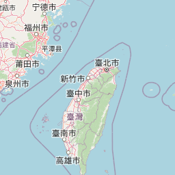
The epicenter is located in Taiwan, a region characterized by the collision of the Luzon volcanic arc with the Eurasian continental margin, where the Philippine Sea Plate converges at 80 mm per year. View all earthquakes in Taiwan.
Learn more: Magnitude scale · Aftershock sequences
Nearest Populated Places
What the Shaking Felt Like
At MMI 8.0 (severe), people in the most strongly affected areas would have experienced: Very strong shaking. Difficult to stand. Damage to weak structures; slight damage to well-built structures. Furniture broken. Fallen plaster and loose bricks.
ShakeMap — predicted shaking intensity
Modeled ground-motion intensity contoured on the Modified Mercalli scale (MMI). Computed by the USGS from the moment-tensor solution and regional ground-motion prediction equations.
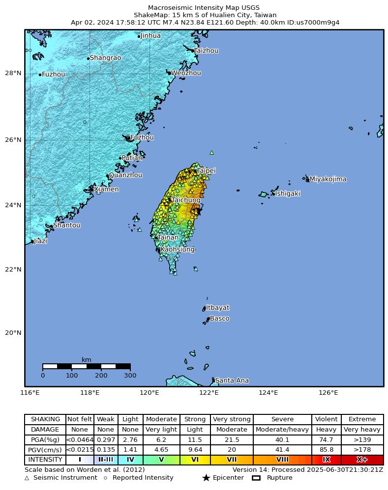
Source: U.S. Geological Survey ShakeMap. View interactive ShakeMap on USGS
Did You Feel It? — community-reported shaking
Aggregated felt-report intensity from 634 citizen responses to the USGS Did You Feel It? system. Each colored zone represents the average MMI from reports in that area.
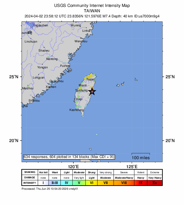
Source: U.S. Geological Survey Did You Feel It?. View on USGS · submit your own report
Population exposure (USGS PAGER)
Estimated population that experienced each level of shaking. Based on the USGS PAGER rapid impact assessment, which combines ShakeMap output with global population grids.
| Shaking intensity (MMI) | Description | Population exposed |
|---|---|---|
| MMI 3 | weak | 19,483,673 |
| MMI 4 | light | 73,956,003 |
| MMI 5 | moderate | 8,996,385 |
| MMI 6 | strong | 14,629,626 |
| MMI 7 | very strong | 381,358 |
| MMI 8 | severe | 176,293 |
Earthquake Details
121.5976°E
Technical Information
Nearby Earthquakes (Last 7 Days)
Common Questions
How strong was the magnitude 7.4 earthquake near Hualien City, Taiwan?
The magnitude 7.4 earthquake that struck 15 km S of Hualien City, Taiwan on April 2, 2024 at 23:58 UTC had a depth of 40.0 km. It was felt by 634 people with maximum shaking intensity of MMI 8.0 (severe). For context, this was a strong earthquake capable of causing significant damage.
Where did the earthquake occur?
The earthquake epicenter was located at 23.8356°, 121.5976°, which is 15 km S of Hualien City, Taiwan. The nearest populated place is Hualien City (population 350,468). View all earthquakes in Taiwan.
Were there aftershocks?
Aftershock activity is monitored continuously by the USGS. Aftershock sequences from magnitude 7.4 earthquakes can continue for months to years and gradually diminish over time.
Has Taiwan had earthquakes this big before?
The largest recorded earthquake in Taiwan was the M7.6 Chi-Chi earthquake of September 21, 1999. Today's magnitude 7.4 event is within one magnitude unit of that historical record.
Authoritative source: USGS event page (event ID: us7000m9g4). All scientific values on this page are sourced verbatim from the USGS feed.
Cite this page: EarthquakeTracker.org. (2024, April 2, 2024). M7.4 Earthquake 15 km S of Hualien City, Taiwan — April 2, 2024. Retrieved June 25, 2026 from https://www.earthquaketracker.org/earthquakes/event/us7000m9g4/