2.7
M2.7 Earthquake 102 km N of Yakutat, Alaska — June 29, 2026
2026-06-29 03:05:34 UTC (1 hour ago) · approx. 6:05 PM UTC-9 local
MagnitudeM2.7(ml)
Time03:05 UTC≈ 6:05 PM UTC-9
Depth5.0 kmshallow crustal
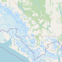
Coordinates60.466°, -139.877°
Felt byNo felt reports
Status✓ Reviewed by USGS
Earthquake Details
Magnitude
2.7 ml
Depth
5.0 km
shallow crustal
Location
60.4660°N
-139.8774°E
-139.8774°E
Technical Information
Event ID
us6000t8wn
Event Type
earthquake
Status
✓ Reviewed
Significance
112
Stations Used
24
Azimuthal Gap
113.0°
Min Station Distance
0.661°
RMS Residual
0.98 sec
Last Updated
2026-06-29 03:16:21 UTC
Nearby Earthquakes (Last 7 Days)
3.05.33.62.52.72.92.62.82.93.0
39 km SSW of Cordova, Alaska
51 min ago · 10.9 km deep
35 km SSW of Cordova, Alaska
55 min ago · 13.3 km deep
21 km E of Eagle Village, Alaska
2 hours ago · 5.9 km deep
55 km NW of Tatitlek, Alaska
1 day ago · 16.7 km deep
33 km WSW of Mosquito Lake, Alaska
4 days ago · 0.3 km deep
133 km SW of Pelican, Alaska
4 days ago · 12.7 km deep
94 km NW of Elfin Cove, Alaska
5 days ago · 9.9 km deep
33 km SSE of Nelchina, Alaska
5 days ago · 17.8 km deep
37 km NNE of Valdez, Alaska
5 days ago · 13.6 km deep
46 km N of Valdez, Alaska
5 days ago · 13.8 km deep
Actions
Understanding This Data
Magnitude 2.7 earthquakes are typically only recorded by instruments.
Authoritative source: USGS event page (event ID: us6000t8wn). All scientific values on this page are sourced verbatim from the USGS feed.
Cite this page: EarthquakeTracker.org. (2026, June 29, 2026). M2.7 Earthquake 102 km N of Yakutat, Alaska — June 29, 2026. Retrieved June 29, 2026 from https://www.earthquaketracker.org/earthquakes/event/us6000t8wn/