2.7
M2.7 Earthquake 142 km E of Chalkyitsik, Alaska — June 28, 2026
2026-06-28 17:22:16 UTC (10 hours ago) · approx. 8:22 AM UTC-9 local
MagnitudeM2.7(ml)
Time17:22 UTC≈ 8:22 AM UTC-9
Depth9.5 kmshallow crustal
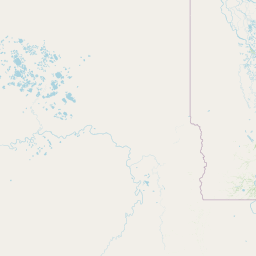
Coordinates66.632°, -140.511°
Felt byNo felt reports
Status✓ Reviewed by USGS
Earthquake Details
Magnitude
2.7 ml
Depth
9.5 km
shallow crustal
Location
66.6321°N
-140.5106°E
-140.5106°E
Technical Information
Event ID
us6000t8u7
Event Type
earthquake
Status
✓ Reviewed
Significance
112
Stations Used
29
Azimuthal Gap
88.0°
Min Station Distance
1.127°
RMS Residual
0.34 sec
Last Updated
2026-06-28 17:37:36 UTC
Nearby Earthquakes (Last 7 Days)
3.62.63.12.94.03.1
21 km E of Eagle Village, Alaska
2 hours ago · 5.9 km deep
84 km NNW of Venetie, Alaska
13 hours ago · 0.2 km deep
6 km ENE of Badger, Alaska
2 days ago · 16.7 km deep
7 km NNW of Arctic Village, Alaska
3 days ago · 4.6 km deep
133 km E of Chalkyitsik, Alaska
3 days ago · 11.4 km deep
133 km E of Chalkyitsik, Alaska
4 days ago · 9.8 km deep
Actions
Understanding This Data
Magnitude 2.7 earthquakes are typically only recorded by instruments.
Authoritative source: USGS event page (event ID: us6000t8u7). All scientific values on this page are sourced verbatim from the USGS feed.
Cite this page: EarthquakeTracker.org. (2026, June 28, 2026). M2.7 Earthquake 142 km E of Chalkyitsik, Alaska — June 28, 2026. Retrieved June 28, 2026 from https://www.earthquaketracker.org/earthquakes/event/us6000t8u7/