M5.9 Earthquake 22 km W of Sarabetsu, Japan — April 26, 2026
2026-04-26 20:23:55 UTC (2026-04-26) · approx. 6:23 AM UTC+10 local
Felt by 19 people across nearby locations. Maximum shaking intensity MMI 4.6 (moderate).
On April 26, 2026 at 20:23 UTC, a magnitude 5.9 intermediate depth earthquake struck 22 km W of Sarabetsu, Japan, at a depth of 81.0 km and coordinates 42.6912°, 142.9150°. The earthquake was reported felt by 19 peopleacross nearby locations, with a maximum shaking intensity of Modified Mercalli Intensity (MMI) 4.6 (moderate). The USGS PAGER system issued a green alert level for this event, indicating no significant casualties or damage expected. This earthquake was detected by 128 seismic stations with excellent location accuracy and was assigned a USGS significance rating of 546, placing it among routine seismic activity. The nearest populated place is Makubetsu (population 26,444).
Physical scale: An earthquake of magnitude 5.9 releases seismic energy equivalent to roughly 11 kilotons of TNT. Empirical fault-scaling laws (Wells & Coppersmith, 1994) estimate the subsurface rupture length at approximately 7.1 km — a useful intuition for the size of the slip patch on the fault.
The epicenter is located in Japan, a region characterized by the intersection of four tectonic plates — Pacific, Philippine Sea, Eurasian, and North American — creating multiple subduction zones. The nearest mapped fault system is the Japan Trench. View all earthquakes in Japan.
Learn more: Magnitude scale · Aftershock sequences
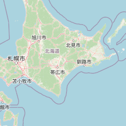
Nearest Populated Places
ShakeMap — predicted shaking intensity
Modeled ground-motion intensity contoured on the Modified Mercalli scale (MMI). Computed by the USGS from the moment-tensor solution and regional ground-motion prediction equations.
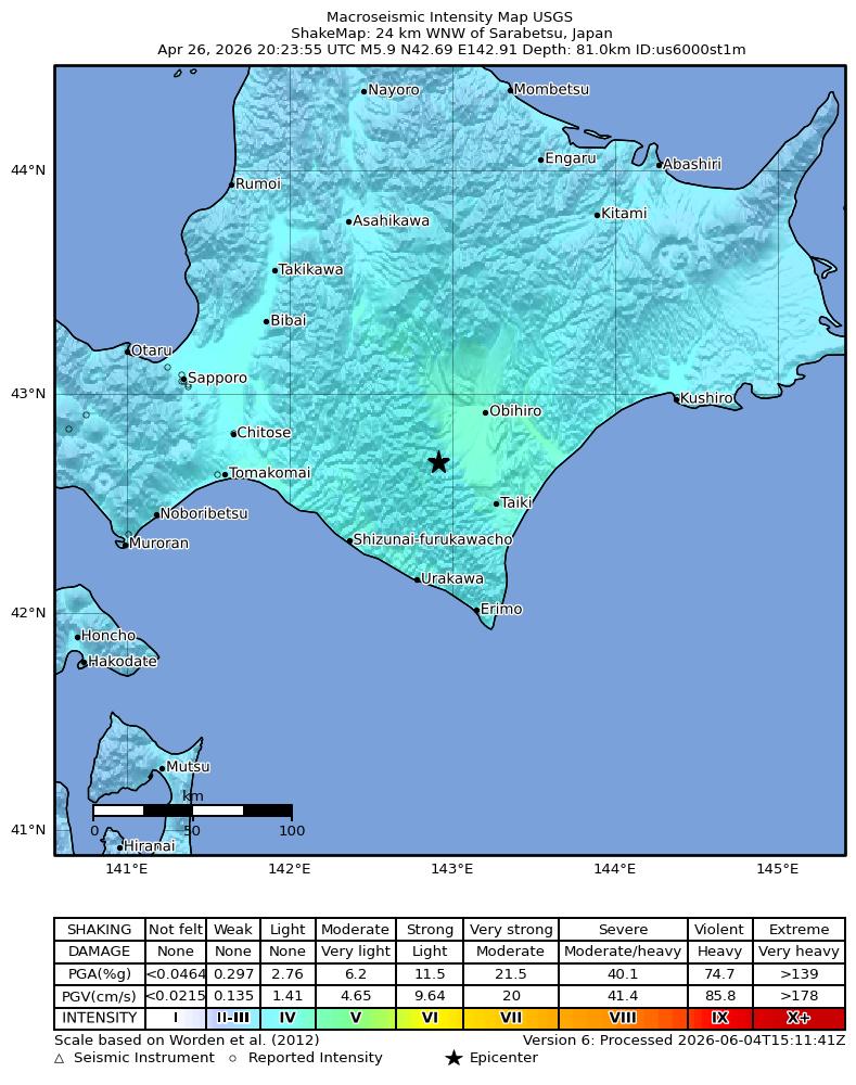
Source: U.S. Geological Survey ShakeMap. View interactive ShakeMap on USGS
Did You Feel It? — community-reported shaking
Aggregated felt-report intensity from 19 citizen responses to the USGS Did You Feel It? system. Each colored zone represents the average MMI from reports in that area.
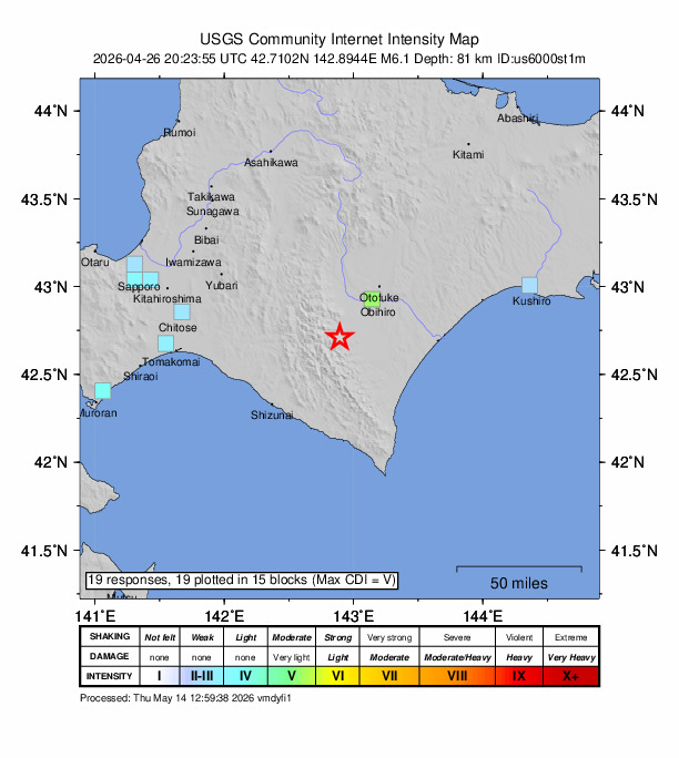
Source: U.S. Geological Survey Did You Feel It?. View on USGS · submit your own report
Population exposure (USGS PAGER)
Estimated population that experienced each level of shaking. Based on the USGS PAGER rapid impact assessment, which combines ShakeMap output with global population grids.
| Shaking intensity (MMI) | Description | Population exposed |
|---|---|---|
| MMI 3 | weak | 360,961 |
| MMI 4 | light | 4,341,426 |
| MMI 5 | moderate | 304,142 |
Earthquake Details
142.9150°E
Technical Information
Nearby Earthquakes (Last 7 Days)
Common Questions
How strong was the magnitude 5.9 earthquake near Sarabetsu, Japan?
The magnitude 5.9 earthquake that struck 22 km W of Sarabetsu, Japan on April 26, 2026 at 20:23 UTC had a depth of 81.0 km. It was felt by 19 people with maximum shaking intensity of MMI 4.6 (moderate). For context, this was a moderate earthquake that could be widely felt.
Where did the earthquake occur?
The earthquake epicenter was located at 42.6912°, 142.9150°, which is 22 km W of Sarabetsu, Japan. The nearest populated place is Makubetsu (population 26,444). View all earthquakes in Japan.
Were there aftershocks?
Aftershock activity is monitored continuously by the USGS. Aftershock sequences from magnitude 5.9 earthquakes can continue for days to weeks and gradually diminish over time.
Has Japan had earthquakes this big before?
The largest recorded earthquake in Japan was the M9.1 Tohoku earthquake of March 11, 2011. Today's magnitude 5.9 event is significantly smaller than that historical record.
What should I do after an earthquake?
If you were in the affected area: check yourself and others for injuries, inspect your home for damage, and be prepared for aftershocks. For detailed guidance, see our earthquake safety guide and emergency planning resources.
Authoritative source: USGS event page (event ID: us6000st1m). All scientific values on this page are sourced verbatim from the USGS feed.
Cite this page: EarthquakeTracker.org. (2026, April 26, 2026). M5.9 Earthquake 22 km W of Sarabetsu, Japan — April 26, 2026. Retrieved June 4, 2026 from https://www.earthquaketracker.org/earthquakes/event/us6000st1m/