M4.5 Earthquake 26 km SE of Palca, Peru — April 19, 2026
2026-04-19 18:20:00 UTC (3 hours ago)
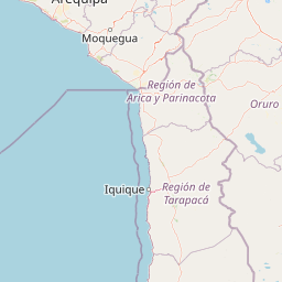
On April 19, 2026 at 18:20 UTC, a magnitude 4.5 intermediate depth earthquake struck 26 km SE of Palca, Peru, at a depth of 135.5 km and coordinates -17.9700°, -69.8069°. This earthquake was detected by 22 seismic stations with excellent location accuracy and was assigned a USGS significance rating of 312, placing it among routine seismic activity.
The epicenter is located in Peru, a region characterized by the northern Peru-Chile subduction zone, complicated by the subduction of the Nazca Ridge. The nearest mapped fault system is the Peru-Chile Trench. View all earthquakes in Peru.
Learn more: Magnitude scale · Aftershock sequences
Earthquake Details
-69.8069°E
Technical Information
Nearby Earthquakes (Last 7 Days)
Common Questions
How strong was the magnitude 4.5 earthquake near Palca, Peru?
The magnitude 4.5 earthquake that struck 26 km SE of Palca, Peru on April 19, 2026 at 18:20 UTC had a depth of 135.5 km. For context, this was a light earthquake commonly felt near the epicenter.
Where did the earthquake occur?
The earthquake epicenter was located at -17.9700°, -69.8069°, which is 26 km SE of Palca, Peru. View all earthquakes in Peru.
Were there aftershocks?
Aftershock activity is monitored continuously by the USGS. Aftershock sequences from magnitude 4.5 earthquakes can continue for several days and gradually diminish over time.
Has Peru had earthquakes this big before?
The largest recorded earthquake in Peru was the M8.0 Arequipa earthquake of June 23, 2001. Today's magnitude 4.5 event is significantly smaller than that historical record.
What should I do after an earthquake?
If you were in the affected area: check yourself and others for injuries, inspect your home for damage, and be prepared for aftershocks. For detailed guidance, see our earthquake safety guide and emergency planning resources.