2.9
M2.9 Earthquake 7 km N of Sparwood, Canada — April 15, 2026
2026-04-15 23:31:36 UTC (2026-04-15) · approx. 3:31 PM UTC-8 local
MagnitudeM2.9(ml)
Time23:31 UTC≈ 3:31 PM UTC-8
Depth0.0 kmshallow crustal
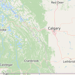
Coordinates49.796°, -114.902°
Felt byNo felt reports
Status✓ Reviewed by USGS
Earthquake Details
Magnitude
2.9 ml
Depth
0.0 km
shallow crustal
Location
49.7963°N
-114.9021°E
-114.9021°E
Technical Information
Event ID
us6000sqfg
Event Type
mining explosion
Status
✓ Reviewed
Significance
129
Stations Used
10
Azimuthal Gap
150.0°
Min Station Distance
0.812°
RMS Residual
0.51 sec
Last Updated
2026-06-24 16:34:27 UTC
Actions
Understanding This Data
Magnitude 2.9 earthquakes are typically only recorded by instruments.
Authoritative source: USGS event page (event ID: us6000sqfg). All scientific values on this page are sourced verbatim from the USGS feed.
Cite this page: EarthquakeTracker.org. (2026, April 15, 2026). M2.9 Earthquake 7 km N of Sparwood, Canada — April 15, 2026. Retrieved June 24, 2026 from https://www.earthquaketracker.org/earthquakes/event/us6000sqfg/