M6.4 Earthquake 48 km W of Port-Olry, Vanuatu — February 14, 2026
2026-02-14 02:27:42 UTC (2026-02-14) · approx. 1:27 PM UTC+11 local
Felt by 1 person across nearby locations. Maximum shaking intensity MMI 6.2 (very strong).
On February 14, 2026 at 02:27 UTC, a magnitude 6.4 shallow crustal earthquake struck 48 km W of Port-Olry, Vanuatu, at a depth of 43.0 km and coordinates -14.9918°, 166.6216°. The earthquake was reported felt by 1 personacross nearby locations, with a maximum shaking intensity of Modified Mercalli Intensity (MMI) 6.2 (very strong). The USGS PAGER system issued a green alert level for this event, indicating no significant casualties or damage expected. This earthquake was detected by 119 seismic stations with excellent location accuracy and was assigned a USGS significance rating of 630, making it a moderate-impact event. The nearest populated place is Port-Olry (population 1,951).
Physical scale: An earthquake of magnitude 6.4 releases seismic energy equivalent to roughly 60 kilotons of TNT. Empirical fault-scaling laws (Wells & Coppersmith, 1994) estimate the subsurface rupture length at approximately 16 km — a useful intuition for the size of the slip patch on the fault.
The epicenter is located in Vanuatu, a region characterized by the New Hebrides subduction zone, where the Australian Plate subducts eastward at approximately 90 mm per year. View all earthquakes in Vanuatu.
Learn more: Magnitude scale · Aftershock sequences
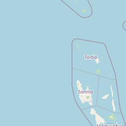
Nearest Populated Places
ShakeMap — predicted shaking intensity
Modeled ground-motion intensity contoured on the Modified Mercalli scale (MMI). Computed by the USGS from the moment-tensor solution and regional ground-motion prediction equations.
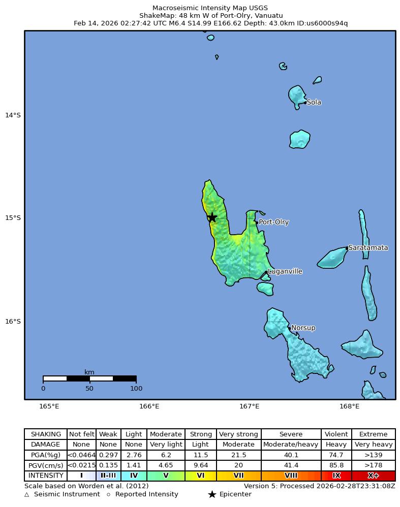
Source: U.S. Geological Survey ShakeMap. View interactive ShakeMap on USGS
Did You Feel It? — community-reported shaking
Aggregated felt-report intensity from 1 citizen response to the USGS Did You Feel It? system. Each colored zone represents the average MMI from reports in that area.
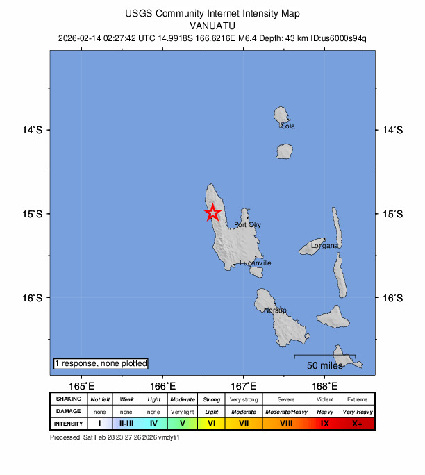
Source: U.S. Geological Survey Did You Feel It?. View on USGS · submit your own report
Population exposure (USGS PAGER)
Estimated population that experienced each level of shaking. Based on the USGS PAGER rapid impact assessment, which combines ShakeMap output with global population grids.
| Shaking intensity (MMI) | Description | Population exposed |
|---|---|---|
| MMI 3 | weak | 56,628 |
| MMI 4 | light | 86,006 |
| MMI 5 | moderate | 33,335 |
| MMI 6 | strong | 1,968 |
Earthquake Details
166.6216°E
Technical Information
Nearby Earthquakes (Last 7 Days)
Common Questions
How strong was the magnitude 6.4 earthquake near Port-Olry, Vanuatu?
The magnitude 6.4 earthquake that struck 48 km W of Port-Olry, Vanuatu on February 14, 2026 at 02:27 UTC had a depth of 43.0 km. It was felt by 1 person with maximum shaking intensity of MMI 6.2 (very strong). For context, this was a strong earthquake capable of causing significant damage.
Where did the earthquake occur?
The earthquake epicenter was located at -14.9918°, 166.6216°, which is 48 km W of Port-Olry, Vanuatu. The nearest populated place is Port-Olry (population 1,951). View all earthquakes in Vanuatu.
Were there aftershocks?
Aftershock activity is monitored continuously by the USGS. Aftershock sequences from magnitude 6.4 earthquakes can continue for weeks to months and gradually diminish over time.
Has Vanuatu had earthquakes this big before?
The largest recorded earthquake in Vanuatu was the M7.9 Vanuatu earthquake of October 7, 2009. Today's magnitude 6.4 event is significantly smaller than that historical record.
What should I do after an earthquake?
If you were in the affected area: check yourself and others for injuries, inspect your home for damage, and be prepared for aftershocks. For detailed guidance, see our earthquake safety guide and emergency planning resources.
Authoritative source: USGS event page (event ID: us6000s94q). All scientific values on this page are sourced verbatim from the USGS feed.
Cite this page: EarthquakeTracker.org. (2026, February 14, 2026). M6.4 Earthquake 48 km W of Port-Olry, Vanuatu — February 14, 2026. Retrieved May 6, 2026 from https://www.earthquaketracker.org/earthquakes/event/us6000s94q/