2.6
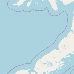
M2.6 Earthquake 34 km ESE of Chignik, Alaska — July 5, 2026
2026-07-05 04:58:28 UTC (57 min ago) · approx. 5:58 PM UTC-11 local
MagnitudeM2.6(ml)
Time04:58 UTC≈ 5:58 PM UTC-11
Depth40.1 kmshallow crustal
Coordinates56.185°, -157.877°
Felt byNo felt reports
StatusAutomatic (preliminary)
Earthquake Details
Magnitude
2.6 ml
Depth
40.1 km
shallow crustal
Location
56.1850°N
-157.8770°E
-157.8770°E
Technical Information
Event ID
aka2026nebzsm
Event Type
earthquake
Status
Automatic
Significance
104
Stations Used
15
Azimuthal Gap
270.0°
Min Station Distance
0.400°
RMS Residual
0.70 sec
Last Updated
2026-07-05 05:00:27 UTC
Nearby Earthquakes (Last 7 Days)
2.82.72.62.72.82.62.52.82.63.9
32 km ENE of Aleneva, Alaska
20 hours ago · 34.9 km deep
92 km SSE of Kokhanok, Alaska
1 day ago · 10.7 km deep
242 km SE of Chignik, Alaska
1 day ago · 5.0 km deep
54 km SW of Akhiok, Alaska
1 day ago · 59.0 km deep
81 km S of Sand Point, Alaska
2 days ago · 35.0 km deep
34 km SSE of False Pass, Alaska
3 days ago · 6.6 km deep
40 km E of Pedro Bay, Alaska
3 days ago · 128.9 km deep
36 km S of Perryville, Alaska
4 days ago · 52.4 km deep
108 km S of False Pass, Alaska
4 days ago · 10.0 km deep
51 km NNE of Aleneva, Alaska
5 days ago · 68.7 km deep
Actions
Understanding This Data
Magnitude 2.6 earthquakes are typically only recorded by instruments.
Authoritative source: USGS event page (event ID: aka2026nebzsm). All scientific values on this page are sourced verbatim from the USGS feed.
Cite this page: EarthquakeTracker.org. (2026, July 5, 2026). M2.6 Earthquake 34 km ESE of Chignik, Alaska — July 5, 2026. Retrieved July 5, 2026 from https://www.earthquaketracker.org/earthquakes/event/aka2026nebzsm/