2.9
M2.9 Earthquake 6 km N of Ridgeway, Alaska — June 16, 2026
2026-06-16 19:11:09 UTC (5 hours ago) · approx. 9:11 AM UTC-10 local
MagnitudeM2.9(ml)
Time19:11 UTC≈ 9:11 AM UTC-10
Depth59.1 kmshallow crustal
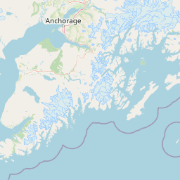
Coordinates60.586°, -151.092°
Felt byNo felt reports
StatusAutomatic (preliminary)
Earthquake Details
Magnitude
2.9 ml
Depth
59.1 km
shallow crustal
Location
60.5860°N
-151.0920°E
-151.0920°E
Technical Information
Event ID
aka2026lwcamc
Event Type
earthquake
Status
Automatic
Significance
129
Stations Used
98
Azimuthal Gap
52.0°
Min Station Distance
0.200°
RMS Residual
0.80 sec
Last Updated
2026-06-16 20:05:09 UTC
Nearby Earthquakes (Last 7 Days)
2.62.82.63.22.72.52.62.52.92.5
47 km W of Happy Valley, Alaska
2 hours ago · 92.9 km deep
67 km SE of Denali National Park, Alaska
5 hours ago · 118.7 km deep
64 km NNE of Petersville, Alaska
9 hours ago · 106.9 km deep
66 km NW of Eureka Roadhouse, Alaska
15 hours ago · 8.5 km deep
77 km NNW of Karluk, Alaska
20 hours ago · 104.7 km deep
66 km ESE of Denali National Park, Alaska
1 day ago · 133.3 km deep
56 km ENE of Chase, Alaska
2 days ago · 56.0 km deep
13 km NW of Happy Valley, Alaska
2 days ago · 62.0 km deep
79 km ESE of Ugashik, Alaska
2 days ago · 84.3 km deep
37 km S of Skwentna, Alaska
2 days ago · 81.8 km deep
Actions
Understanding This Data
Magnitude 2.9 earthquakes are typically only recorded by instruments.
Authoritative source: USGS event page (event ID: aka2026lwcamc). All scientific values on this page are sourced verbatim from the USGS feed.
Cite this page: EarthquakeTracker.org. (2026, June 16, 2026). M2.9 Earthquake 6 km N of Ridgeway, Alaska — June 16, 2026. Retrieved June 17, 2026 from https://www.earthquaketracker.org/earthquakes/event/aka2026lwcamc/