2.8
M2.8 Earthquake 53 km NNE of White Mountain, Alaska — June 15, 2026
2026-06-15 06:05:24 UTC (3 days ago) · approx. 7:05 PM UTC-11 local
MagnitudeM2.8(ml)
Time06:05 UTC≈ 7:05 PM UTC-11
Depth7.9 kmshallow crustal
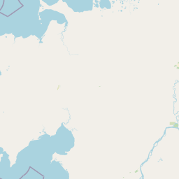
Coordinates65.132°, -163.020°
Felt byNo felt reports
Status✓ Reviewed by USGS
Earthquake Details
Magnitude
2.8 ml
Depth
7.9 km
shallow crustal
Location
65.1320°N
-163.0200°E
-163.0200°E
Technical Information
Event ID
aka2026ltfupt
Event Type
earthquake
Status
✓ Reviewed
Significance
121
Stations Used
14
Azimuthal Gap
70.0°
Min Station Distance
0.900°
RMS Residual
0.80 sec
Last Updated
2026-06-18 04:45:25 UTC
Nearby Earthquakes (Last 7 Days)
3.02.73.12.73.92.83.03.03.12.7
9 km NNE of Brevig Mission, Alaska
4 hours ago · 103.6 km deep
53 km NNE of White Mountain, Alaska
21 hours ago · 11.9 km deep
46 km NNE of White Mountain, Alaska
1 day ago · 5.0 km deep
52 km NNE of White Mountain, Alaska
1 day ago · 10.0 km deep
57 km NNE of White Mountain, Alaska
1 day ago · 5.0 km deep
54 km NNE of White Mountain, Alaska
1 day ago · 1.6 km deep
51 km NNE of White Mountain, Alaska
1 day ago · 2.2 km deep
51 km NNE of White Mountain, Alaska
2 days ago · 4.0 km deep
55 km NNE of White Mountain, Alaska
2 days ago · 1.2 km deep
54 km NNE of White Mountain, Alaska
2 days ago · 1.7 km deep
Actions
Understanding This Data
Magnitude 2.8 earthquakes are typically only recorded by instruments.
Authoritative source: USGS event page (event ID: aka2026ltfupt). All scientific values on this page are sourced verbatim from the USGS feed.
Cite this page: EarthquakeTracker.org. (2026, June 15, 2026). M2.8 Earthquake 53 km NNE of White Mountain, Alaska — June 15, 2026. Retrieved June 18, 2026 from https://www.earthquaketracker.org/earthquakes/event/aka2026ltfupt/