2.1
M2.1 Earthquake 111 km N of Yakutat, Alaska — May 16, 2026
2026-05-16 12:43:12 UTC (3 days ago) · approx. 3:43 AM UTC-9 local
MagnitudeM2.1(ml)
Time12:43 UTC≈ 3:43 AM UTC-9
Depth9.9 kmshallow crustal
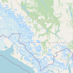
Coordinates60.534°, -140.067°
Felt byNo felt reports
Status✓ Reviewed by USGS
Earthquake Details
Magnitude
2.1 ml
Depth
9.9 km
shallow crustal
Location
60.5340°N
-140.0670°E
-140.0670°E
Technical Information
Event ID
aka2026jqikmc
Event Type
earthquake
Status
✓ Reviewed
Significance
68
Stations Used
16
Azimuthal Gap
110.0°
Min Station Distance
0.500°
RMS Residual
0.70 sec
Last Updated
2026-05-18 19:47:21 UTC
Nearby Earthquakes (Last 7 Days)
2.72.82.52.72.52.6
164 km N of Yakutat, Alaska
2 hours ago · 16.6 km deep
46 km S of Nelchina, Alaska
2 days ago · 22.5 km deep
104 km N of Yakutat, Alaska
2 days ago · 1.9 km deep
285 km SW of Yakutat, Alaska
5 days ago · 10.0 km deep
8 km NW of Sutton-Alpine, Alaska
6 days ago · 8.1 km deep
53 km WNW of Elfin Cove, Alaska
6 days ago · 0.8 km deep
Actions
Understanding This Data
Magnitude 2.1 earthquakes are typically only recorded by instruments.
Authoritative source: USGS event page (event ID: aka2026jqikmc). All scientific values on this page are sourced verbatim from the USGS feed.
Cite this page: EarthquakeTracker.org. (2026, May 16, 2026). M2.1 Earthquake 111 km N of Yakutat, Alaska — May 16, 2026. Retrieved May 19, 2026 from https://www.earthquaketracker.org/earthquakes/event/aka2026jqikmc/