2.0
M2.0 Earthquake 8 km W of Seldovia, Alaska — May 5, 2026
2026-05-05 19:11:19 UTC (2026-05-05) · approx. 9:11 AM UTC-10 local
MagnitudeM2.0(ml)
Time19:11 UTC≈ 9:11 AM UTC-10
Depth64.9 kmshallow crustal
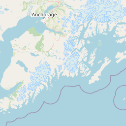
Coordinates59.436°, -151.855°
Felt byNo felt reports
Status✓ Reviewed by USGS
Earthquake Details
Magnitude
2.0 ml
Depth
64.9 km
shallow crustal
Location
59.4360°N
-151.8550°E
-151.8550°E
Technical Information
Event ID
aka2026iwncta
Event Type
earthquake
Status
✓ Reviewed
Significance
62
Stations Used
27
Azimuthal Gap
132.0°
Min Station Distance
0.600°
RMS Residual
0.50 sec
Last Updated
2026-05-08 05:08:22 UTC
Nearby Earthquakes (Last 7 Days)
3.42.62.52.72.73.13.82.54.02.6
20 km NW of Susitna, Alaska
4 hours ago · 78.7 km deep
86 km E of Ugashik, Alaska
2 days ago · 4.2 km deep
87 km E of Ugashik, Alaska
2 days ago · 5.4 km deep
80 km SE of King Salmon, Alaska
2 days ago · 7.3 km deep
79 km SE of King Salmon, Alaska
2 days ago · 1.9 km deep
84 km E of Ugashik, Alaska
2 days ago · 3.9 km deep
27 km SW of Petersville, Alaska
2 days ago · 82.4 km deep
7 km N of Nikiski, Alaska
2 days ago · 83.5 km deep
42 km WNW of Nanwalek, Alaska
2 days ago · 93.5 km deep
51 km ENE of Pedro Bay, Alaska
3 days ago · 132.3 km deep
Actions
Understanding This Data
Magnitude 2.0 earthquakes are typically only recorded by instruments.
Authoritative source: USGS event page (event ID: aka2026iwncta). All scientific values on this page are sourced verbatim from the USGS feed.
Cite this page: EarthquakeTracker.org. (2026, May 5, 2026). M2.0 Earthquake 8 km W of Seldovia, Alaska — May 5, 2026. Retrieved May 17, 2026 from https://www.earthquaketracker.org/earthquakes/event/aka2026iwncta/