2.8
M2.8 Earthquake 58 km WNW of Sitka, Alaska — January 17, 2026
2026-01-17 22:32:28 UTC (2026-01-17) · approx. 1:32 PM UTC-9 local
MagnitudeM2.8(ml)
Time22:32 UTC≈ 1:32 PM UTC-9
Depth5.6 kmshallow crustal
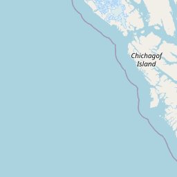
Coordinates57.251°, -136.220°
Felt byNo felt reports
Status✓ Reviewed by USGS
Earthquake Details
Magnitude
2.8 ml
Depth
5.6 km
shallow crustal
Location
57.2510°N
-136.2200°E
-136.2200°E
Technical Information
Event ID
ak2026bfclod
Event Type
earthquake
Status
✓ Reviewed
Significance
121
Stations Used
19
Azimuthal Gap
185.0°
Min Station Distance
0.300°
RMS Residual
0.30 sec
Last Updated
2026-04-30 20:02:22 UTC
Nearby Earthquakes (Last 7 Days)
Actions
Understanding This Data
Magnitude 2.8 earthquakes are typically only recorded by instruments.
Authoritative source: USGS event page (event ID: ak2026bfclod). All scientific values on this page are sourced verbatim from the USGS feed.
Cite this page: EarthquakeTracker.org. (2026, January 17, 2026). M2.8 Earthquake 58 km WNW of Sitka, Alaska — January 17, 2026. Retrieved April 30, 2026 from https://www.earthquaketracker.org/earthquakes/event/ak2026bfclod/