2.1
M2.1 Earthquake 85 km NW of Yakutat, Alaska — January 1, 2026
2026-01-01 20:22:01 UTC (2026-01-01) · approx. 11:22 AM UTC-9 local
MagnitudeM2.1(ml)
Time20:22 UTC≈ 11:22 AM UTC-9
Depth17.7 kmshallow crustal
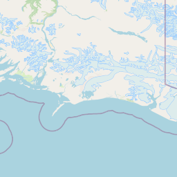
Coordinates60.039°, -140.885°
Felt byNo felt reports
StatusAutomatic (preliminary)
Earthquake Details
Magnitude
2.1 ml
Depth
17.7 km
shallow crustal
Location
60.0390°N
-140.8850°E
-140.8850°E
Technical Information
Event ID
ak2026abonaa
Event Type
earthquake
Status
Automatic
Significance
68
Stations Used
14
Azimuthal Gap
188.0°
Min Station Distance
0.300°
RMS Residual
1.20 sec
Last Updated
2026-01-01 21:09:55 UTC
Nearby Earthquakes (Last 7 Days)
2.72.52.63.02.82.92.72.92.82.7
285 km SW of Yakutat, Alaska
1 day ago · 10.0 km deep
8 km NW of Sutton-Alpine, Alaska
2 days ago · 8.1 km deep
53 km WNW of Elfin Cove, Alaska
2 days ago · 0.8 km deep
99 km WSW of Pelican, Alaska
3 days ago · 5.8 km deep
196 km WSW of Yakutat, Alaska
3 days ago · 5.0 km deep
19 km NNW of Mosquito Lake, Alaska
3 days ago · 10.0 km deep
17 km SE of Eureka Roadhouse, Alaska
4 days ago · 27.7 km deep
40 km WSW of Haines, Alaska
5 days ago · 1.8 km deep
7 km ENE of Butte, Alaska
5 days ago · 24.8 km deep
5 km ENE of Chitina, Alaska
5 days ago · 48.8 km deep
Actions
Understanding This Data
Magnitude 2.1 earthquakes are typically only recorded by instruments.
Authoritative source: USGS event page (event ID: ak2026abonaa). All scientific values on this page are sourced verbatim from the USGS feed.
Cite this page: EarthquakeTracker.org. (2026, January 1, 2026). M2.1 Earthquake 85 km NW of Yakutat, Alaska — January 1, 2026. Retrieved May 15, 2026 from https://www.earthquaketracker.org/earthquakes/event/ak2026abonaa/